Fredelsloh
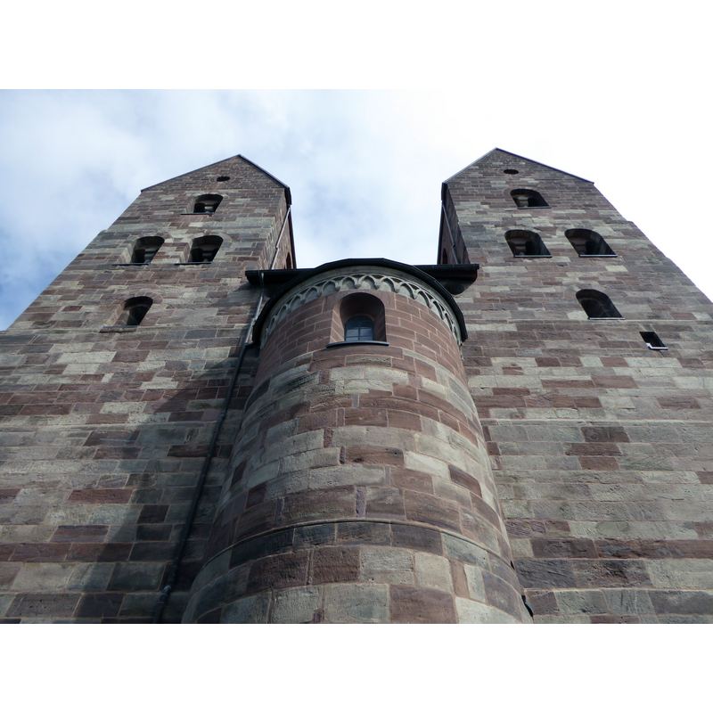
Image copyright © Jan Stubenitzky (Dehio), 2016
CC-BY-SA-4.0
Results: 3 records
view of church exterior - west façade
Scene Description: with the unusual west apse
Copyright Statement: Image copyright © Jan Stubenitzky (Dehio), 2016
Image Source: digital photograph taken 26 March 2016 by Jan Stubenitzky (Dehio) [https://commons.wikimedia.org/wiki/File:Fredelsloh_Klosterkirche_05.jpg] [accessed 24 February 2016]
Copyright Instructions: CC-BY-SA-4.0
view of church exterior in context - southeast view
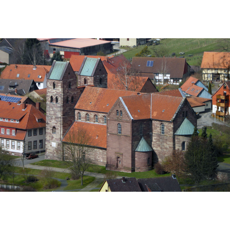
Copyright Statement: Image copyright © Jan Stubenitzky (Dehio), 2016
Image Source: digital photograph taken 26 March 2016 by Jan Stubenitzky (Dehio) [https://commons.wikimedia.org/wiki/File:Fredelsloh_Klosterkirche_06.jpg] [accessed 24 February 2016]
Copyright Instructions: CC-BY-SA-4.0
view of font in context
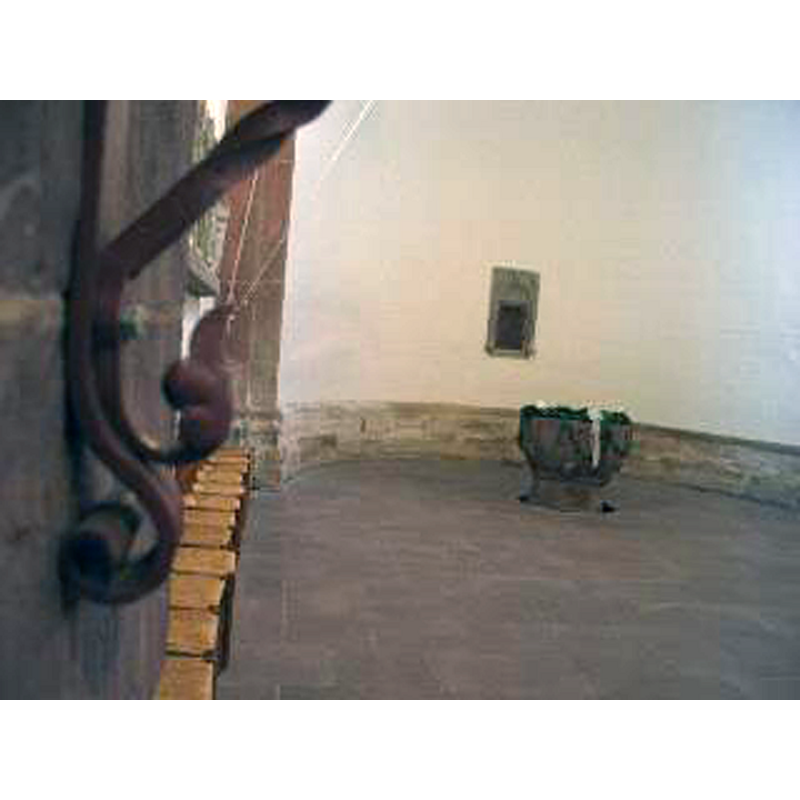
Copyright Statement: Image copyright © Friedrich H. Balck, 2008
Image Source: digital image by Friedrich H. Balck in Biosensor-Physik [www.biosensor-physik.de/biosensor/fredelsloh.htm] [accessed 24 February 2017]
Copyright Instructions: No known copyright restriction / Fair Dealing
INFORMATION
Font ID: 02543FRE
Object Type: Baptismal Font1
Font Century and Period/Style: 13th century, Late Romanesque
Church / Chapel Name: Klosterkirche Fredelsloh St. Blasii und Marien [aka Evangelisch-lutherische Kirche St. Blasii und Marien] (formerly Augustinian Collegiate)
Font Location in Church: Inside the church, in the main apse
Church Patron Saint(s): St. Blaise [aka Biagio, Blas, Blásios, Blasius]
Church Notes: the 12thC [ca. 1132?] church of a former Augustinian collegiate is today an Evangelical church. (Wulf, 1996, p. 47)
Church Address: 37186 Fredelsloh, Germany
Site Location: Northeim, Niedersachsen, Germany, Europe
Directions to Site: Fredelsloh is a small town about 30 kms N-W of Gottingen, 8 kms N-W of Moringen.
Font Notes:
Click to view
Very weathered font, dated by Wulf to the 134th century (Wulf, 1996, p. 47)
COORDINATES
UTM: 32U 554637 5731988
Latitude & Longitude (Decimal): 51.73614, 9.79124
Latitude & Longitude (DMS): 51° 44′ 10.1″ N, 9° 47′ 28.46″ E
MEDIUM AND MEASUREMENTS
Material: stone, type unknown
Font Shape: unknown
Basin Exterior Shape: Unknown
REFERENCES
- Wulf, Walter, Saxe romane, La Pierre-qui-vire, Yonne: Zodiaque, 1996, p. 45-47