Vilac No. 2 / Vilach
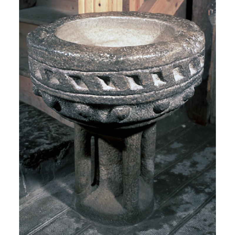
Image copyright © Baptisteria Sacra Index, 2023
CC-BY-NC-ND-4.0
Results: 4 records
design element - architectural - rectangle - blind
Scene Description: concave, with diagonal sides
Copyright Statement: Image copyright © Baptisteria Sacra Index, 2023
Image Source: BSI - Photographed June 1999
Copyright Instructions: CC-BY-NC-ND-4.0
design element - motifs - ball
Scene Description: a row of protruding half-ball motifs
Copyright Statement: Image copyright © Baptisteria Sacra Index, 2023
Image Source: BSI - Photographed June 1999
Copyright Instructions: CC-BY-NC-ND-4.0
design element - architectural - column - 5
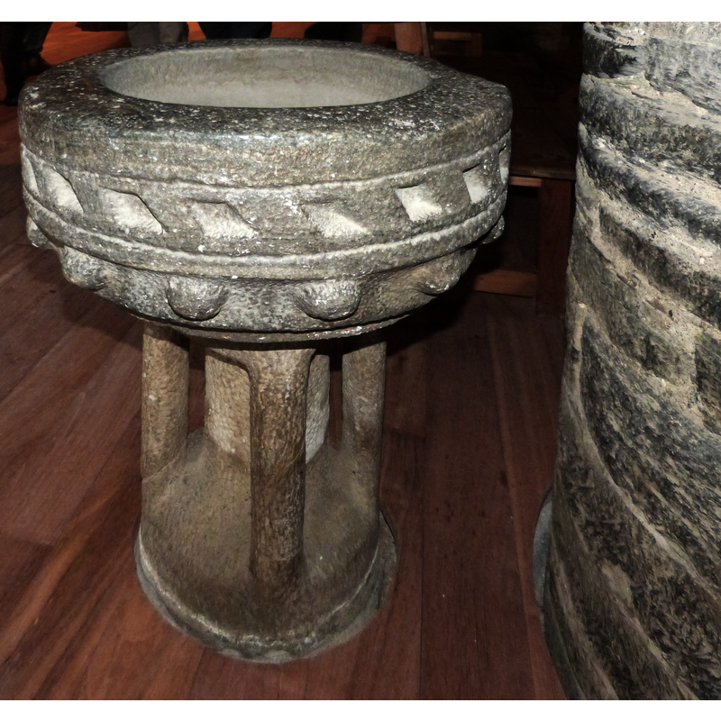
Scene Description: the four outer colonnettes are carved from the same block as the central shaft
Copyright Statement: Image copyright © Merçé Rota Serra, 2015
Image Source: digital photograph taken 3 May 2015 by Merçé Rota Serra
Copyright Instructions: Image and permission received via Mikel Unanue (e-mail of 3 June 2015)
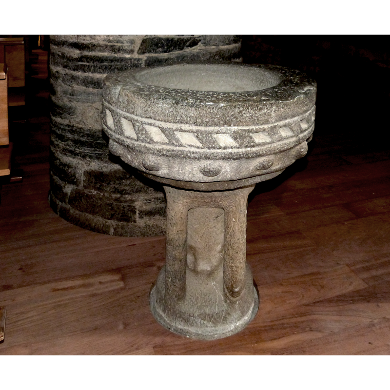
view of stoup
Copyright Statement: Image copyright © Merçé Rota Serra, 2015
Image Source: digital photograph taken 3 May 2015 by Merçé Rota Serra
Copyright Instructions: Image and permission received via Mikel Unanue (e-mail of 3 June 2015)
INFORMATION
Font ID: 02396VIL
Object Type: Stoup?
Date Visited: 1999-06-18
Font Century and Period/Style: 12th - 13th century, Romanesque
Church / Chapel Name: Església de Sant Feliu / San Félix
Font Location in Church: Inside the church, at the foot of the stairwell leading to the choir
Church Patron Saint(s): St. Felix
Site Location: Lérida / Lleida, Cataluña / Catalunya, Spain, Europe
Directions to Site: Located 3-4 km N of Vielha up the 230
Ecclesiastic Region: Diócesis de Urgel
Historical Region: Valle de Aran / Vall d'Aran
Additional Comments: recycled stoup? was it a font originally?
Font Notes:
Click to view
Noted by Gudiol (2008) in his 1907 visit. Described in Durliat (1978). Described and illustrated in Catalunya romànica (1984- ), which also points out the large proportions of the object, more appropriate to those of a baptismal font ["grans proporcions, més pròpies gairebé d'una pica baptismal"]. On-site notes: dark local marble holy-water stoup of larger than usual proportions for this area, as big as some baptismal fonts of this valley; the basin is roughly hemispherical with a band of notches around its middle resembling concave trapezoidal parallelograms; another row below it, this one of convex ball motif. The stem of the base consists of a central cylindrical shaft and four semi-detached corner colonnettes. Evidence of the original iron staples of the cover on the upper rim of the basin. Was it a baptismal font originally?
Credit and Acknowledgements: We are grateful to Merçé Rota Serra for her photographs of this stoup or font
COORDINATES
UTM: 31T 319690 4732289
Latitude & Longitude (Decimal): 42.721944, -797778
Latitude & Longitude (DMS): 42° 43′ 19″ N, 0° 47′ 52″ E
MEDIUM AND MEASUREMENTS
Material: stone, marble (local)
Number of Pieces: two
Font Shape: hemispheric, mounted
Basin Interior Shape: round
Basin Exterior Shape: round
Drainage System: centre hole in basin
Rim Thickness: 10-11 cm
Diameter (inside rim): 45 cm
Diameter (includes rim): 67 cm
Basin Total Height: 29 cm
Height of Base: 49 cm / 50 cm*
Font Height (less Plinth): 78 cm
Notes on Measurements: BSI on-site / *Catalunya rom... (1984- , v. XIII: 440)
LID INFORMATION
Notes: old cover staples still in the upper rim of the basin
REFERENCES
- Alcolea Blanch, Santiago, La missió arqueològica del 1907 als Pirineus, Barcelona: Fundació Institut Amatller d'Art Hispànic; Obra Social, Fundació La Caixa, 2008, p. 83
- Durliat, Marcel, Pyrénées romanes, La Pierre-qui-vire, Yonne: Zodiaque, 1978, p. 204
- Fundació Enciclopèdia Catalana, Catalunya romànica, Barcelona: Fundació Enciclopèdia Catalana, 1984-, vol. XIII: 439-440