Paull / Paghel [Domesday] / Paghil / Paghill / Pagula / Pall / Paul / Paulle / Pawel / Pawle
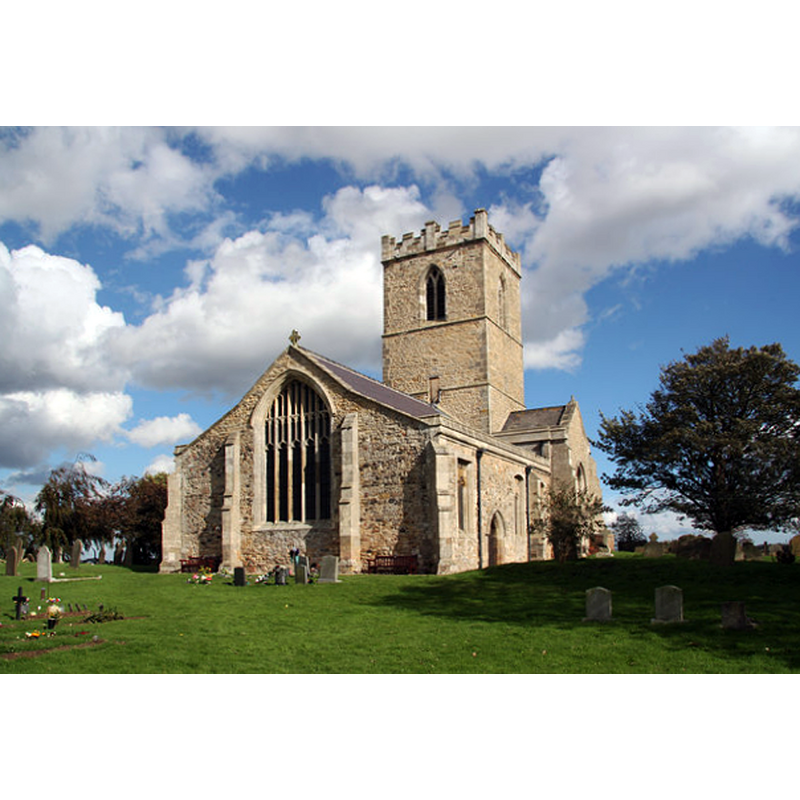
![Main image for Paull / Paghel [Domesday] / Paghil / Paghill / Pagula / Pall / Paul / Paulle / Pawel / Pawle](/static-50478a99ec6f36a15d6234548c59f63da52304e5/compressed/1140731014_compressed.png)
Image copyright © Richard Croft, 2010
CC-BY-SA-2.0
Results: 2 records
view of church exterior - southeast view
Copyright Statement: Image copyright © Richard Croft, 2010
Image Source: digital photograph taken 6 October 2010 by Richard Croft [www.geograph.org.uk/photo/2100899] [accessed 31 July 2014]
Copyright Instructions: CC-BY-SA-2.0
view of church exterior - northeast view
Copyright Statement: Image copyright © Richard Croft, 2010
Image Source: digital photograph taken 6 October 2010 by Richard Croft [www.geograph.org.uk/photo/2100890] [accessed 31 July 2014]
Copyright Instructions: CC-BY-SA-2.0
INFORMATION
Font ID: 01950OAU
Object Type: Baptismal Font1
Font Century and Period/Style: 14th - 15th century, Medieval
Church / Chapel Name: Parish Church of St. Andrew [and St. Mary]
Church Patron Saint(s): St. Andrew & St. Mary [earlier St. Mary]
Church Address: Thorngumbald Road, Paull, East Riding of Yorkshire HU12 8FP
Site Location: East Riding of Yorkshire, Yorkshire and the Humber, England, United Kingdom
Directions to Site: Located on the N banks of the estuary of the Humber, 10 km ESE of Hull
Ecclesiastic Region: Diocese of York
Historical Region: Hundred of Holderness [South Hundred]
Additional Comments: disappeared font? (the one from the original church here)
Font Notes:
Click to view
There is an entry for Paull [variant spelling] in the Domesday survey [http://domesdaymap.co.uk/place/TA1626/paull/] [accessed 31 July 2014], but it mentions neither church nor cleric in it. A font here is listed in Cox & Harvey (1907) as a baptismal font of the Perpendicular period. However, Glynne (in Butler, 2007) reports "The font is modern" in his 29 April visit to this church on 29 April 1872 [NB: as Butler (ibid.) informs, the church was restored in 1877]. English Heritage notes: "Parish church. Mid C14-C15, perhaps incorporating material from former church. Burnt in seige of Hull 1643. Repairs of 1663, c1700. Restorations of 1879 included reseating, reroofing; further restorations of c1890. [...] C19 octagonal font. Church was built on a new site after the destruction of the former church by the Humber in 1355."
COORDINATES
UTM: 30U 683050 5955378
Latitude & Longitude (Decimal): 53.71493, -0.22605
Latitude & Longitude (DMS): 53° 42′ 53.75″ N, 0° 13′ 33.78″ W
MEDIUM AND MEASUREMENTS
Material: type unknown
REFERENCES
- Cox, John Charles, English Church Furniture, New York: E.P. Dutton & Co., 1907, p. 229
- Glynne, Stephen Richard, The Yorkshire notes of Sir Stephen Glynne (1825-1874), Woodbridge: The Boydell Press; Yorkshire Archaeological Society, 2007, p. 323