East Tuddenham / East Tudenham / Toddenham / Toteham / Tudenham
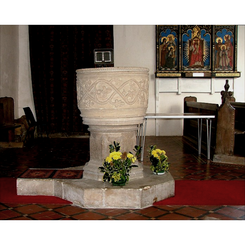
Image copyright © Simon Knott, 2009
Standing permission
Results: 9 records
view of font in context
Copyright Statement: Image copyright © Simon Knott, 2009
Image Source: digital photograph taken February 2006 by Simon Knott [www.norfolkchurches.co.uk/easttuddenham/easttuddenham.htm] [accessed 24 July 2009]
Copyright Instructions: Standing permission
view of font
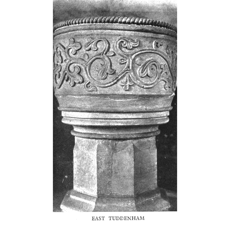
Copyright Statement: Image copyright © Cautley, 1949
Image Source: Cautley (1949: 127)
Copyright Instructions: Standing permission received from the publisher
design element - motifs - rope
Scene Description: all around the edge of the upper rim
Copyright Statement: Image copyright © Simon Knott, 2009
Image Source: digital photograph taken February 2006 by Simon Knott [www.norfolkchurches.co.uk/easttuddenham/easttuddenham.htm] [accessed 24 July 2009]
Copyright Instructions: Standing permission
design element - motifs - roll moulding
Scene Description: just below the rope motif at the upper basin side
Copyright Statement: Image copyright © Simon Knott, 2009
Image Source: digital photograph taken February 2006 by Simon Knott [www.norfolkchurches.co.uk/easttuddenham/easttuddenham.htm] [accessed 24 July 2009]
Copyright Instructions: Standing permission
design element - motifs - scroll work
Scene Description: a wide band all around the basin sides
Copyright Statement: Image copyright © Simon Knott, 2009
Image Source: digital photograph taken February 2006 by Simon Knott [www.norfolkchurches.co.uk/easttuddenham/easttuddenham.htm] [accessed 24 July 2009]
Copyright Instructions: Standing permission
view of church exterior - south view
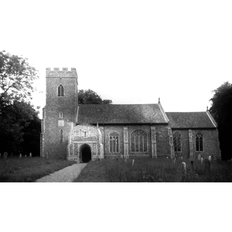
Scene Description: Photo caption: "The former south arcade was taken out to widen the nave"
Copyright Statement: Image copyright © George Plunkett, 2014
Image Source: B&W photograph taken 12 June 1994 by George Plunkett [www.georgeplunkett.co.uk/Norfolk/E/E Tuddenham All Saints church south side [7129] 1994-06-12.jpg] [accessed 27 March 2014
Copyright Instructions: Standing permission by Jonathan Plunkett
view of church exterior - south view
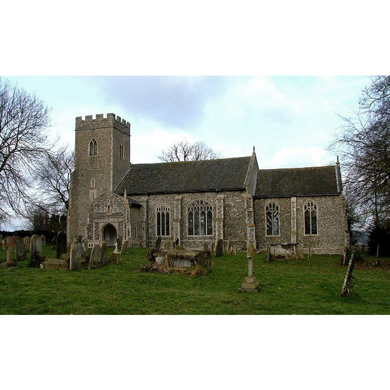
Copyright Statement: Image copyright © Simon Knott, 2009
Image Source: digital photograph February 2006 taken by Simon Knott [www.norfolkchurches.co.uk/easttuddenham/easttuddenham.htm] [accessed 28 March 2014
Copyright Instructions: Standing permission
view of church interior - nave - looking west
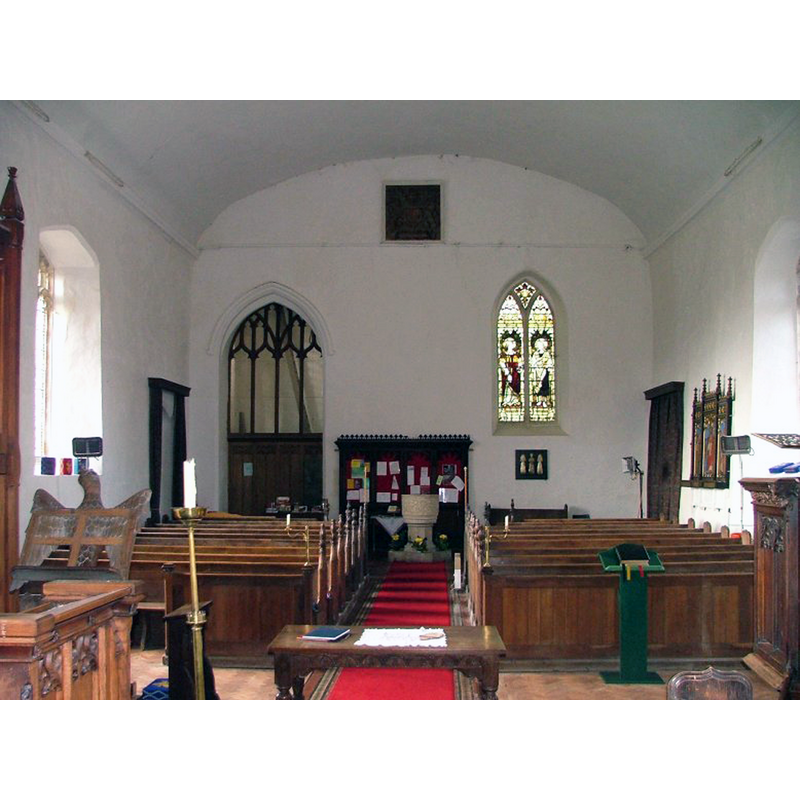
Copyright Statement: Image copyright © Simon Knott, 2009
Image Source: digital photograph taken February 2006 by Simon Knott [www.norfolkchurches.co.uk/easttuddenham/easttuddenham.htm] [accessed 24 July 2009]
Copyright Instructions: Standing permission
view of church interior - nave - looking east
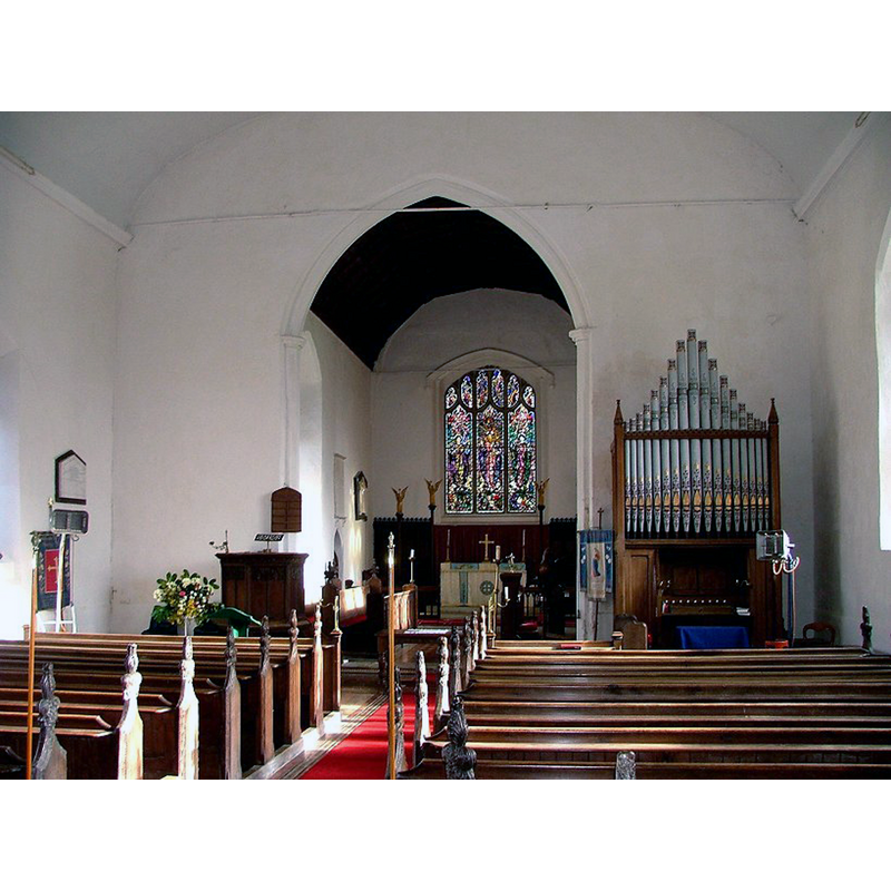
Copyright Statement: Image copyright © Simon Knott, 2009
Image Source: digital photograph taken February 2006 by Simon Knott [www.norfolkchurches.co.uk/easttuddenham/easttuddenham.htm] [accessed 24 July 2009]
Copyright Instructions: Standing permission
INFORMATION
Font ID: 01856TUD
Object Type: Baptismal Font1
Font Century and Period/Style: 12th - 13th century [basin only], Medieval / composite
Church / Chapel Name: Parish Church of All Saints
Font Location in Church: Inside the church, at the W end
Church Patron Saint(s): All Saints
Church Address: Church Lane, East Tuddenham, Norfolk NR20 3NB
Site Location: Norfolk, East Anglia, England, United Kingdom
Directions to Site: Located on Mattishall Rd., off the A47, 10 km E of East Dereham, 16 km W of Norwich
Ecclesiastic Region: Diocese of Norwich
Historical Region: Hundred and helf of Mitford
Additional Comments: disappeared font? (the one from the Domesday-time church here [could have been pre-Conquest])
Font Notes:
Click to view
There are five entries related to [East] Tuddenham [variant spelling] in the Domesday survey [http://domesdaymap.co.uk/place/TG0811/east-tuddenham/] [accessed 27 March 2014], one of which reports and church and church lands in it. Blomefield (1805-1810) gives the extent of those church lands as 20 acres, and describes the church of his time: "The Church of East Tudenham is dedicated to All-Saints, has a large broad nave and chancel, the nave covered with lead, the chancel tiled, and a square tower embattled, and 4 bells at the south-west end of the nave." Blomefield (ibid.) also notes that the patronage of the church had been "granted by fine a[nn]o. 15 King John" [i.e., 1214] to "the prior of Wyrmegey", priory which is identified in the VCH (Norfolk, vol. 2, 1906): "The Austin priory of Wormegay, dedicated to the honour of the Blessed Virgin, the Holy Cross, and St. John the Evangelist, was founded by William de Warenne in the reign of Richard I" [1189-1199]. As per usual, the rectory was converted to a vicarage in the ensuing years. The present font is illustrated in Cautley (1949). Described in Tyrrell-Green (1928) as a round stone baptismal font. the basin is almost cylindrical, slightly narrower at the bottom; the upper rim side has a rope motif at the top followed down by a roll moulding of equal thickness; the sides of the basin are ornamented with a wide band of scroll-work; there are two other thin mouldings at the bottom of the basin, as well as one on the upper side of the pedestal of the base; this pedestal is rounded where it meets the underbowl but octagonal everywhere else and has a wider splayed lower base also octagonal. Noted in Pevsner & Wilson (1999): "Late C12, circular, with a broad band of stiff-leaf trails." Noted and illustrated in Knott (2006): "The font is unusual for East Anglia, in that it is circular; vines and foliage twist around it. Pevsner thought it late 12th century, which means it is probably contemporary with the doorway. Perhaps they were crafted by the same hands." [NB: the round-to-octagonal stem is a later replacement of the original base, as is the octagonal plinth with kneeling stone]
Credit and Acknowledgements: We are grateful to Simon Knott, of www.norfolkchurches.co.uk, for his photographs of this church and font; we are also grateful to Jonathan Plunkett for the photographs of this church taken by his father, George Plunkett, in June 1994
COORDINATES
UTM: 31U 370258 5836330
Latitude & Longitude (Decimal): 52.661377, 1.081623
Latitude & Longitude (DMS): 52° 39′ 40.96″ N, 1° 4′ 53.84″ E
MEDIUM AND MEASUREMENTS
Material: stone, type unknown
Number of Pieces: two?
Font Shape: round, mounted
Basin Interior Shape: round
Basin Exterior Shape: round
REFERENCES
- Victoria County History [online], University of London, 1993-. URL: https://www.british-history.ac.uk.
- Cautley, Henry Munro, Norfolk Churches, Ipswich: Norman Adlard & Co., 1949, p. 21 and ill. on p. 127
- Knott, Simon, The Norfolk Churches Site, Simon Knott, 2004. [standing permission to reproduce images received from Simon (February 2005]. URL: www.norfolkchurches.co.uk.
- Pevsner, Nikolaus, Norfolk 2: North-West and South (2nd ed.), London: Penguin, 1999, p. 325
- Tyrrell-Green, E., Baptismal Fonts Classified and Illustrated, London: Society for Promoting Christian Knowledge: The Macmillan Co., 1928, p. 55, 79