Burnham Norton
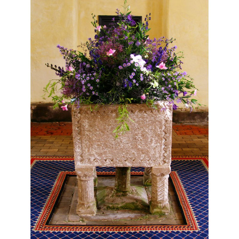
Image copyright © John Ward, 2007
Standing permission
Results: 15 records
B01: design element - patterns - lattice pattern
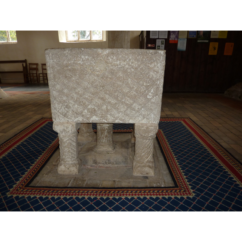
Scene Description: side 1
Copyright Statement: Image copyright © Janice Tostevin, 2009
Image Source: digital photograph taken 26 September 2009 by Janice Tostevin
Copyright Instructions: Standing permission
B02: design element - motifs - sawtooth
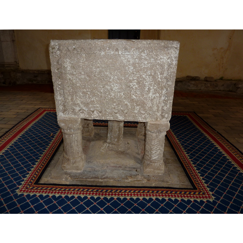
Scene Description: side 2
Copyright Statement: Image copyright © Janice Tostevin, 2009
Image Source: digital photograph taken 26 September 2009 by Janice Tostevin
Copyright Instructions: Standing permission
B03: design element - motifs - sawtooth
Scene Description: side 3
Copyright Statement: Image copyright © Janice Tostevin, 2009
Image Source: digital photograph taken 26 September 2009 by Janice Tostevin
Copyright Instructions: Standing permission
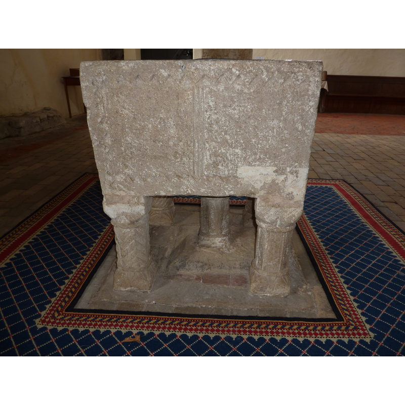
B04: design element - architectural - arcade
Scene Description: side 4
Copyright Statement: Image copyright © Janice Tostevin, 2009
Image Source: digital photograph taken 26 September 2009 by Janice Tostevin
Copyright Instructions: Standing permission
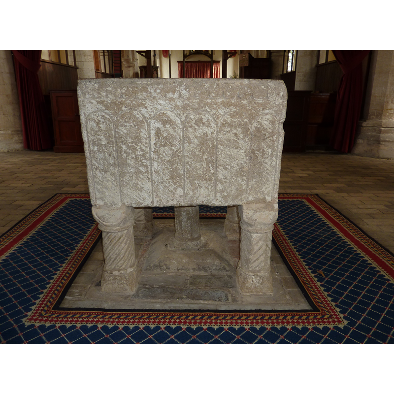
view of font
Copyright Statement: Image copyright © John Ward, 2007
Image Source: digital photograph 15 June 2007 by John Ward
Copyright Instructions: Standing permission
view of font in context
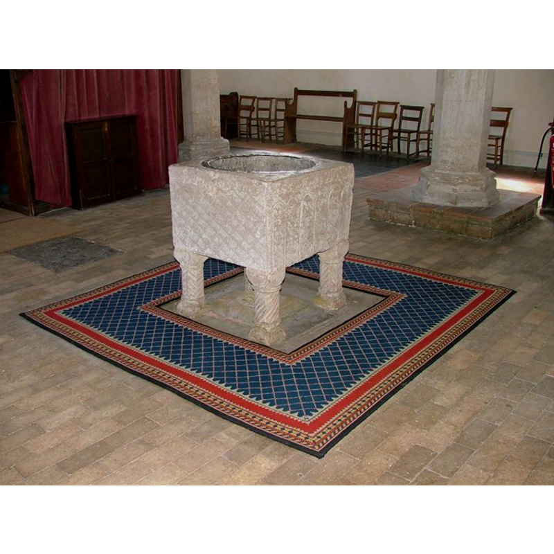
Copyright Statement: Image copyright © Simon Knott, 2009
Image Source: digital photograph taken 7 May 2005 by Simon Knott [http://www.norfolkchurches.co.uk/burnhamnorton/burnhamnorton.htm] [accessed 20 July 2009]
Copyright Instructions: Standing permission
view of basin - interior
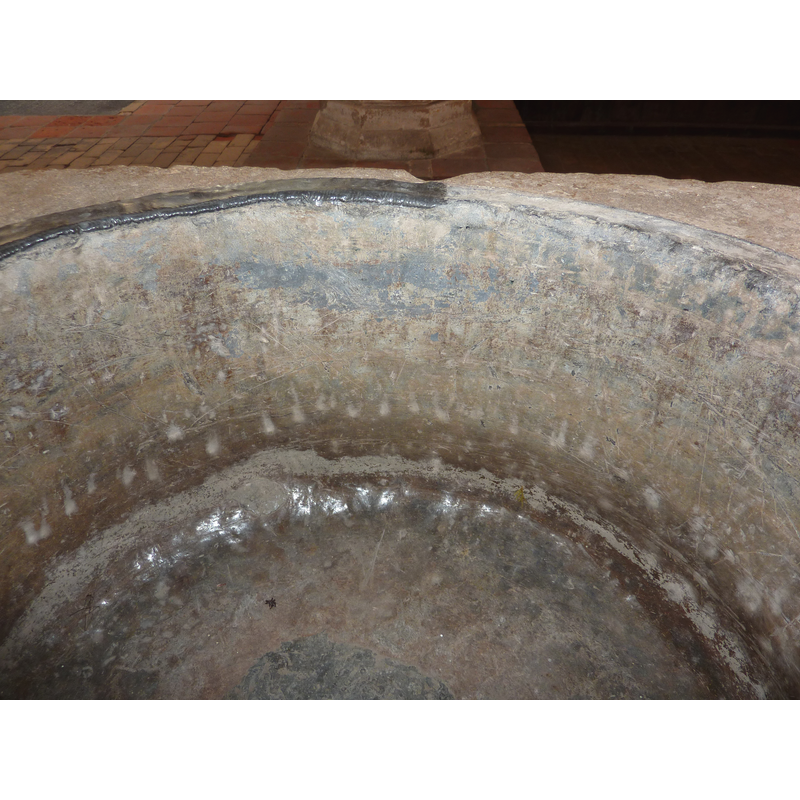
Copyright Statement: Image copyright © Janice Tostevin, 2009
Image Source: digital photograph taken 26 September 2009 by Janice Tostevin
Copyright Instructions: Standing permission
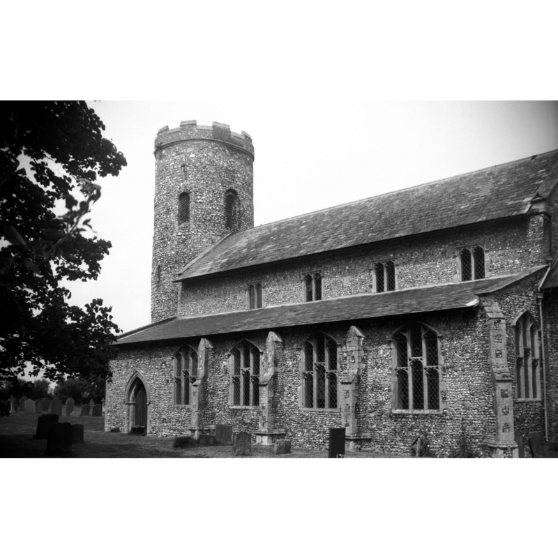
view of church exterior - west tower
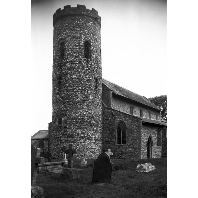
Scene Description: Photo caption: "Norman round tower is intact except for its later parapet"
Copyright Statement: Image copyright © George Plunkett, 2014
Image Source: B&W photograph taken 10 June 1980 by George Plunkett [www.georgeplunkett.co.uk/Norfolk/B/Burnham Norton St Margaret's church tower [6106] 1980-06-10.jpg] [accessed 24 June 2014]
Copyright Instructions: Standing permission by Jonathan Plunkett
view of church exterior - southeast view
Copyright Statement: Image copyright © George Plunkett, 2014
Image Source: B&W photograph taken 10 June 1980 by George Plunkett [www.georgeplunkett.co.uk/Norfolk/B/Burnham Norton St Margaret's church from SE [6107] 1980-06-10.jpg] [accessed 24 June 2014]
Copyright Instructions: Standing permission by Jonathan Plunkett
view of church exterior - southeast view
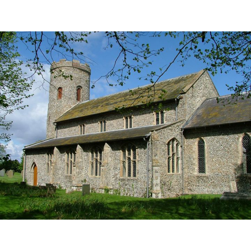
Copyright Statement: Image copyright © Simon Knott, 2005
Image Source: digital photograph May 2005 taken by Simon Knott [www.norfolkchurches.co.uk/burnhamnorton/burnhamnorton.htm] [accessed 4 June 2013]
Copyright Instructions: Standing permission
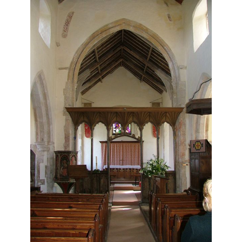
view of church interior - nave - looking west
Scene Description: the font at the west end, centre aisle
Copyright Statement: Image copyright © Simon Knott, 2005
Image Source: digital photograph May 2005 taken by Simon Knott [www.norfolkchurches.co.uk/burnhamnorton/burnhamnorton.htm] [accessed 4 June 2013]
Copyright Instructions: Standing permission
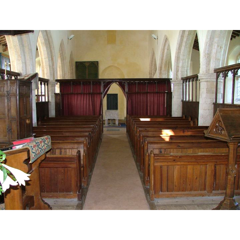
view of church interior - nave - looking east
Copyright Statement: Image copyright © Simon Knott, 2005
Image Source: digital photograph May 2005 taken by Simon Knott [www.norfolkchurches.co.uk/burnhamnorton/burnhamnorton.htm] [accessed 4 June 2013]
Copyright Instructions: Standing permission
design element - patterns - fluted
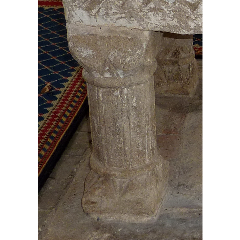
Scene Description: on one of the outer colonnettes of the base
Copyright Statement: Image copyright © Janice Tostevin, 2009
Image Source: detail of digital photograph taken 26 September 2009 by Janice Tostevin
Copyright Instructions: Standing permission
design element - patterns - torsade
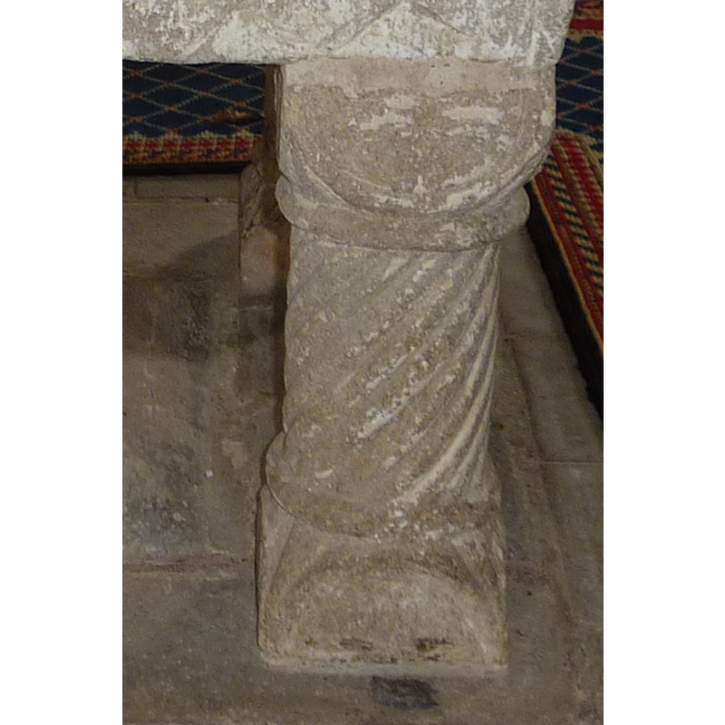
Scene Description: on one of the outer colonnettes of the base
Copyright Statement: Image copyright © Janice Tostevin, 2009
Image Source: detail of digital photograph taken 26 September 2009 by Janice Tostevin
Copyright Instructions: Standing permission
design element - motifs - chevron - nested chevrons
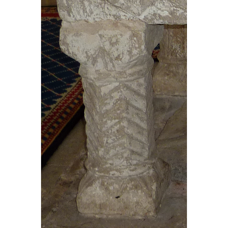
Scene Description: on two of the outer colonnettes of the base
Copyright Statement: Image copyright © Janice Tostevin, 2009
Image Source: detail of digital photograph taken 26 September 2009 by Janice Tostevin
Copyright Instructions: Standing permission
INFORMATION
Font ID: 01671BUR
Object Type: Baptismal Font1
Font Century and Period/Style: 12th century, Late Norman? / Transitional?
Workshop/Group/Artisan: Northwest-Norfolk group
Cognate Fonts: Similar, though not identical, fonts at Crambe, Fincham, Locking, etc. Of a related shape, the nearby font at Burnham Deepdale
Church / Chapel Name: Parish Church of St. Margaret
Font Location in Church: Inside the church
Church Patron Saint(s): St. Margaret of Antioch [aka Margaret the Virgin, Marina]
Church Notes: round-tower church
Church Address: Bellamy's Lane, Burnham Norton, Norfolk PE31 8BF
Site Location: Norfolk, East Anglia, England, United Kingdom
Directions to Site: Located just W of Burnham Deepdale, up the B1355 from Fakenham, or about 50 km NE on the A149 from King's Lynn
Ecclesiastic Region: Diocese of Norwich
Historical Region: Hundreds of Gallows and Brothercross
Font Notes:
Click to view
Blomefield (1805-1810) writes: "To the church of Burnham Norton belonged two medieties or rectories: in the reign of Edward I. the heirs of Polsted were patrons of one; the rector of this had then a manse, and forty acres of land, called Robert's mediety; the other was in the patronage of Wendling abbey, and was the mediety of William; each was valued at twenty marks, and they paid Peter-pence 20d. ob. In 1249, Robert occurs rector, and about the said time [...] On August 5th, 1420. John Bishop of Norwich united and consolidated the medieties of Burnham Margaret Norton, and that of Burnham Ulp [...] which were void some time, on account of the meanness of them. [...] The Church is dedicated to St. Margaret, and stands on an hill, about a mile dis ant from the town, has a nave, a north and south isle (the church is decayed) covered with lead, and, in a round tower, there is one bell". The present font here is noted in Lewis' Dictionary of 1848 as a dating to the Norman period. Described and illustrated in Bond (1908) as a 12th-century Norman baptismal font of stone; the square basin is mounted on four constructional grooved shafts at the angles and one at the centre; the sides of the basin are carved with a lattice motif, arcade, etc. Tyrrell-Green (1928) notes one of its sides "covered with a trellis pattern of shallow incised lines". Described in Pevsner & Wilson (1999). In Kroesen & Steensma (2004). [NB: the church pamphlet, compiled by Richard Butler-Stoney, informs that the central drain of the basin continues down the central shaft of the base]. The round basin well is lead-lined.
Credit and Acknowledgements: We are grateful to Simon Knott, of www.norfolkchurches.co.uk, to John Ward, of Oxfordshire Churches [http://homepage.mac.com/john.ward/oxfordshirechurches], and to Janice Tostevin for their photographs of this font
COORDINATES
UTM: 31U 347454 5869215
Latitude & Longitude (Decimal): 52.950845, 0.72936
Latitude & Longitude (DMS): 52° 57′ 3.04″ N, 0° 43′ 45.7″ E
MEDIUM AND MEASUREMENTS
Material: stone, type unknown
Font Shape: square, mounted
Basin Interior Shape: round
Basin Exterior Shape: square
Drainage System: centre hole in basin & base
Drainage Notes: lead-lined; the drain is through the central shaft of the base
REFERENCES
- Blomefield, Francis, An essay towards a topographical history of Norfolk, 1805-1810, vol. 7: 16-19 / [www.british-history.ac.uk/report.aspx?compid=78293] [accessed 4 June 2013]
- Bond, Francis, Fonts and Font Covers, London: Waterstone, 1985 c1908, p. 46, 144, 149, 151 and ill. on p. 148
- Knott, Simon, The Norfolk Churches Site, Simon Knott, 2004. [standing permission to reproduce images received from Simon (February 2005]. URL: www.norfolkchurches.co.uk.
- Kroesen, Justin E.A., The Interior of the medieval village church = Het middeleeuwse Dorpskerkinterieur, Leuven: Uitgeverij Peeters, 2004, p. 327 and pl. 15-6
- Lewis, Samuel, A Topographical Dictionary of England, Comprising the Several Counties, Cities, Boroughs, Corporate and Market Towns, Parishes, Chapelries, and Townships, and the Islands of Guernsy, Jersey, and Man, with Historical and Statistical Descriptions [...], London: S. Lewis, 1831, [www.british-history.ac.uk/report.asp?compid=50845] [accessed 22 January 2007]
- Pevsner, Nikolaus, Norfolk 2: North-West and South (2nd ed.), London: Penguin, 1999, p. 230
- Tyrrell-Green, E., Baptismal Fonts Classified and Illustrated, London: Society for Promoting Christian Knowledge: The Macmillan Co., 1928, p. 27, 85