Tunstall nr. Borden / Dunstall / Tunestelle
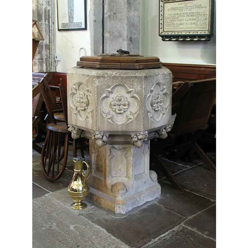
Image copyright © John Salmon, 2008
CC-BY-SA-3.0
Results: 4 records
view of font and cover
Scene Description: the modern font and cover [cf. FontNotes]
Copyright Statement: Image copyright © John Salmon, 2008
Image Source: digital photograph taken 16 April 2008 by John Salmon [www.geograph.org.uk/photo/769421] [accessed 7 September 2013]
Copyright Instructions: CC-BY-SA-3.0
view of church exterior - southwest end
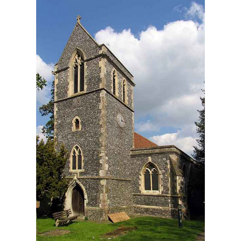
Copyright Statement: Image copyright © John Salmon, 2008
Image Source: digital photograph taken 16 April 2008 by John Salmon [www.geograph.org.uk/photo/769417] [accessed 7 September 2013]
Copyright Instructions: CC-BY-SA-3.0
view of church exterior - southeast view
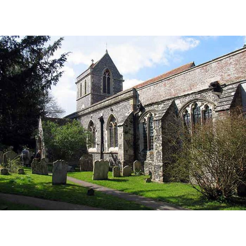
Copyright Statement: Image copyright © John Salmon, 2008
Image Source: digital photograph taken 16 April 2008 by John Salmon [www.geograph.org.uk/photo/769409] [accessed 7 September 2013]
Copyright Instructions: CC-BY-SA-3.0
view of church interior - nave - looking east
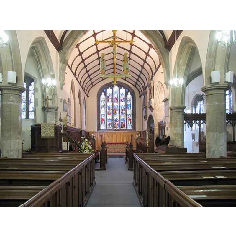
Copyright Statement: Image copyright © John Salmon, 2008
Image Source: digital photograph taken 16 April 2008 by John Salmon [www.geograph.org.uk/photo/769441] [accessed 7 September 2013]
Copyright Instructions: CC-BY-SA-3.0
INFORMATION
Font ID: 01597TUN
Object Type: Baptismal Font1
Font Century and Period/Style: 13th century, Early English
Church / Chapel Name: Parish Church of St. John the Baptist
Font Location in Church: Inside the church until ca.1850
Church Patron Saint(s): St. John the Baptist
Church Address: Tunstall Road, Tunstall, Kent, ME9 8DX
Site Location: Kent, South East, England, United Kingdom
Directions to Site: Located S of Sittingbourne, E of Borden
Ecclesiastic Region: Diocese of Canterbury
Historical Region: Hundred of Milton [aka Middleton] -- Lath of Sherwinhope [aka Scray, Wiwarlet]
Additional Comments: disappeared font? (the early round font seen here by Glynne ca. 1850)
Font Notes:
Click to view
There is an entry for this Tunstall [variant spelling] in the Domesday survey [http://opendomesday.org/place/TQ8961/tunstall/] [accessed 3 May 2015], but it mentions neither cleric nor church in it. Hasted (1798) writes: "The church, which is dedicated to St. John Baptist, consists of three isles and a chancel, to which has been added a small chapel on the north side of it. It has a tower steeple at the west end, in which there is a peal of five bells." Glynne (1877) describes the font he saw at the time he visited this church: "The font seems early, the bowl is cylindrical, with trefoil niches moulded, on shafts of rather Romanesque appearance". That font is no longer in the church, and Glynne would have visited the church before, or during, the mid-19th century restoration by R.C. Hussey. The report by Tim Tatton-Brown (1996) [www.kentarchaeology.org.uk/01/03/TUS.htm] [accessed 7 September 2013] to the Historical and Archaeological Survey of the Dioces of Canterbury, notes: "Part of a Rood Screen, a corbel for the north side of the Rood beam survey, and the medieval font (mentioned by Glynne) were unfortunately removed in the 1850s when whole interior was given expensive new pews, pulpit, font etc. R.C. Hussey's restoration started in the chancel in 1848-50, and then moved on to the nave". The present font is modern, probably of the Hussey restoration, and consists of an octagonal basin with floral motifs inscribed in quatrefoils, fleurons at the underbowl angles; raised on an octagonal-to-square pedestal base with window tracery on the sides and ball motifs on the transitional part to square. Octagonal wooden cover with metal ring handle; also modern. [NB: we have no information on the whereabouts of the font of the medieval church here].
COORDINATES
UTM: 31U 341109 5688402
Latitude & Longitude (Decimal): 51.324691, 0.719531
Latitude & Longitude (DMS): 51° 19′ 28.89″ N, 0° 43′ 10.31″ E
MEDIUM AND MEASUREMENTS
Material: stone
Font Shape: cylindrical, mounted
Basin Interior Shape: round
Basin Exterior Shape: round
REFERENCES
- Glynne, Steven Richard, Sir, Notes on the churches of Kent, London: John Murray, 1877, p. 166
- Hasted, Edward, The History and topographical survey of the County of Kent [...], Canterbury: Printed for the author, by Simmons and Kirkby, 1778-, vol. 6: 80-98 / [www.british-history.ac.uk/report.aspx?compid=62948] [accessed 7 September 2013]