Standish nr. Wigan
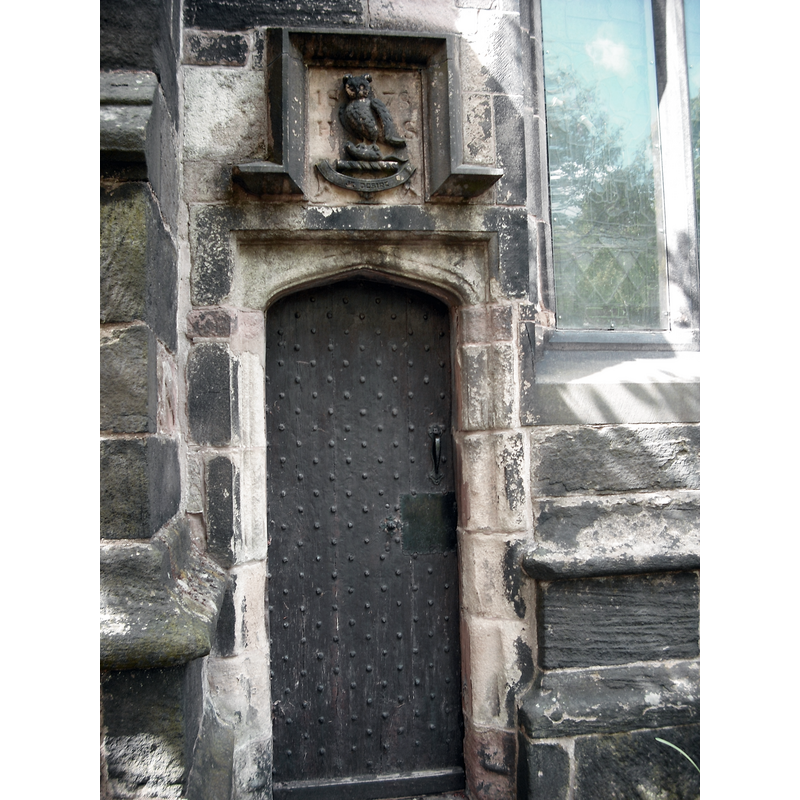
Image copyright © Martinevans123, 2012
CC-BY-SA-3.0
Results: 6 records
view of church exterior - north portal
Copyright Statement: Image copyright © Martinevans123, 2012
Image Source: digital photograph taken 12 May 2012 by Martinevans123 [whttps://commons.wikimedia.org/wiki/File:St_Wilfrid's_north_doorway,_Standish.jpg] [accessed 14 February 2019]
Copyright Instructions: CC-BY-SA-3.0
view of church exterior in context
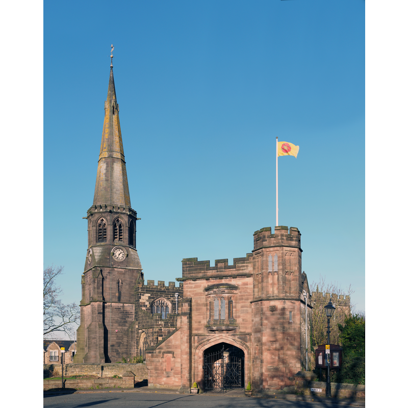
Scene Description: The Peace Gate in the foreground was built by public subscription inn 1926 as a memorial to the dead in the First World War.
Copyright Statement: Image copyright © Francis Franklin, 2014
Image Source: digital photograph taken 2 December 2014 by Francis Franklin [https://commons.wikimedia.org/wiki/File:Standish_st_wilfrids.jpg] [accessed 14 February 2019]
Copyright Instructions: CC-BY-SA-4.0
view of church interior - looking west
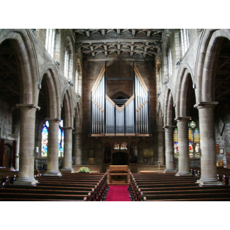
Copyright Statement: Image copyright © Alexander P Kapp, 2008
Image Source: digital photograph taken 2 September 2008 by Alexander P Kapp [www.geograph.org.uk/photo/95290] [accessed 14 February 2019]
Copyright Instructions: CC-BY-SA-2.0
view of church interior - looking east
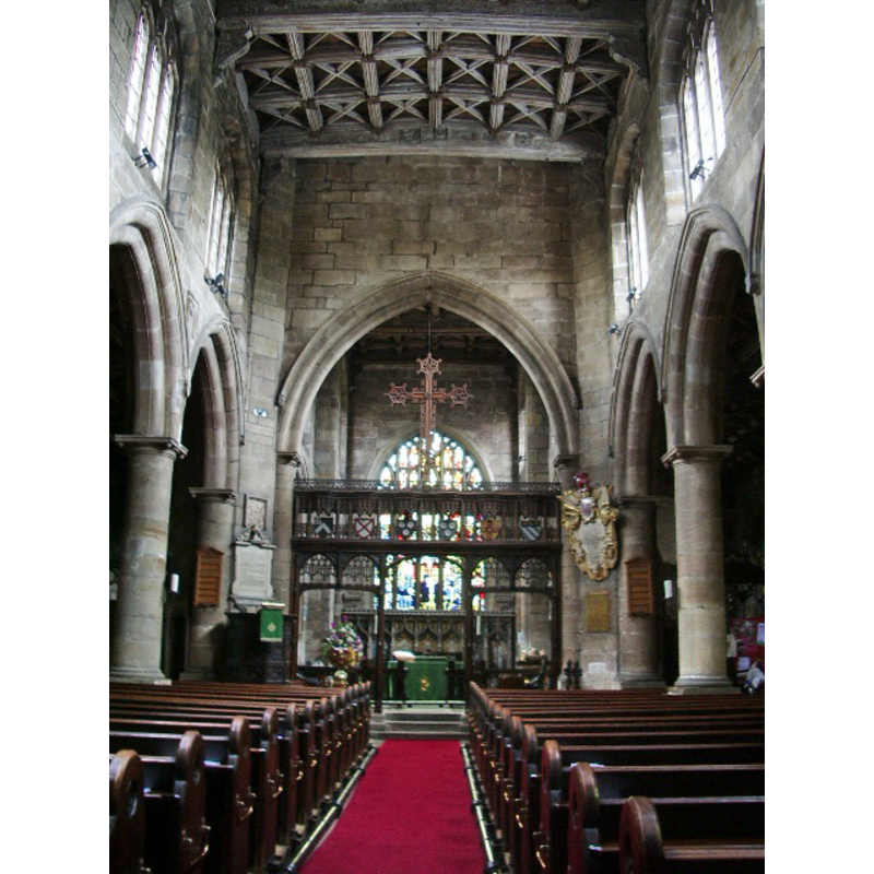
Copyright Statement: Image copyright © Alexander P Kapp, 2008
Image Source: digital photograph taken 2 September 2008 by Alexander P Kapp [www.geograph.org.uk/photo/952894] [accessed 14 February 2019]
Copyright Instructions: CC-BY-SA-2.0
view of church interior - plan

Copyright Statement: Image copyright © The Victoria County History [www.british-history.ac.uk], 2008
Image Source: plan in The Victoria County History [www.british-history.ac.uk] [accessed 30 January 2008]
Copyright Instructions: PERMISSION NOT AVAILABLE -- IMAGE NOT FOR PUBLIC USE
symbol - shield - blank - in a hexafoil - 8


INFORMATION
Font ID: 01562STA
Object Type: Baptismal Font1
Font Century and Period/Style: 12th century / 15th - 16th century[composite font?], Medieval [composite]
Workshop/Group/Artisan: heraldic font
Cognate Fonts: the basin at Sefton (form. In Lancs., now in Merseyside)
Church / Chapel Name: Parish Church of St. Wilfrid
Font Location in Church: Inside the church, in the W end of the S aisle
Church Patron Saint(s): St. Wilfrid [aka Wilfred, Wilfrith]
Church Notes: church documented 1205 but may have existed much earlier; re-built late-16thC; 19thC tower; renovated/restored 20thC
Church Address: 13 Rectory Ln, Standish, Wigan WN6 0XA, UK
Site Location: Greater Manchester, North West, England, United Kingdom
Directions to Site: Located off the A49, 6 km NNW of Wigan
Ecclesiastic Region: Diocese of Blackburn
Historical Region: formerly Lancashire
Additional Comments: altered font / disappeared font (the older one?)
Font Notes:
Click to view
No individual entry found for this Standish in the Domesday survey. An entry for the church at Standish in the Transactions of the Historic Society of Lancashire and Cheshire (LV, 1905: 260-261) reads: "The font seems to be a patchwork of three distinct periods, each marked by a different quality of stone. The bowl is of yellow sandstone, octagonal in shape, the eight panels being alike in design, and having a six-leaved ornament deeply cut, with a shield in the centre. This bowl corresponds exactly in every detail with the bowl in the font in Sefton Church. It stands upon a circular stem of plain clustered columns of a hard grey stone; this appears to be the remains of an earlier font of perhaps late Norman date. The base upon which the stem stands is again of a different stone, and in design is out of keeping with the other parts of the font." Listed in Cox & Harvey (1907) as a baptismal font of the Perpendicular period. Noted in the Victoria County History (Lancaster, vol. 6, 1911): "The font stands at the west end of the south aisle, and consists of an octagonal bowl of yellow sandstone with blank shields within sexfoils on each face. It is probably of early 16th-century date, but stands on an older stem of plain clustered shafts of hard greystone, and the base, again, is of different stone and of later date." This same source reports on a 1739 archdeacon's report on the state of the church which includes the font and cover (ibid., fn90): "From Chester Consistory Court records. There was a stone font with a cover." Pollard & Pevsner (2006) note: Base C19, bowl C16, stem of unknown date."
[NB: this same source notes that there is little trace of the church building which was replaced by the 16th-century church; perhaps the stem of the present font belonged to an earlier font?]
[NB: this same source notes that there is little trace of the church building which was replaced by the 16th-century church; perhaps the stem of the present font belonged to an earlier font?]
COORDINATES
UTM: 30U 522414 5937648
Latitude & Longitude (Decimal): 53.5872, -2.6614
Latitude & Longitude (DMS): 53° 35′ 13.92″ N, 2° 39′ 41.04″ W
MEDIUM AND MEASUREMENTS
Material: stone, type unknown
Font Shape: octagonal, mounted
Basin Interior Shape: round
Basin Exterior Shape: octagonal
REFERENCES
- Victoria County History [online], University of London, 1993-. URL: https://www.british-history.ac.uk.
- Cox, John Charles, English Church Furniture, New York: E.P. Dutton & Co., 1907, p. 205
- Pollard, Richard, Lancashire: Liverpool and the South-West, New Haven, London: Yale University Press, 2006, p. 592