Maghull / Magele / Maghal / Maghale / Maghell / Maghul / Maghyl / Maile / Male / Mauhale / Mauwell
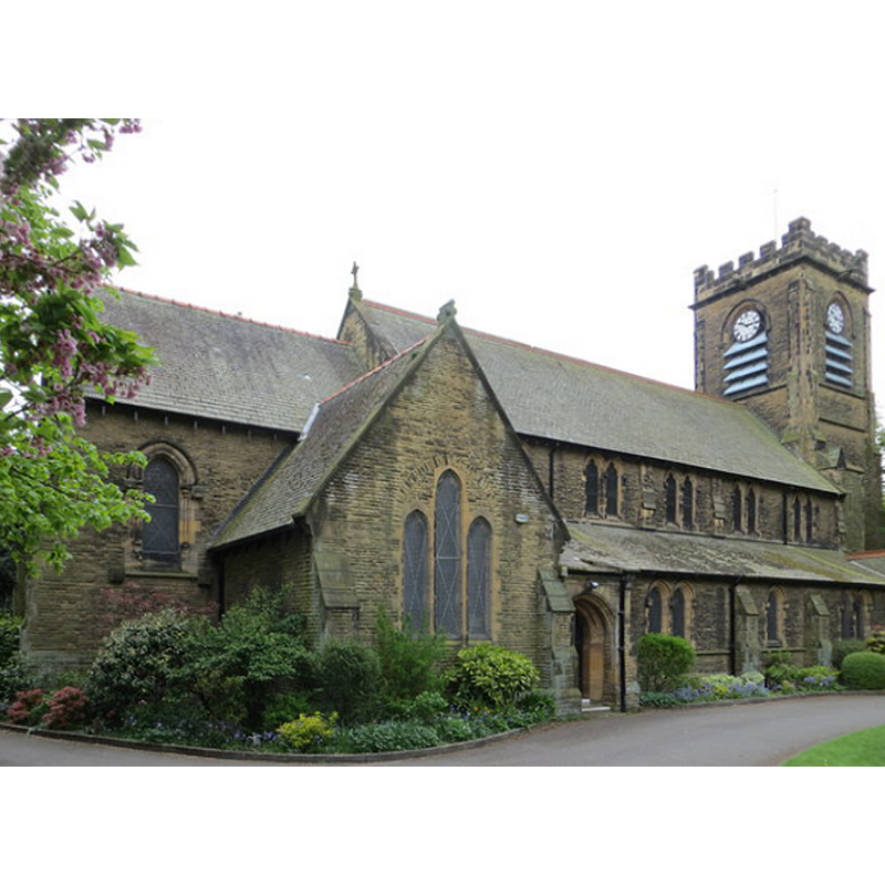
Image copyright © Peter Wood, 2014
CC-BY-SA-2.0
Results: 2 records
view of church exterior - northeast view
Copyright Statement: Image copyright © Peter Wood, 2014
Image Source: digital photograph taken 3 May 2014 by Peter Wood [www.geograph.org.uk/photo/3960521] [accessed 25 June 2014]
Copyright Instructions: CC-BY-SA-2.0
view of church exterior - southwest view
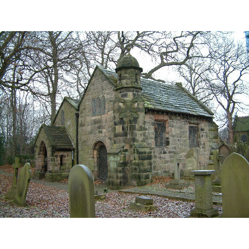
Scene Description: Source caption: "Ancient Chapel Maghull. Located in the grounds of St Andrews Church. Parts of this chapel date from the 13th century. It is open for public viewing only a few days per year."
Copyright Statement: Image copyright © Peter Hodge, 2005
Image Source: digital photograph taken 29 December 2005 by Peter Hodge [www.geograph.org.uk/photo/97160] [accessed 25 June 2014]
Copyright Instructions: CC-BY-SA-2.0
INFORMATION
Font ID: 01557MAG
Object Type: Stoup
Font Century and Period/Style: 15th century [later base], Late Medieval [composite]
Church / Chapel Name: Parish Church of St. Andrew
Font Location in Church: [cf. FontNotes]
Church Patron Saint(s): St. Andrew
Church Address: Northway, Maghull, Sefton L31 7DN
Site Location: Merseyside, North West, England, United Kingdom
Directions to Site: Located in the Borough of Sefton, N of Liverpool, S of Ormskirk
Ecclesiastic Region: Diocese of Liverpool
Historical Region: Hundred of West Derby
Additional Comments: altered font? (the Perpendicular font has a Victorian base) -- disappeared font? (the one from the ca. 1200(?) church here)
Font Notes:
Click to view
There is an entry for Maghull [variant spelling] in the Domesday survey [http://domesdaymap.co.uk/place/SD3702/maghull/] [accessed 25 June 2014], but it mentions neither church nor priest in it. The present font here is listed in Cox & Harvey (1907) as a baptismal font of the Perpendicular period. The Victoria County History (Lancaster, vol. 3, 1907) however, notes: "The origin of the chapel is unknown, but from what has been said above one must have stood there in the thirteenth century [...] The present church of St. Andrew was consecrated 8 September, 1880, and stands near the old site [...] There are a mutilated piscina and a prismshaped holy-water font. A Georgian baptismal font is built into the wall over the modern west door." The information above is also included in F.H. Cheetham's 16 March 1922 presentation to the Transactions... [https://www.hslc.org.uk/wp-content/uploads/2017/06/74-2-Cheetham.pdf] [accessed 4 March 2019], published with photographs.
COORDINATES
UTM: 30U 503800 5929045
Latitude & Longitude (Decimal): 53.5103, -2.9434
Latitude & Longitude (DMS): 53° 30′ 37.19″ N, 2° 56′ 33.72″ W
MEDIUM AND MEASUREMENTS
Material: stone, type unknown
LID INFORMATION
Date: Victorian
Material: wood
REFERENCES
- Victoria County History [online], University of London, 1993-. URL: https://www.british-history.ac.uk.
- Cox, John Charles, English Church Furniture, New York: E.P. Dutton & Co., 1907, p. 205