Burnley / Brumleye / Brunley
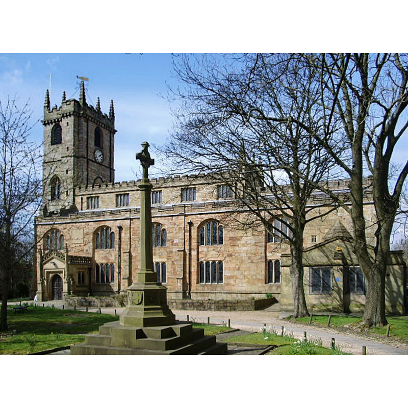
Image copyright © Alexander P Kapp, 2008
CC-BY-SA-2.0
Results: 4 records
view of church exterior - southeast view
Copyright Statement: Image copyright © Alexander P Kapp, 2008
Image Source: digital photograph taken 8 April 2008 by Alexander P Kapp [www.geograph.org.uk/photo/763760] [accessed 18 March 2019]
Copyright Instructions: CC-BY-SA-2.0
view of font

Scene Description: drawing of the destroyed font
Copyright Statement: Image copyright © Burnley St. Peter's Heritage, 2006
Image Source: drawing in the Burnley St. Peter's Heritage web site [www.burnleystpeterheritage.co.uk/tudorstuart.htm]
Copyright Instructions: PERMISSION NOT AVAILABLE -- IMAGE NOT FOR PUBLIC USE
symbol - shield - coat of arms - Townley family
Scene Description: [probably the family of Charles Townley, himself related to the Townleian Collections of ancient art in the British Museum, Townley marbles, etc.]
Copyright Statement: Image copyright © Burnley St. Peter's Heritage, 2006
Image Source: detail of a drawing in the Burnley St. Peter's Heritage web site [www.burnleystpeterheritage.co.uk/tudorstuart.htm]
Copyright Instructions: PERMISSION NOT AVAILABLE -- IMAGE NOT FOR PUBLIC USE
view of church exterior - detail
Scene Description: carving from a stone of the tower, believed to be similar to the one on the destroyed font
Copyright Statement: Image copyright © Burnley St. Peter's Heritage, 2006
Image Source: drawing in the Burnley St. Peter's Heritage web site [www.burnleystpeterheritage.co.uk/tudorstuart.htm]
Copyright Instructions: PERMISSION NOT AVAILABLE -- IMAGE NOT FOR PUBLIC USE
INFORMATION
Font ID: 01554BUR
Object Type: Baptismal Font1
Font Date: ca. 1532?
Font Century and Period/Style: 16th century(early?), Late Perpendicular / Tudor
Workshop/Group/Artisan: heraldic font
Church / Chapel Name: Parish Church of St. Peter
Font Location in Church: [cf. FontNotes]
Church Patron Saint(s): St. Peter
Church Address: 42 Church St, Burnley BB11 2DL, UK -- Tel.: +44 1282 413120
Site Location: Lancashire, North West, England, United Kingdom
Directions to Site: Located about half way between Accrington, to the SW, and Nelson, to the NE
Ecclesiastic Region: Diocese of Blackburn
Historical Region: Hundred of Blackburn
Additional Comments: destroyed font / by a fire -- only a fragment remains -- disappeared font? (the one from the medieval chapel / church here)
Font Notes:
Click to view
No individual entry for Burnley found in the Domesday survey. Cox & Harvey (1907) list a baptismal font of the Perpendicular period here. The entry for this township in the Victoria County History (Lancaster, vol. 6, 1911) notes: "The ancient cross at Burnley suggests the existence of a church there from an early time [...] otherwise the first record of one is in the grant of Whalley Church to the monks of Pontefract about 1121, the charter of Hugh de la Val including with it the 'church' of Burnley [...] At this time [i.e., 1532-3] the present tower was standing, but whether the rest of the building was of 15th-century date or older can only be conjectured. [...] The font stands under the tower [...] and is of 16thcentury date and octagonal in shape, two of its sides bearing the Towneley arms, the others being either plain or carved with shields and other emblems" [footnoted: "These have been variously interpreted. See Wilkinson, op. cit. 4; Whitaker's Whalley (ed. 4, 1876), ii, 159, where there is a full description with illustration."] Noted in Pevsner (1969): "Font. Octagonal. 1532; with the Townley arms. Also a monster and a goat." [NB: the Townley arms refer probably to the family of Charles Townley (1737-1805), himself related to the Townleian Collections of ancient art in the British Museum, Townley marbles, etc. -- an earlier Charles Towneley (d.1644) was killing fighting for Charles I at Marston Moor]. Hartwell & Pevsner (2009) report that the only a fragment of the font now remains. After a fire in 1991. [NB: the Burnley St. Peter's Heritage web site [www.burnleystpeterheritage.co.uk/tudorstuart.htm] informs that "most of it was destroyed in the fire of 1991. A small remaining part is on display in the heritage centre."
COORDINATES
UTM: 30U 550071 5960726
Latitude & Longitude (Decimal): 53.7927, -2.2399
Latitude & Longitude (DMS): 53° 47′ 33.72″ N, 2° 14′ 23.64″ W
MEDIUM AND MEASUREMENTS
Material: stone, type unknown
Font Shape: octagonal, mounted
Basin Interior Shape: round
Basin Exterior Shape: octagonal
REFERENCES
- Victoria County History [online], University of London, 1993-. URL: https://www.british-history.ac.uk.
- Cox, John Charles, English Church Furniture, New York: E.P. Dutton & Co., 1907, p. 205
- Hartwell, Clare, Lancashire North, New Haven; London: Yale University Press, 2009, p. 178
- Pevsner, Nikolaus, Lancashire, Harmondsworth: Penguin Books, 1969, vol. 2: 80