Formby / Form by / Fornebei / Fornebi / Forneby / Mele / Raven Meols
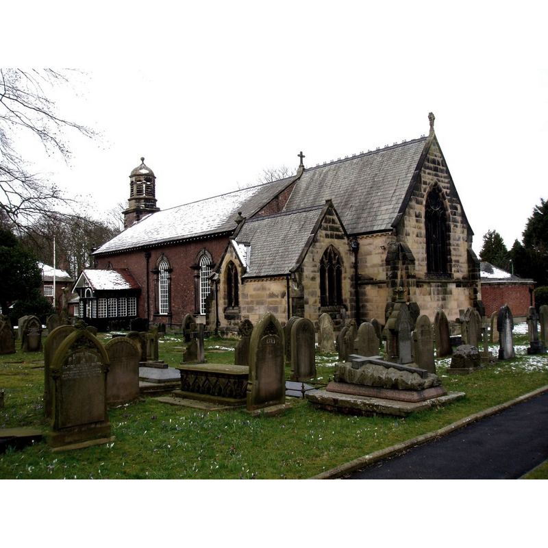
Image copyright © Norman Caesar, 2013
CC-BY-SA-2.0
Results: 8 records
view of church exterior - southeast view
Copyright Statement: Image copyright © Norman Caesar, 2013
Image Source: digital photograph taken 24 March 2013 by Norman Caesar [www.geograph.org.uk/photo/3380645] [accessed 26 February 2019]
Copyright Instructions: CC-BY-SA-2.0
view of font

Scene Description: the old basin on the new wooden base
Copyright Statement: Image copyright © CRSBI, 2019
Image Source: digital photograph taken 28 April 2018 by James Cameron, in the CRSBI (2019) [www.crsbi.ac.uk/site/3840/] [accessed 26 February 2019]
Copyright Instructions: PERMISSION NOT AVAILABLE -- IMAGE NOT FOR PUBLIC USE
view of font
Scene Description: the old basin on a modern pedestal base
Copyright Statement: Image copyright © Formby Civic Society, 2010
Image Source: B&W photograph taken on June 26, 2010 and watermarked 'Formby Civic Society' [www.flickr.com/photos/formbycivicsociety/4736548520/] [accessed 25 June 2014]
Copyright Instructions: PERMISSION NOT AVAILABLE -- IMAGE NOT FOR PUBLIC USE
view of basin
Copyright Statement: Image copyright © CRSBI, 2019
Image Source: digital photograph taken 28 April 2018 by James Cameron, in the CRSBI (2019) [www.crsbi.ac.uk/site/3840/] [accessed 26 February 2019]
Copyright Instructions: PERMISSION NOT AVAILABLE -- IMAGE NOT FOR PUBLIC USE
view of basin
Copyright Statement: Image copyright © CRSBI, 2019
Image Source: digital photograph taken 28 April 2018 by James Cameron, in the CRSBI (2019) [www.crsbi.ac.uk/site/3840/] [accessed 26 February 2019]
Copyright Instructions: PERMISSION NOT AVAILABLE -- IMAGE NOT FOR PUBLIC USE
view of basin
Copyright Statement: Image copyright © CRSBI, 2019
Image Source: digital photograph taken 28 April 2018 by James Cameron, in the CRSBI (2019) [www.crsbi.ac.uk/site/3840/] [accessed 26 February 2019]
Copyright Instructions: PERMISSION NOT AVAILABLE -- IMAGE NOT FOR PUBLIC USE
view of basin
Copyright Statement: Image copyright © Formby Civic Society, 2010
Image Source: B&W photograph taken on June 26, 2010 and watermarked 'Formby Civic Society' [www.flickr.com/photos/formbycivicsociety/4736549698/] [accessed 25 June 2014]
Copyright Instructions: PERMISSION NOT AVAILABLE -- IMAGE NOT FOR PUBLIC USE
information
Scene Description: plaque attached to the wooden base of the font
Copyright Statement: Image copyright © CRSBI, 2019
Image Source: edited detail of a digital photograph taken 28 April 2018 by James Cameron, in the CRSBI (2019) [www.crsbi.ac.uk/site/3840/] [accessed 26 February 2019]
Copyright Instructions: PERMISSION NOT AVAILABLE -- IMAGE NOT FOR PUBLIC USE
INFORMATION
Font ID: 01542FOR
Object Type: Baptismal Font1
Font Century and Period/Style: 12th century, Late Norman
Church / Chapel Name: Parish Church of St. Luke
Font Location in Church: Inside the church
Church Patron Saint(s): St. Luke
Church Address: St Luke's Church Road, Formby, Liverpool L37 2DF, UK -- Tel.: +44 1704 877655
Site Location: Merseyside, North West, England, United Kingdom
Directions to Site: Located between Ainsdale (N) and Raven Meols (SW)
Ecclesiastic Region: Diocese of Liverpool
Historical Region: formerly in Lancashire [and Cheshire?] -- Hundred of West Derby
Font Notes:
Click to view
There is an entry for Formby [variant spelling] in the Domesday survey [http://domesdaymap.co.uk/place/SD3007/formby/] [accessed 25 June 2014], but it mentions neither cleric nor church in it. The Domesday survey has a separate entry for Raven Meols [variant spelling] [http://www.domesdaymap.co.uk/place/SD2906/raven-meols/] [accessed 24 July 2014], which has no mention of cleric or church in it either. Ellis (1902) notes: "A memorial chapel has been erected on or near the site of the older church, and on a heap of stone, which formed part of this older structure, is the bowl of an ancient font, in a dilapidated condition. It is of coarse sandstone, is roughly circular, about two feet in diameter, and in favourable lighting bear trace of having been fluter perpendicularly. It has been perforated for drainage, but bears no trace of lining. It has the appearance and size of a font of the twelfth century, but I fear it is not possible to estimate its age with any approach to accuracy." Listed in Cox & Harvey (1907) as a baptismal font of the Norman period. Th entry for this parish in the e Victoria County History (Lancaster, vol. 3, 1907) notes: "The parochial chapel appears to have stood originally in Raven Meols, [...] but the site of the modern St. Luke's Church, with its ancient burial ground, [...] is now within the limits of Formby. Little is known of its history. In 1334 a settlement was made of a dispute as to the tithes of the fishery at Raven Meols between the rectors of Walton and Sefton. [...] Its fate after the Reformation is not known. [...] The Commonwealth Surveyors of 1650 described the chapel as ancient and parochial"; there is no mention of font or stoup in the VCH entry for this church, except for a reference in a footnote: "For the font see Trans. Hist. Soc. (New Ser.), xvii, 62." The web page for the Parish of Formby St. Luke's notes: "this is an ancient site. We've got a 12th Century font from the original Formby Chapel as evidence for that. The Church before this one was destroyed in a sandstorm in 1739, a storm so bad that it obliterated all the boundary marks." The entry for this church in the CRSBI (2019) notes: "A chapel there was destroyed by a sandstorm in 1739, and may have been medieval. [...] The precise location of the original chapel is not known, and no fragments remain, except the font. [...] A plain bowl, very worn, placed on a wooden stand in the corner of the porch. There appears to be a detailed lower rim to the font, the recent Building of England claims to be a "rope-moulding" although this does not appear to be evident. There is a lead infill visible, presumably the fixing for the font cover. The bowl is currently filled in with soil for flowers so it is not possible to measure the depth of the bowl.
The Formby Civic Society shows a photograph [www.flickr.com/photos/formbycivicsociety/4736548520/] [accessed 25 June 2014] of an old weathered basin raised on a modern pedestal base. [NB: the weathered basin surface does not offer much to the eye, but the angles of the lower part may indicate a polygonal shape; it this font as old as claimed to be?]
The Formby Civic Society shows a photograph [www.flickr.com/photos/formbycivicsociety/4736548520/] [accessed 25 June 2014] of an old weathered basin raised on a modern pedestal base. [NB: the weathered basin surface does not offer much to the eye, but the angles of the lower part may indicate a polygonal shape; it this font as old as claimed to be?]
COORDINATES
UTM: 30U 496072 5935316
Latitude & Longitude (Decimal): 53.566702, -3.059313
Latitude & Longitude (DMS): 53° 34′ 00.13″ N, 3° 3′ 33.53″ W
MEDIUM AND MEASUREMENTS
Material: stone, sandstone
Font Shape: round
Basin Interior Shape: round
Basin Exterior Shape: round
Drainage System: centre hole in basin
Drainage Notes: no lining [cf. FontNotes]
Diameter (includes rim): 60.96 cm* / 30 cm**
Basin Total Height: 36 cm**
Notes on Measurements: * [approximately 2 ft. in Ellis (1902)] / ** CRSBI [approximately] (2019)
REFERENCES
- Victoria County History [online], University of London, 1993-. URL: https://www.british-history.ac.uk.
- Corpus of Romanesque Sculpture in Britain and Ireland, The Corpus of Romanesque Sculpture in Britain and Ireland, The Corpus of Romanesque Sculpture in Britain and Ireland. URL: http://www.crsbi.ac.uk.
- Cox, John Charles, English Church Furniture, New York: E.P. Dutton & Co., 1907, p. 205
- Ellis, John W., "The Mediaeval Fonts of the Hundreds of West Derby and Wirral", LVIII (New series: XVII), Transactions of the Historic Society of Lancashire and Cheshire, 1902, pp. 59-80; p. 62-63