Marbury / Marbury-cum-Quoisley / Merberie
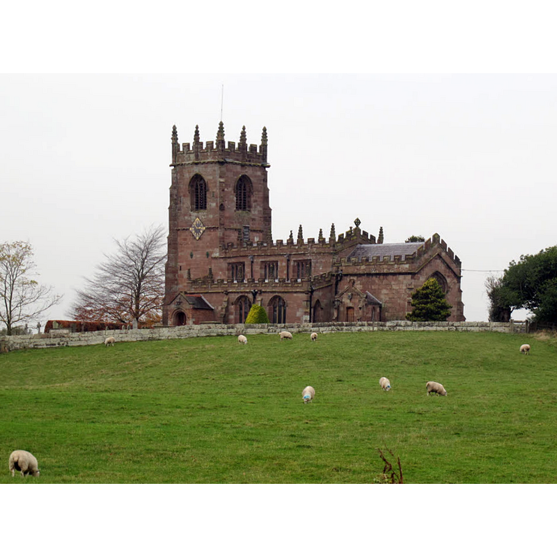
Image copyright © Stephen Craven, 2014
CC-BY-SA-3.0
Results: 3 records
view of church exterior in context - southeast view
Scene Description: Source caption: "Church of St Michael, Marbury: [...] A view of the parish church from the road approaching Marbury from the south. "
Copyright Statement: Image copyright © Stephen Craven, 2014
Image Source: digital photograph taken 16 November 2014 by Stephen Craven [www.geograph.org.uk/photo/4269359] [accessed 26 August 2020]
Copyright Instructions: CC-BY-SA-3.0
view of church exterior - information sign - southwest view
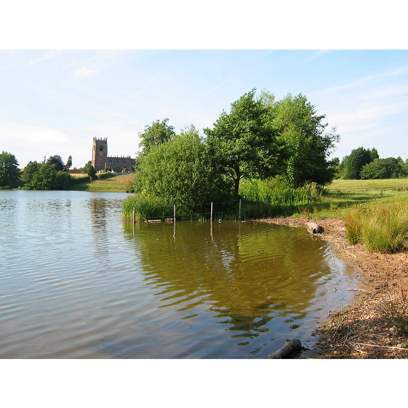
Scene Description: Church of St Michael and All Angels, Marbury, on the northeast shores of the Big Mere
Copyright Statement: Image copyright © Espresso Addict, 2006
Image Source: digital photograph taken 16 July 2006 bu Espresso Addict [https://commons.wikimedia.org/wiki/File:Marbury_church_from_Big_Mere.jpg] [accessed 26 August 2020]
Copyright Instructions: GFDL / CC-BY-SA-3.0
view of church interior - looking east
![Source caption: "Church of St Michael, Marbury:[...] The nave is 16th century."](/static-50478a99ec6f36a15d6234548c59f63da52304e5/compressed/1200826003_compressed.png)
Scene Description: Source caption: "Church of St Michael, Marbury:[...] The nave is 16th century."
Copyright Statement: Image copyright © Stephen Craven, 2014
Image Source: digital photograph taken 16 November 2014 by Stephen Craven [www.geograph.org.uk/photo/4269342] [accessed 26 August 2020]
Copyright Instructions: CC-BY-SA-3.0
INFORMATION
Font ID: 01444MAR
Object Type: Baptismal Font1
Font Century and Period/Style: 15th century, Perpendicular
Church / Chapel Name: Parish Church of St. Michael and All Angels
Font Location in Church: Inside the church
Church Patron Saint(s): St. Michael & All Angels
Church Notes: church here documented 1299; present church is 1thC, a chapel of ease to Whitchurch; became parochial 1870; modified and restored 19thC
Church Address: 23 Wirswall Rd, Marbury, Whitchurch SY13 4LL, UK -- Tel.: +44 1948 662910
Site Location: Cheshire, North West, England, United Kingdom
Directions to Site: Located on the NE shore of the Big Mere, E of the A49, 3-4 km NNE of Whitchurch, about 25 km SSE of Chester
Ecclesiastic Region: Diocese of Chester
Historical Region: Hundred of Warmundestrou
Font Notes:
Click to view
There is an entry for Marbury [variant spelling] in the Domesday survey [https://opendomesday.org/place/SJ5545/marbury/] [accessed 26 August 2020] but it mentions neither cleric nor church in it. Cox & Harvey (1907) list a baptismal font of the Perpendicular period here. The entry for this church in Historic England [Listing NGR: SJ5605245636] mentions no font in it.
COORDINATES
UTM: 30U 523056 5873015
Latitude & Longitude (Decimal): 53.0062, -2.6564
Latitude & Longitude (DMS): 53° 0′ 22.32″ N, 2° 39′ 23.04″ W
MEDIUM AND MEASUREMENTS
Material: stone, type unknown
Font Shape: octagonal, mounted
Basin Interior Shape: round
Basin Exterior Shape: octagonal
REFERENCES
- Cox, John Charles, English Church Furniture, New York: E.P. Dutton & Co., 1907, p. 189