Fen Drayton / Draitone
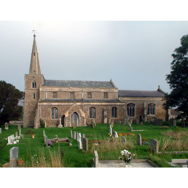
Image copyright © Philip Talmage, 2005
CC-BY-SA-2.0
Results: 1 records
view of church exterior - south view
Scene Description: Source caption: "Fen Drayton parish church […] The Parish Church of St Mary dates from the 12th century."
Copyright Statement: Image copyright © Philip Talmage, 2005
Image Source: digital photograph taken 15 October 2005 by Philip Talmage [www.geograph.org.uk/photo/69422] [accessed 4 July 2016]
Copyright Instructions: CC-BY-SA-2.0
INFORMATION
Font ID: 01406FEN
Object Type: Baptismal Font1
Font Century and Period/Style: 14th century [basin only] [composite font], Medieval [composite]
Church / Chapel Name: Parish Church of St. Mary
Font Location in Church: Inside the church, in the nave
Church Patron Saint(s): St. Mary the Virgin
Church Address: Church Street, Fen Drayton, Cambridgeshire CB4 5SG
Site Location: Cambridgeshire, East, England, United Kingdom
Directions to Site: Located off (N) the A14, halfway (12-13 km) between Cambridge and Huntingdon
Ecclesiastic Region: Diocese of Ely
Historical Region: Hundred of Papworth
Additional Comments: altered font? (the present font: old basin on modern replacement columns) -- disappeared font? (the one from the pre-1184 church here)
Font Notes:
Click to view
There are five entries for [Fen] Drayton [variant spelling] in the Domesday survey [http://opendomesday.org/place/TL3368/fen-drayton/] [accessed 4 July 2016], none of which mentions cleric or church in it. The 1844+ catalogue of the British Museum notes "sketches, in pencil, of the piscina and font in Fen-Drayton Church; drawn by Samuel Lysons Esq.: 4 in. x 3 1/2 in. [add. 9461. fol. 41]". Listed in Cox & Harvey (1907) as a baptismal font of the Decorated period. [cf. Index entry for Waterbeach, Cambs]. The Victoria County History (Cambridge…, vol. 9, 1989) notes: "The church had probably belonged in the 12th century to the Richmond manor: in 1184 Alan, viscount of Rohan, gave it in free alms to his newly founded abbey of Bon Repos (Côtesdu-Nord). […] The plain octagonal font was still built into an aisle pier in 1850." The Vicarage Web Site [www.honeyhill.org] [accessed 25 October 2007] dates the font to the 14th century.
COORDINATES
UTM: 30U 701879 5798149
Latitude & Longitude (Decimal): 52.29654, -0.039392
Latitude & Longitude (DMS): 52° 17′ 47.54″ N, 0° 2′ 21.81″ W
MEDIUM AND MEASUREMENTS
Material: stone, type unknown
Font Shape: octagonal, mounted
Basin Interior Shape: round
Basin Exterior Shape: octagonal
REFERENCES
- Victoria County History [online], University of London, 1993-. URL: https://www.british-history.ac.uk.
- British Museum, Catalogue of the manuscript maps, charts, and plans, and of the topographical drawings in the British Museum, London: Printed by order of the Trustees, 1844-
- Cox, John Charles, English Church Furniture, New York: E.P. Dutton & Co., 1907, p. 188