Wilburton / Wilbertone
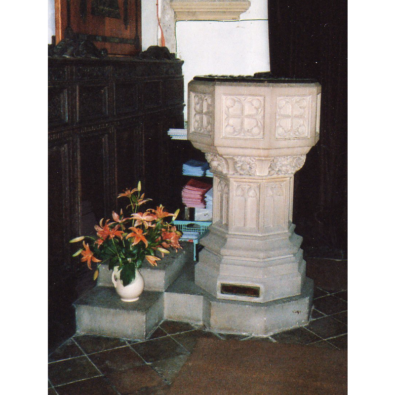
Image copyright © joyze, 2008
No known copyright restriction / Fair Dealing
Results: 2 records
view of font and cover
Scene Description: the modern font
Copyright Statement: Image copyright © joyze, 2008
Image Source: digital photograph taken 22 June 2008 by
joyze [ref.: 51110240109], in [http://wilburton.ccan.co.uk/content/catalogue_item/the-font-in-wilburton-church] [accessed 25 April 2016]
Copyright Instructions: No known copyright restriction / Fair Dealing
view of church exterior - southwest view
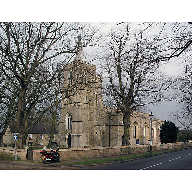
Copyright Statement: Image copyright © mym, 2004
Image Source: digital photograph taken 2 November 2004 by mym [www.geograph.org.uk/photo/3262] [accessed 25 April 2016]
Copyright Instructions: CC-BY-SA-2.0
INFORMATION
Font ID: 01401WIL
Object Type: Baptismal Font1?
Font Century and Period/Style: 13th century (early?), Early English
Church / Chapel Name: Parish Church of St. Peter
Church Patron Saint(s): St. Peter
Church Address: Church Lane, Wilburton, Cambridgeshire CB6 3RE
Site Location: Cambridgeshire, East, England, United Kingdom
Directions to Site: Located off the A1123, just W of the A10, 11 km SW of Ely, 20 km N of Cambridge
Ecclesiastic Region: Diocese of Ely
Historical Region: Hundred of Ely 1 [in Domesday] --
Additional Comments: disappeared font? (the one from the early-13thC church here)
Font Notes:
Click to view
There is an entry for Wilburton [variant spelling] in the Domesday survey [http://opendomesday.org/place/TL4774/wilburton/] [accessed 25 April 2016], but it mentions neither cleric nor church in it. A font here is listed as Early English in Parker (1852). Cox & Harvey (1907) list a baptismal font of the Early English period here. The Victoria Count History (Cambridge..., vol. 4, 2002) notes: "The church was appropriated (annexata) to the archdeaconry of Ely before 1291, when it was valued at £14 13s. 4d. [...] Earlier valuations had been £10 (1217) and £13 6s. 8d. (1254) [...] The [present] chancel arch and the tower are of the 13th century. There was an extensive rebuilding in the second half of the 15th century [...] The font is modern." A baptismal font inside the church is reported in Cambridgeshire Churches (2004): "The font itself is 19th century and not terribly interesting" [NB: did the font Cox & Harvey noted as Early English, or did that font disappear?]
COORDINATES
UTM: 31U 307169 5803891
Latitude & Longitude (Decimal): 52.35135, 0.168605
Latitude & Longitude (DMS): 52° 21′ 4.86″ N, 0° 10′ 6.98″ E
MEDIUM AND MEASUREMENTS
Material: type unknown
REFERENCES
- Victoria County History [online], University of London, 1993-. URL: https://www.british-history.ac.uk.
- Cox, John Charles, English Church Furniture, New York: E.P. Dutton & Co., 1907, p. 188
- Parker, John Henry, The Ecclesiastical and architectural topography of England: Huntingdonshire, London: Archaeological Institute of Great Britain and Ireland, 1851