Arrington / Erningtone / Erningtune

Image copyright © John Salmon, 2012
CC-BY-SA-2.0
Results: 5 records
view of font and cover
Scene Description: the fragments (?) of the old font and the restoration repairs are easily discernible here
Copyright Statement: Image copyright © John Salmon, 2012
Image Source: digital photograph taken 8 September 2012 by John Salmon [www.geograph.org.uk/photo/3150361] [accessed 16 May 2016]
Copyright Instructions: CC-BY-SA-2.0
design element - motifs - roll moulding
Copyright Statement: Image copyright © John Salmon, 2012
Image Source: digital photograph taken 8 September 2012 by John Salmon [www.geograph.org.uk/photo/3150361] [accessed 16 May 2016]
Copyright Instructions: CC-BY-SA-2.0
view of church exterior - south view
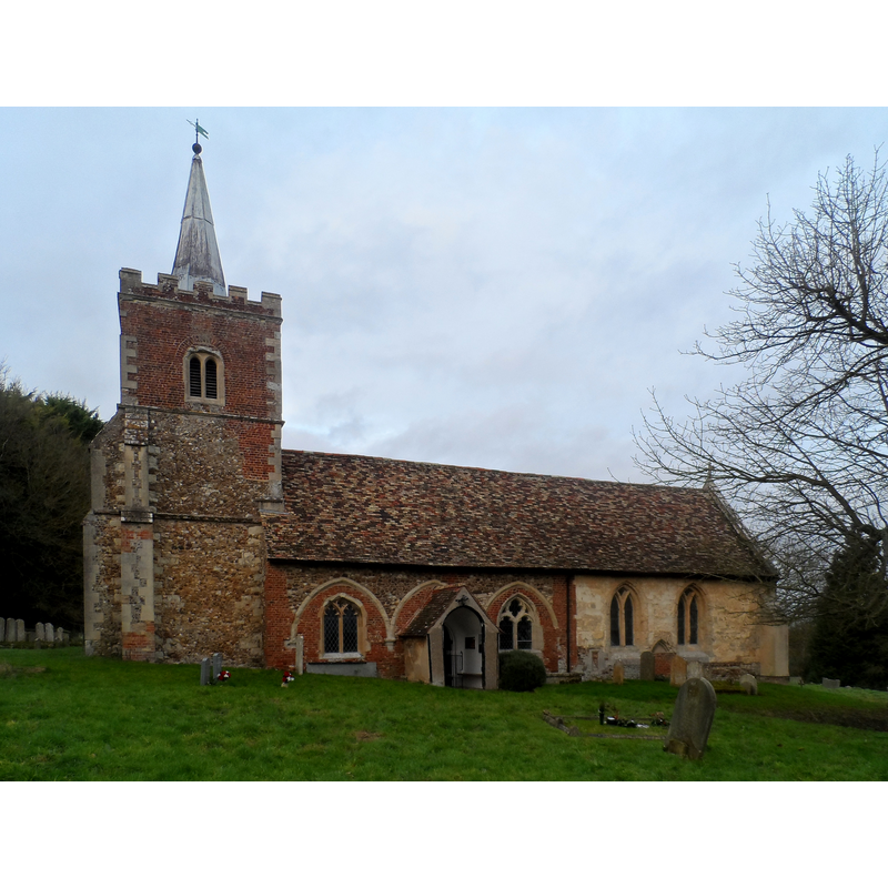
Scene Description: Source caption: "St Nicholas' church, Arrington Mostly C13. The bell stage of the tower is C17. The two chancel windows (far right) are C13."
Copyright Statement: Image copyright © Bikeboy, 2014
Image Source: digital photograph taken 22 December 2014 by Bkeboy [www.geograph.org.uk/photo/4295658] [accessed 16 May 2016]
Copyright Instructions: CC-BY-SA-2.0
view of church interior - nave - looking west
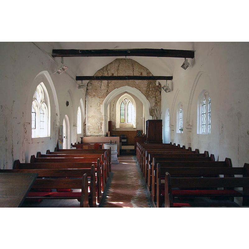
Scene Description: the font and cover are visible towards the west end of the nave, opposite the south entranceway
Copyright Statement: Image copyright © John Salmon, 2012
Image Source: digital photograph taken 8 September 2012 by John Salmon [www.geograph.org.uk/photo/3150357] [accessed 16 May 2016]
Copyright Instructions: CC-BY-SA-2.0
view of church interior - nave - looking east
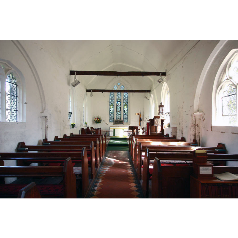
Copyright Statement: Image copyright © John Salmon, 2012
Image Source: digital photograph taken 8 September 2012 by John Salmon [www.geograph.org.uk/photo/3150353] [accessed 16 May 2016]
Copyright Instructions: CC-BY-SA-2.0
INFORMATION
Font ID: 01375ARR
Object Type: Baptismal Font1
Font Century and Period/Style: 11th - 12th century, Transitional / Early English
Cognate Fonts: the font at Stanstead, Essex
Church / Chapel Name: Parish Church of St. Nicholas
Font Location in Church: Inside the church
Church Patron Saint(s): St. Nicholas of Myra
Church Address: 6 Croydon Road, Arrington, Cambridgeshire SG8 0BD
Site Location: Cambridgeshire, East, England, United Kingdom
Directions to Site: Located on the A1198, just N of the A603, 20 km SW of Cambridge
Ecclesiastic Region: Diocese of Ely
Historical Region: Hundred of Wetherley
Additional Comments: disappeared font? (the one from the late-11thC church here)
Font Notes:
Click to view
There are two entries for Arrington [variant spelling] in the Domesday survey [http://opendomesday.org/place/TL3250/arrington/] [accessed 16 May 2016], neither of which mentions cleric or church in it. Gough (1792) notes that this font and the one at Stanstead (Essex) "are shaped like the frustum of a pillar on a base." Listed in Cox & Harvey (1907) as a baptismal font of the Norman period. There is no mention of this font in the RCHM (Cambridgeshire, 1968) entry for the church and village. The entry for this church in English Heritage [Listing NGR: TL3251650303] (1967) notes: " Font, c.13. Limestone. Tapering bowl with roll moulded lower edge, round stem and plinths with chamfered upper edge." The Victoria County History (Cambridge..., vol. 5, 1972) notes: "Between 1087 and 1093 Roger, earl of Shrewsbury, gave Arrington church, the priest's land, and part of the tithes to the abbey of St. Martin, Sées (Orne) [...] The early medieval church was completely rebuilt in the course of a continuous building operation in the later 13th century;" no font mentioned in the VCH entry. The font is described in Cambridgeshire Churches [www.druidic.org/camchurch] as being of "an unusual design -- an extremely uneven round cylindrical bowl with a protruding ring around the waist. It looks like a fat little hat sitting on a tree stump"; the same source compares it to the font at St. Laurence's in Foxton [cf. Index entry]. The 'Recent Grants' report of the Grants Committee of the Historic Churches Preservation Trust [28 September 2004] records a baptismal font "of particular interest" in this church. [source: www.historicchurches.org.uk/recent_grants]
COORDINATES
UTM: 30U 700825 578032930U 700825 5780329
Latitude & Longitude (Decimal): 52.136918, -0.065406
Latitude & Longitude (DMS): 52° 8′ 12.91″ N, 0° 3′ 55.46″ W
MEDIUM AND MEASUREMENTS
Material: stone, type unknown
Font Shape: cylindrical, mounted
Basin Interior Shape: round
Basin Exterior Shape: round
LID INFORMATION
Material: wood, oak?
Apparatus: no
Notes: round, flat and plain, with large acorn finial
REFERENCES
- Victoria County History [online], University of London, 1993-. URL: https://www.british-history.ac.uk.
- Cox, John Charles, English Church Furniture, New York: E.P. Dutton & Co., 1907, p. 188
- Gough, Richard, "Description of the old font in the Church of East Meon, Hampshire, 1789: with some observations on fonts", X, Archaeologia, 1792, pp. 183-209; p. 189