Stoke Goldington / Stoches / Stocking / Stok Goldington / Stokes
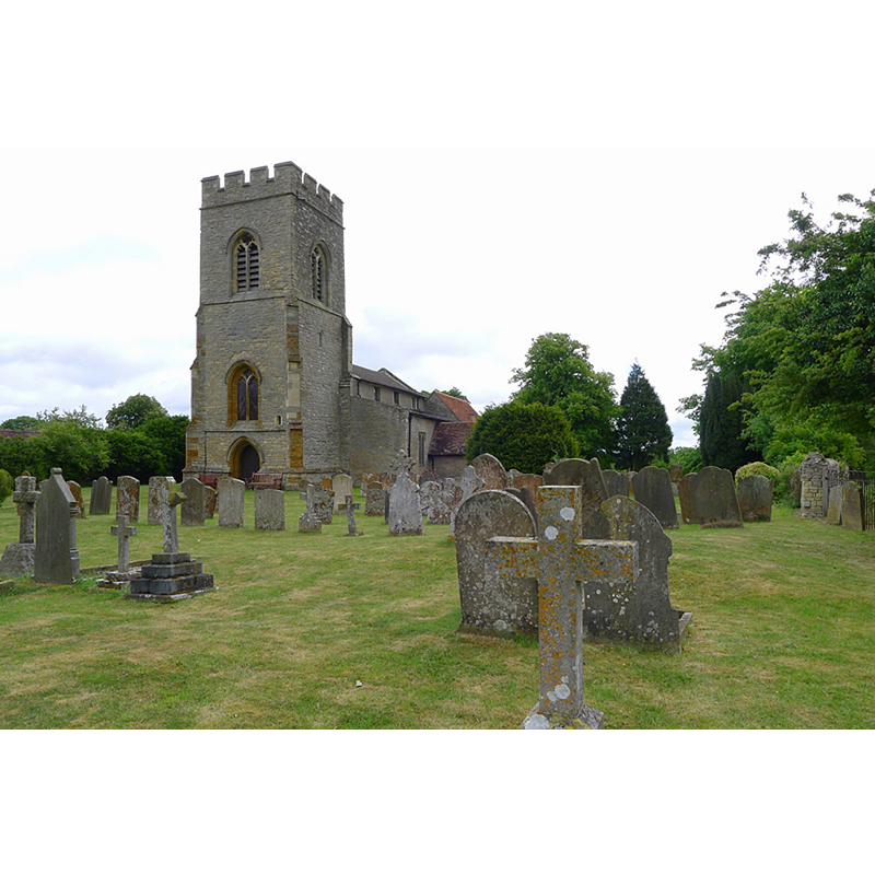
Image copyright © Cameraman, 2011
CC-BY-SA-2.0
Results: 2 records
view of church exterior - southwest view
Copyright Statement: Image copyright © Cameraman, 2011
Image Source: digital photograph taken 2 May 2011 by Cameraman [www.geograph.org.uk/photo/2427944] [accessed 25 February 2016]
Copyright Instructions: CC-BY-SA-2.0
view of font

Copyright Statement: Image copyright © The Corpus of Romanesque Sculpture in Britain and Ireland, 2016
Image Source: photograph by Ron Baxter in the CRSBI [www.crsbi.ac.uk/site/3139/] [accessed 25 February 2016]
Copyright Instructions: PERMISSION NOT AVAILABLE -- IMAGE NOT FOR PUBLIC USE
INFORMATION
Font ID: 01352STO
Object Type: Baptismal Font1
Font Century and Period/Style: 12th century, Late Norman
Church / Chapel Name: Parish Church of St. Peter
Font Location in Church: Inside the church, S aisle, W end
Church Patron Saint(s): St. Peter
Church Address: 6 Dag Lane, Stoke Goldington, Milton Keynes MK16 8NZ
Site Location: Buckinghamshire, South East, England, United Kingdom
Directions to Site: Located on the B526, just N of the M1, 6 km WSW of Olney, 6 NW of Newport Pagnell, 16 km N of Milton Keynes, 20 km SSE of Northampton
Ecclesiastic Region: Diocese of Oxford
Historical Region: Hundred of Bunsty [in Domesday] -- Hundred of Newport
Additional Comments: altered font? (repaired and restored)
Font Notes:
Click to view
There are two entries for Stoke [Goldington] [variant spelling] in the Domesday survey [http://opendomesday.org/place/SP8348/stoke-goldington/] [accessed 25 February 2016], neither of which mentions cleric or church in it. Parker (1850), Sheahan (19862) and Cox & Harvey (1907) report a baptismal font of the Norman period here. The Victoria County History (Buckingham, vol. 4, 1927) notes: "The earliest part of the structure is the nave, which is shown by the chancel arch to be of the early 12th century. [...] The font is quite plain, and has a tapered circular bowl of the 12th or 13th century." Noted and illustrated in the CRSBI (2016): "At the W end of the S aisle is a plain, tub-shaped font on a drum base. The bowl has three horizontal circumferential cracks. All have been repaired and the sections below the top crack have been treated with a yellowish protective coating. The top section, comprising approximately one-third of the height of the bowl, has been tooled and is uncoated. The bowl is lead lined, and on the rim is an insert repair at the S, and a filled hole at the N, suggesting the removal of staples."
COORDINATES
UTM: 30U 651438 5778247
Latitude & Longitude (Decimal): 52.133963, -0.787323
Latitude & Longitude (DMS): 52° 8′ 2.27″ N, 0° 47′ 14.36″ W
MEDIUM AND MEASUREMENTS
Material: stone, type unknown
Font Shape: bucket-shaped
Basin Interior Shape: round
Basin Exterior Shape: round
Drainage Notes: lead-lined
Rim Thickness: 8.75 cm [calculated]
Diameter (inside rim): 57 cm*
Diameter (includes rim): 74.5 cm*
Basin Total Height: 63 cm*
Height of Base: 15 cm [calculated]
Font Height (less Plinth): 78 cm*
LID INFORMATION
Notes: [cf. FontNotes]
REFERENCES
- Victoria County History [online], University of London, 1993-. URL: https://www.british-history.ac.uk.
- Corpus of Romanesque Sculpture in Britain and Ireland, The Corpus of Romanesque Sculpture in Britain and Ireland, The Corpus of Romanesque Sculpture in Britain and Ireland. URL: http://www.crsbi.ac.uk.
- Cox, John Charles, English Church Furniture, New York: E.P. Dutton & Co., 1907, p. 187
- Parker, John Henry, The Ecclesiastical and architectural topography of England: Oxfordshire, Oxford, London: Published under the sanction of the Central Commitee of the Archaeological Institute of Great Britain and Ireland [by] John Henry Parker, 1850, [entry no.] 109