Hawridge nr. Cholesbury-cum-St Leonards / Aucrug / Harridge / Hauregge / Hauerigge / Hawryg / Hoquerug
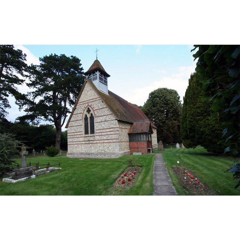
Image copyright © Tom Presland, 2010
CC-BY-SA-2.0
Results: 4 records
view of church exterior - southwest view
Copyright Statement: Image copyright © Tom Presland, 2010
Image Source: digital photograph taken 17 September 2010 by Tom Presland [www.geograph.org.uk/photo/2070375] [accessed 16 November 2015]
Copyright Instructions: CC-BY-SA-2.0
view of font

Copyright Statement: Image copyright © Martin Beek, 2005
Image Source: digital photograph in FLICKR [www.flickr.com/photos/oxfordshire_church_photos] taken by Martin Beek on 25 September 2005
Copyright Instructions: PERMISSION NOT AVAILABLE -- IMAGE NOT FOR PUBLIC USE
design element - motifs - floral - rosette - in a circle
Copyright Statement: Image copyright © Martin Beek, 2005
Image Source: detail of a digital photograph in FLICKR [www.flickr.com/photos/oxfordshire_church_photos] taken by Martin Beek on 25 September 2005
Copyright Instructions: PERMISSION NOT AVAILABLE -- IMAGE NOT FOR PUBLIC USE
design element - motifs
Scene Description: abstract plant-like motifs between the inscribed rosettes
Copyright Statement: Image copyright © Martin Beek, 2005
Image Source: detail of a digital photograph in FLICKR [www.flickr.com/photos/oxfordshire_church_photos] taken by Martin Beek on 25 September 2005
Copyright Instructions: PERMISSION NOT AVAILABLE -- IMAGE NOT FOR PUBLIC USE
INFORMATION
Font ID: 01347HAW
Object Type: Baptismal Font1
Font Century and Period/Style: 12th - 13th century, Medieval
Church / Chapel Name: Parish Church of St. Mary
Font Location in Church: Inside the church
Church Patron Saint(s): St. Mary the Virgin
Church Notes: church here first documented 1227; re-built 1856
Church Address: Church Lane, St Leonards, Buckinghamshire HP5 2UH
Site Location: Buckinghamshire, South East, England, United Kingdom
Directions to Site: Located near Cholesbury and St Leonards, 5 km NNW of Chesham, 10 km E of Wendover, to the SE of Aylesbury
Ecclesiastic Region: Diocese of Oxford
Historical Region: Hundred of Cottesloe [in Domesday]
Font Notes:
Click to view
No entry for Hawridge found in the Domesday survey. The Lysons (1806-1833) report a round baptismal font decorated with a border of roses in this church. Rickman (1850) notes it as circular and Norman. The Records of Buckinghamshire (1858: 268) reports the cleaning and re-fitting of the old Norman font in the replacement church consecrated on 13 November 1856. [NB: this same source notes: "The old Church, which was a plain uninteresting structure of the 13th century, having become very dilapidated, was taken down", which would suggest the font itself was not Norman but Early English]. Listed in Cox & Harvey (1907) as a baptismal font of the Norman period, a noteworthy example. Described in the RCAHM (Buckinghamshire, 1912): "Font: with shallow round basin ornamented with circular flowers and foliage, round, moulded stem, of clunch, crude workmanship." The Victoria County History (Buckingham, vol. 3, 1925) notes: "The font, which dates from the 13th century, is circular, the bowl being carved with flowers and leaves." Pevsner (1960) notes: "Font. C13, circular, with flowers, etc." The font consists of a cylindrical basin decorated with a round moulding at the upper im, and a band of inscribed rosettes alternating with abstract motifs that act as separators between the former; the bottom of the basin appears flat, and the apparent underbowl is actually a moulding of the upper end of the circular stem; conical lower base separated from the stem by a thin moulding; circular plinth with priest's stone.
COORDINATES
UTM: 30U 663953 5735207
Latitude & Longitude (Decimal): 51.743755, -0.625144
Latitude & Longitude (DMS): 51° 44′ 37.52″ N, 0° 37′ 30.52″ W
MEDIUM AND MEASUREMENTS
Material: stone, limestone (clunch)
Font Shape: cylindrical, mounted
Basin Interior Shape: round
Basin Exterior Shape: round
REFERENCES
- Victoria County History [online], University of London, 1993-. URL: https://www.british-history.ac.uk.
- Cox, John Charles, English Church Furniture, New York: E.P. Dutton & Co., 1907, p. 187
- Great Britain. Royal Commission on Historical Monuments (England), An inventory of the historical monuments in Buckinghamshire, London: H.M. Stationary Office, 1912-, vol. 1: 191
- Lysons, Daniel, Magna Britannia, being a concise topographical account of the several counties of Great Britain, London: Printed for T. Cadell and W. Davies, 1806-1822, vol. I: p. 489
- Parker, John Henry, The Ecclesiastical and architectural topography of England: Oxfordshire, Oxford, London: Published under the sanction of the Central Commitee of the Archaeological Institute of Great Britain and Ireland [by] John Henry Parker, 1850, [entry no.] 76
- Pevsner, Nikolaus, Buckinghamshire, Harmondsworth: Penguin, 1960, p. 159
- Sheahan, James Joseph, History and topography of Buckinghamshire, comprising a general survey of the county, preceded by an epitome of the early history of Great Britain, London; Pontefract: Longman, Green, Longman, and Roberts; William Edward Bonas [...], 1862, p. 850