Didcot nr. Oxfoed / Didcott / Dodecote / Doudecote / Doudecothe / Dudcote / Dudcott / Dudecote
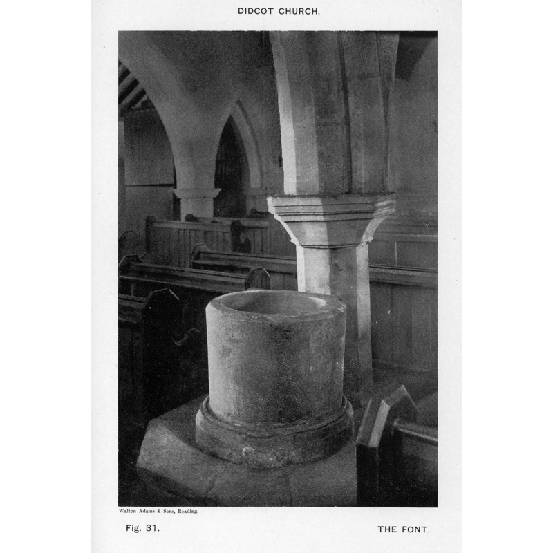
Image copyright © [in the public domain]
PD
Results: 4 records
view of font in context
Scene Description: ca. 1910?
Copyright Statement: Image copyright © [in the public domain]
Image Source: B&W photograph [ca. 1910?] by Walton Adams and Sons, Reading
Copyright Instructions: PD
view of church exterior - southeast view
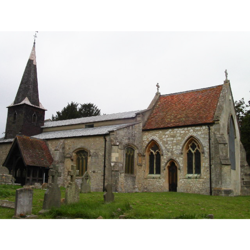
Copyright Statement: Image copyright © Dennis Jackson, 2005
Image Source: digital photograph taken 8 October 2005 by Dennis Jackson [http://www.geograph.org.uk/photo/64064] [accessed 8 December 2011]
Copyright Instructions: CC-BY-SA-3.0
view of church exterior - southeast view
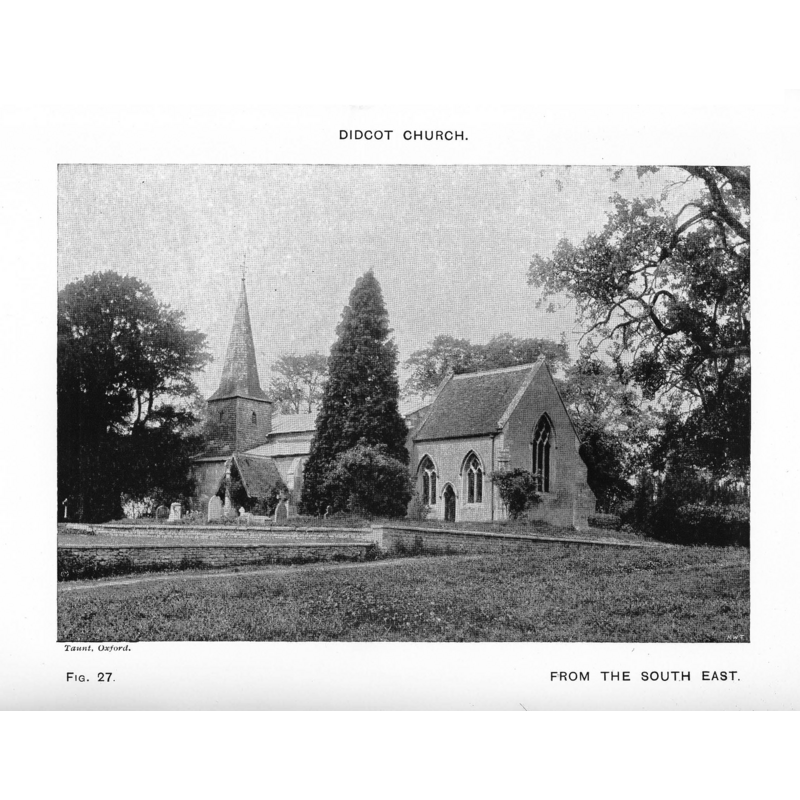
Scene Description: ca. 1910?
Copyright Statement: Image copyright © [in the public domain]
Image Source: B&W photograph [ca. 1910?] by H.W. Taunt, Oxford
Copyright Instructions: PD
view of church interior - nave - looking east
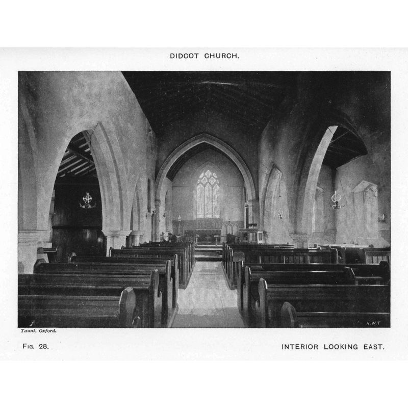
Scene Description: ca. 1910?
Copyright Statement: Image copyright © [in the public domain]
Image Source: B&W photograph [ca. 1910?] by H.W. Taunt, Oxford
Copyright Instructions: PD
INFORMATION
Font ID: 01305DID
Object Type: Baptismal Font1
Font Century and Period/Style: 12th century (late?), Late Norman? / Transitional?
Church / Chapel Name: Parish Church of All Saints
Font Location in Church: Inside the church, at the W end of the S arcade
Church Patron Saint(s): All Saints
Church Address: Lydalls Road, Didcot, Oxfordshire, OX11 7EA -- Tel.: +44 1235 813244
Site Location: Oxfordshire, South East, England, United Kingdom
Directions to Site: Located off the A34, about 16 km S of Oxford
Ecclesiastic Region: Diocese of Oxford
Historical Region: formerly in Berkshire -- Hundred of Moreton
Font Notes:
Click to view
No entry found for this Didcot in the Domesday survey. Listed in Cox & Harvey (1907) as a baptismal font of the Early English period. The Victoria County History (Berkshire, vol. 3, 1923) notes: "The nave walls are probably of the 12th century, a capital of c. 1160 having been found at a recent repair [...] Built against the west face of the western pier of the south arcade of the nave is a tub font, perhaps of late 12th-century date, standing on an octagonal step with chamfered nosing."
COORDINATES
UTM: 30U 621043 5719116
Latitude & Longitude (Decimal): 51.610048, -1.251905
Latitude & Longitude (DMS): 51° 36′ 36.17″ N, 1° 15′ 6.86″ W
MEDIUM AND MEASUREMENTS
Material: stone, type unknown
Font Shape: tub-shaped
Basin Interior Shape: round
Basin Exterior Shape: round
REFERENCES
- Victoria County History [online], University of London, 1993-. URL: https://www.british-history.ac.uk.
- Cox, John Charles, English Church Furniture, New York: E.P. Dutton & Co., 1907, p. 186