Stanbridge / Stanbrig / Stanbrugge
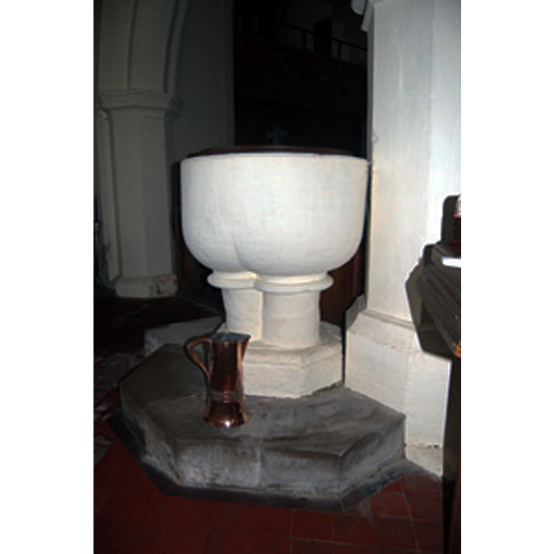
Image copyright © Bedfordshire County Council, 2015
No known copyright restriction / Fair Dealing
Results: 2 records
view of font and cover
Copyright Statement: Image copyright © Bedfordshire County Council, 2015
Image Source: digital photograph taken December 2008, in the Bedfordshire County Council page 'List of Stanbridge Vicars' [www.bedfordshire.gov.uk/CommunityAndLiving/ArchivesAndRecordOffice/CommunityArchives/Stanbridge/ListOfStanbridgeVicars.aspx] [accessed 22 September 2015]
Copyright Instructions: No known copyright restriction / Fair Dealing
view of church exterior - southeast end
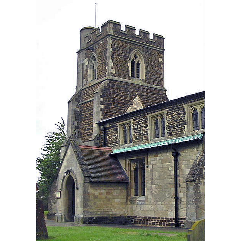
Copyright Statement: Image copyright © Nick Macneill, 2004
Image Source: digital photograph taken 8 May 2004 by nick macneill [www.geograph.org.uk/photo/2254203] [accessed 22 September 2015]
Copyright Instructions: CC-BY-SA-2.0
INFORMATION
Font ID: 01255STA
Object Type: Baptismal Font1
Font Date: ca. 1300?
Font Century and Period/Style: 13th - 14th century, Early English
Church / Chapel Name: Parish Church of St. John the Baptist
Font Location in Church: Inside the church
Church Patron Saint(s): St. John the Baptist
Church Notes: originally a 13thC chapel of ease to Leighton Buzzard; restored late19thC
Church Address: Tilsworth Road, Stanbridge, Central Bedfordshire LU7 9HY
Site Location: Bedfordshire, East, England, United Kingdom
Directions to Site: Located 5 km ESE of Leighton Buzzard
Ecclesiastic Region: Diocese of St. Albans
Historical Region: Hundred of Stanbridge
Font Notes:
Click to view
No individual entry for Stanbridge found in the Domesday survey. Listed in Cox & Harvey (1907) as a baptismal font of the Early English period. The Victoria County History (Bedfordshire, vol. 3, 1912) notes: "The chancel, which has a distinct deviation to the south, was built in the 13th century and lengthened and nearly rebuilt in the 15th. [...] The font has a plain circular bowl on a pedestal formed of three engaged shafts, an unusual arrangement; it probably dates from c. 1300." Pevsner (1968) notes only: "Font. The base of three short shafts is E.E."
COORDINATES
UTM: 30U 665252 5753555
Latitude & Longitude (Decimal): 51.9082, -0.5976
Latitude & Longitude (DMS): 51° 54′ 29.52″ N, 0° 35′ 51.36″ W
MEDIUM AND MEASUREMENTS
Material: stone, type unknown
Font Shape: hemispheric, mounted
Basin Interior Shape: round
Basin Exterior Shape: round
LID INFORMATION
Date: modern
Material: wood
Apparatus: no
Notes: round, flat and plain; appears modern
REFERENCES
- Victoria County History [online], University of London, 1993-. URL: https://www.british-history.ac.uk.
- Cox, John Charles, English Church Furniture, New York: E.P. Dutton & Co., 1907, p. 186
- Pevsner, Nikolaus, Bedfordshire and the County of Huntingdon and Peterborough, Harmondsworth: Penguin, 1968, p. 148