Penn nr, Beaconsfield / La Penne
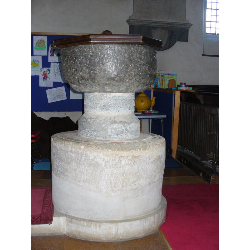
Image copyright © Colin Smith, 2009
Standing permission
Results: 6 records
view of font and cover
Copyright Statement: Image copyright © Colin Smith, 2009
Image Source: digital photograph taken by Colin Smith January 2009
Copyright Instructions: Standing permission
view of basin and cover
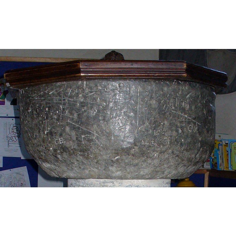
Copyright Statement: Image copyright © Colin Smith, 2009
Image Source: digital photograph taken by Colin Smith January 2009
Copyright Instructions: Standing permission
view of church exterior - southeast view
![EXT SE digital photograph taken 10 April 2015 by David Purchase [www.geograph.org.uk/photo/4425336] [accessed 2 November 2015]
INT E digital photograph taken 11 May 2003 by John Salmon [www.geograph.org.uk/photo/333164] [accessed 2 November 2015]
NT W digital photograph taken 11 May 2003 by John Salmon [www.geograph.org.uk/photo/333162] [accessed 2 November 2015]](/static-50478a99ec6f36a15d6234548c59f63da52304e5/compressed/1151103021_compressed.png)
Scene Description: EXT SE digital photograph taken 10 April 2015 by David Purchase [www.geograph.org.uk/photo/4425336] [accessed 2 November 2015]
INT E digital photograph taken 11 May 2003 by John Salmon [www.geograph.org.uk/photo/333164] [accessed 2 November 2015]
NT W digital photograph taken 11 May 2003 by John Salmon [www.geograph.org.uk/photo/333162] [accessed 2 November 2015]
Copyright Statement: Image copyright © David Purchase, 2015
Image Source: digital photograph taken 10 April 2015 by David Purchase [www.geograph.org.uk/photo/4425336] [accessed 2 November 2015]
Copyright Instructions: CC-BY-SA-2.0
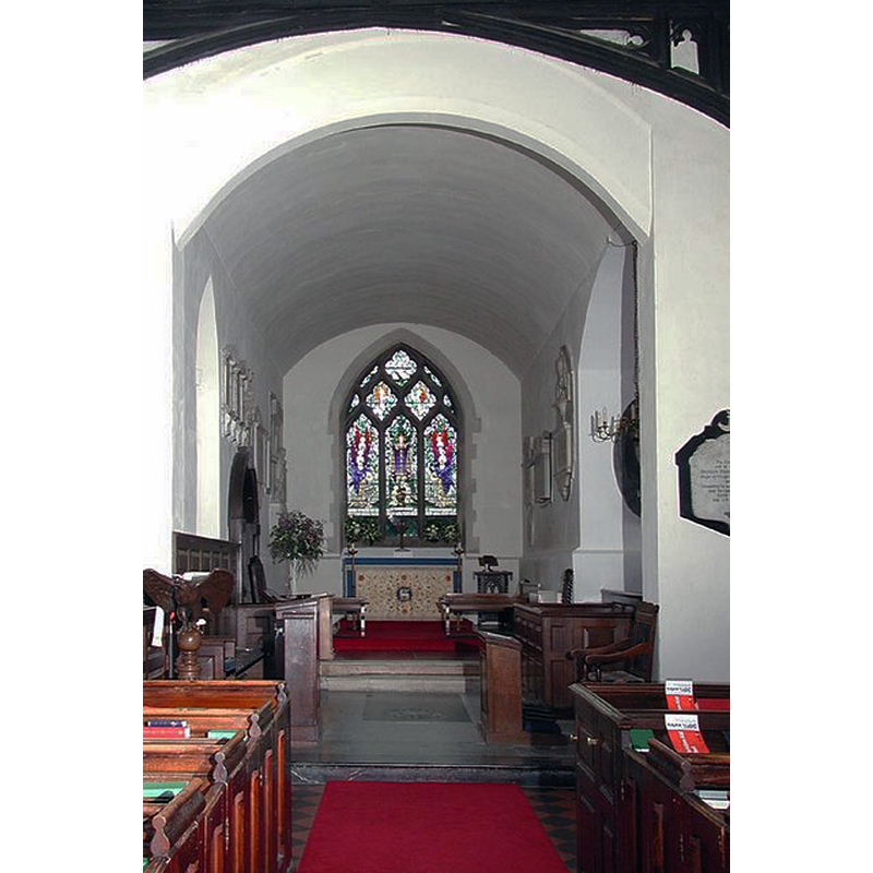
view of church interior - nave - looking west
Scene Description: with the font at the west end, centre aisle
Copyright Statement: Image copyright © John Salmon, 2007
Image Source: digital photograph taken 11 May 2003 by John Salmon [www.geograph.org.uk/photo/333162] [accessed 2 November 2015]
Copyright Instructions: CC-BY-SA-2.0
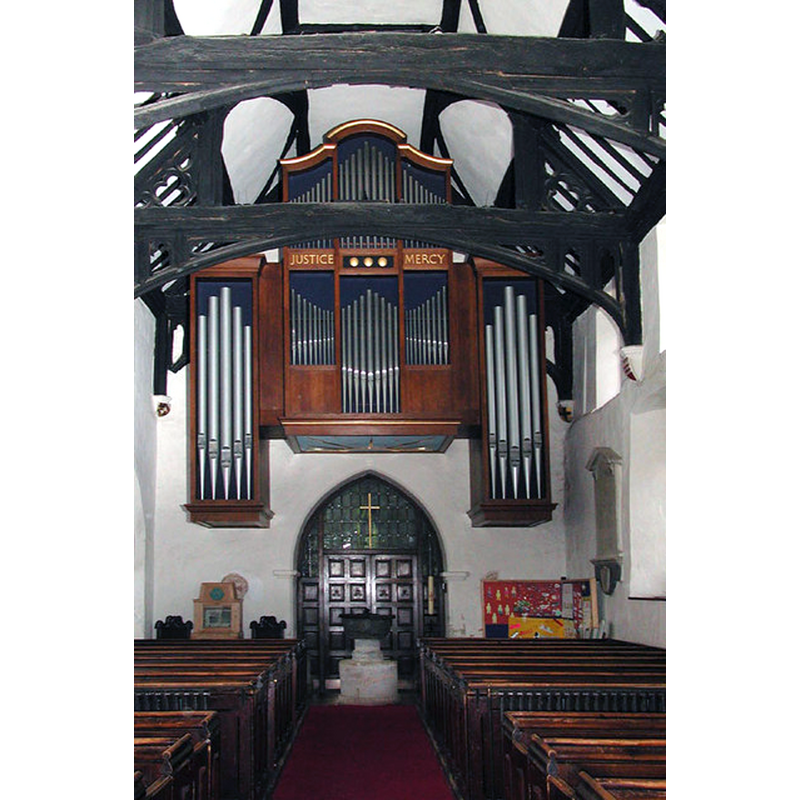
view of church interior - nave - looking east
Copyright Statement: Image copyright © John Salmon, 2007
Image Source: digital photograph taken 11 May 2003 by John Salmon [www.geograph.org.uk/photo/333164] [accessed 2 November 2015]
Copyright Instructions: CC-BY-SA-2.0
view of base
![[cf. Font notes]](/static-50478a99ec6f36a15d6234548c59f63da52304e5/compressed/1090123012_compressed.png)
Scene Description: [cf. Font notes]
Copyright Statement: Image copyright © Colin Smith, 2009
Image Source: digital photograph taken by Colin Smith January 2009
Copyright Instructions: Standing permission
INFORMATION
Font ID: 01214PEN
Object Type: Baptismal Font1
Font Century and Period/Style: 17th century[basin only] --12th century [stem only] [composite font], Medieval / Baroque [composite]
Workshop/Group/Artisan: lead font
Church / Chapel Name: Parish Church of the Holy Trinity
Font Location in Church: Inside the church, at the W end of the nave
Church Patron Saint(s): The Holy Trinity
Church Notes: Church and churchyard overlook the Chillterns on three sides. Built mainly of flint and brick, it has two porches and nave roof of c.1380. The chancel and much of the furniture dates from 18th century. There are 13th-century consecration crosses and late 15th-century Doom painting on boards above chancel arch, found in the roof in the 1930s. A series of post-reformation brasses in the S aisle and in the centre aisle the tombstone of a descendant of William Penn, proprietor of Pennsylvania.
Church Address: Church Road, Penn, Buckinghamshire, HP10 8NY
Site Location: Buckinghamshire, South East, England, United Kingdom
Directions to Site: Located on the B474, 5 km NW of Beaconsfield
Ecclesiastic Region: Diocese of Oxford
Historical Region: Hundred of Burnham
Additional Comments: composite font? -- two fonts?
Font Notes:
Click to view
No entry for this Penn found in the Domesday survey. Sheahan (1862) notes that the original church building was Early English, but he does not mention a font in it [NB: Sheahan (ibid.) does mention an "elegantly sculpted" font in the 1849 district church of the same dedication]. Described in Bond (1908) simply as "a font which is quite plain", made of lead [there is no indication of a date in Bond]. The RCAHM (Buckinghamshire, 1912) reports: "The font at Penn has a bowl of uncertain nature covered with lead." The Victoria County History (Buckingham, vol. 3, 1925) notes: "The bowl of the font, probably of the 17th century, is covered with lead and is supported on a 12th-century Purbeck marble stem with base and a circular plinth." The font is a composite object, as indicated in the VCH [cf. supra]; the lead cauldron is devoid of any ornamentation; it is raised on a short round stone stem of two volumes, and a very broad cylindrical stone repaired with cement on its lower half [NB: this large lower base looks suspiciously like an early stone basin filled with mortar or concrete]; on a modern plinth. The wooden cover is octagonal and flat, of the type that overlaps the basin an inch or two; carved low finial/handle.
Credit and Acknowledgements: We are grateful to Colin Smith for his photograph of this font
COORDINATES
UTM: 30U 660726 5722550
Latitude & Longitude (Decimal): 51.630972, -0.677681
Latitude & Longitude (DMS): 51° 37′ 51.5″ N, 0° 40′ 39.65″ W
MEDIUM AND MEASUREMENTS
Material: Metal and stone, lead [basin only] -- limestone (Purbeck marble) [stem only]
Font Shape: cauldron-shaped, mounted
Basin Interior Shape: round
Basin Exterior Shape: round
LID INFORMATION
Material: wood
Apparatus: no
Notes: [cf. FontNotes]
REFERENCES
- Victoria County History [online], University of London, 1993-. URL: https://www.british-history.ac.uk.
- Betjeman, John, Collins Guide to Parish Churches of England and Wales (including The Isle of Man), St.Jame's Place, London: Collins, 1980, p. 105
- Bond, Francis, Fonts and Font Covers, London: Waterstone, 1985 c1908, p. 87
- Great Britain. Royal Commission on Historical Monuments (England), An inventory of the historical monuments in Buckinghamshire, London: H.M. Stationary Office, 1912-, vol. 1: xxvii
- Sheahan, James Joseph, History and topography of Buckinghamshire, comprising a general survey of the county, preceded by an epitome of the early history of Great Britain, London; Pontefract: Longman, Green, Longman, and Roberts; William Edward Bonas [...], 1862, p. 852