Rudston / Rodestan / Rudstone
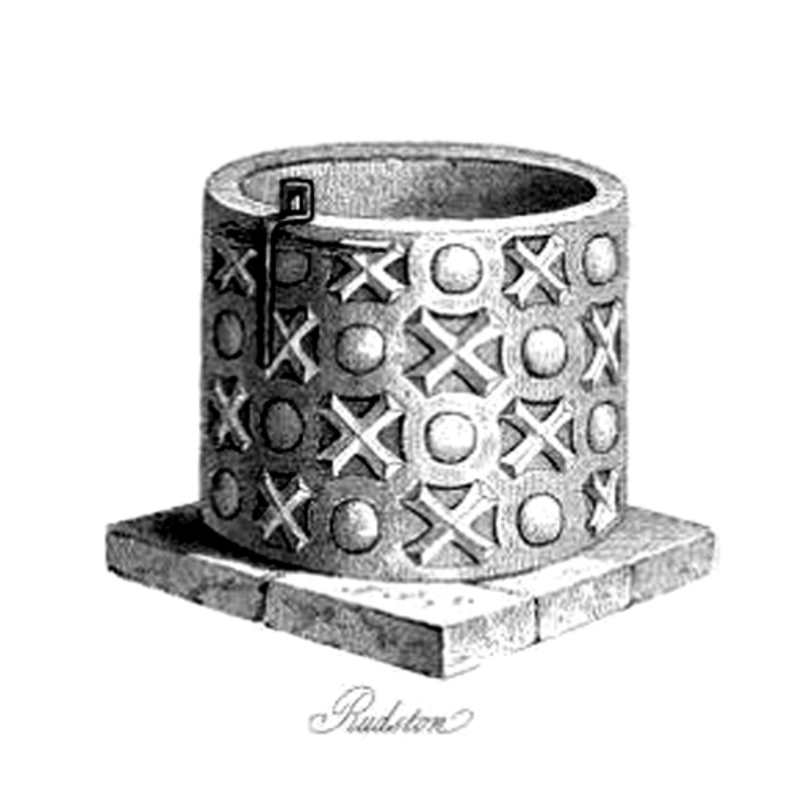
Image copyright © [in the public domain]
PD
Results: 18 records
B01: design element - patterns - trellis
Scene Description: a particularly rare and interesting pattern of linked circles
Copyright Statement: Image copyright © Colin Hinson, 2008
Image Source: digital photograph July 2004 taken by Colin Hinson [www.yorkshireCDbooks.coml]
Copyright Instructions: Image and permission received (e-mail of 17 July 2004)
B02: symbol - cross
Scene Description: many of them (crosses of X-shaped motifs), inserted in the trellis pattern
Copyright Statement: Image copyright © Colin Hinson, 2008
Image Source: digital photograph July 2004 taken by Colin Hinson [www.yorkshireCDbooks.coml]
Copyright Instructions: Image and permission received (e-mail of 17 July 2004)
LB01: design element - motifs - spur - 2?
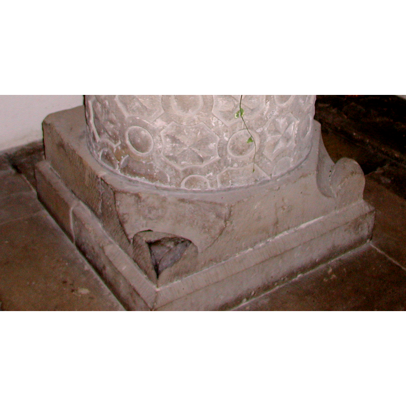
Scene Description: they appear to be only on the east angles, one of them broken
Copyright Statement: Image copyright © Colin Hinson, 2008
Image Source: digital photograph July 2004 taken by Colin Hinson [www.yorkshireCDbooks.coml]
Copyright Instructions: Image and permission received (e-mail of 17 July 2004)
view of font
Copyright Statement: Image copyright © [in the public domain]
Image Source: engraving in Prickett (1831)
Copyright Instructions: PD
view of font and cover
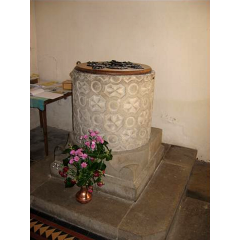
Copyright Statement: Image copyright © Mary Harris, 2003
Image Source: digital photograph January 2007 taken by Mary Harris
Copyright Instructions: Standing permission
view of font and cover
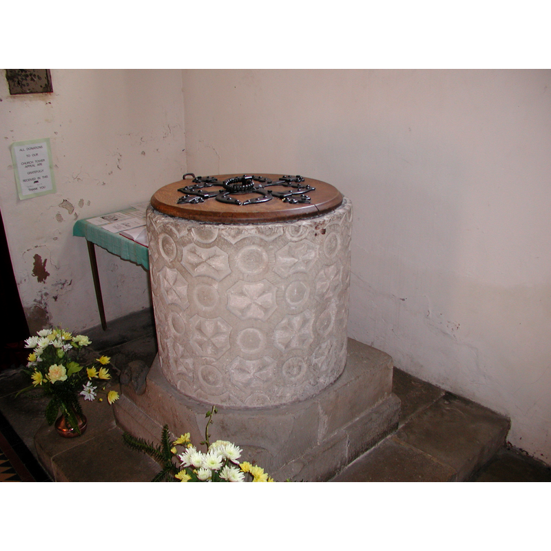
Copyright Statement: Image copyright © Colin Hinson, 2008
Image Source: digital photograph August 2004 taken by Colin Hinson [www.yorkshireCDbooks.coml]
Copyright Instructions: Image and permission received (e-mail of 13 August 2005)
view of font and cover - east side
Copyright Statement: Image copyright © Colin Hinson, 2008
Image Source: digital photograph July 2004 taken by Colin Hinson [www.yorkshireCDbooks.coml]
Copyright Instructions: Image and permission received (e-mail of 17 July 2004)
view of basin - upper view
Copyright Statement: Image copyright © Colin Hinson, 2008
Image Source: digital photograph August 2004 taken by Colin Hinson [www.yorkshireCDbooks.coml]
Copyright Instructions: Image and permission received (e-mail of 13 August 2005)
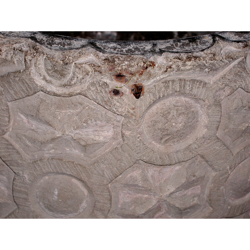
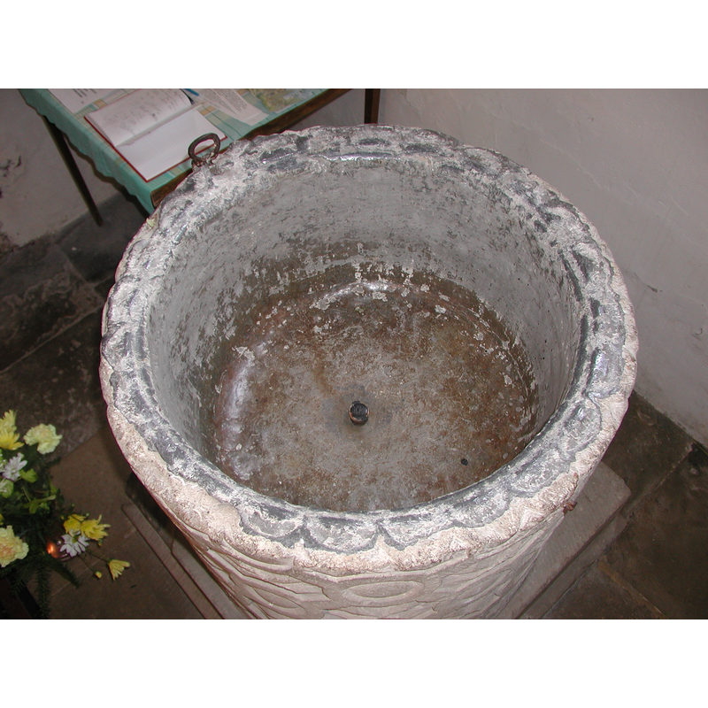
view of basin - interior
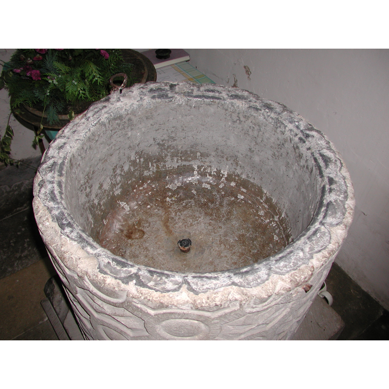
Copyright Statement: Image copyright © Colin Hinson, 2008
Image Source: digital photograph July 2004 taken by Colin Hinson [www.yorkshireCDbooks.coml]
Copyright Instructions: Image and permission received (e-mail of 17 July 2004)
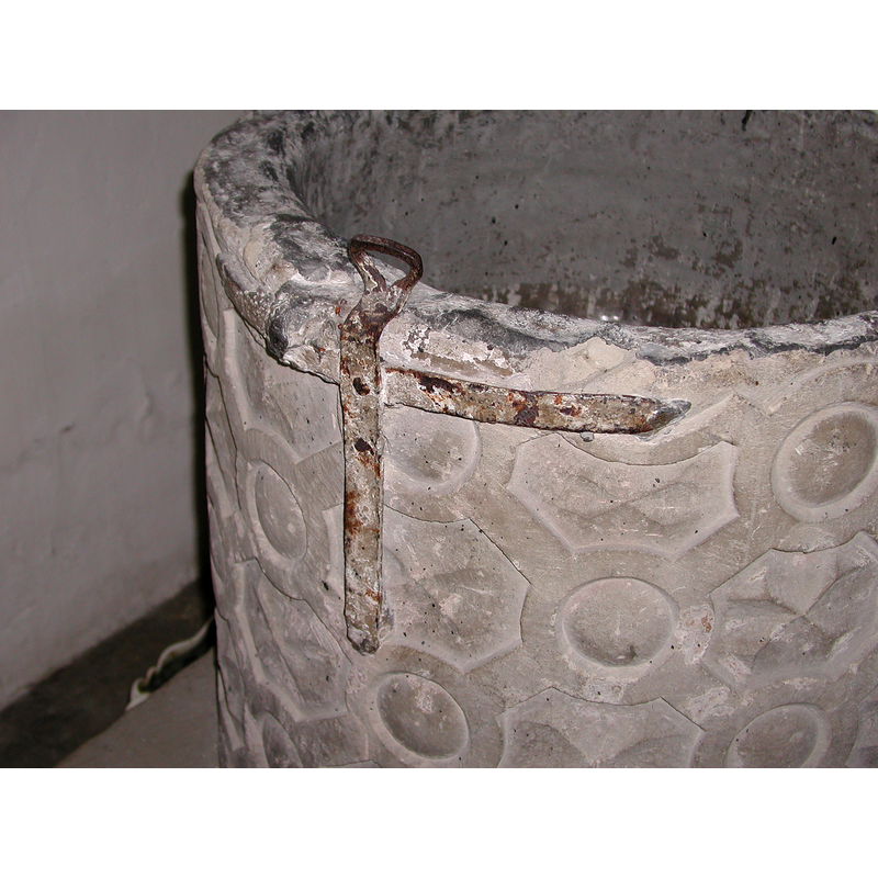
view of basin - south side
Scene Description: note the hardware from the old cover
Copyright Statement: Image copyright © Colin Hinson, 2008
Image Source: digital photograph July 2004 taken by Colin Hinson [www.yorkshireCDbooks.coml]
Copyright Instructions: Image and permission received (e-mail of 17 July 2004)
view of church exterior - northeast view
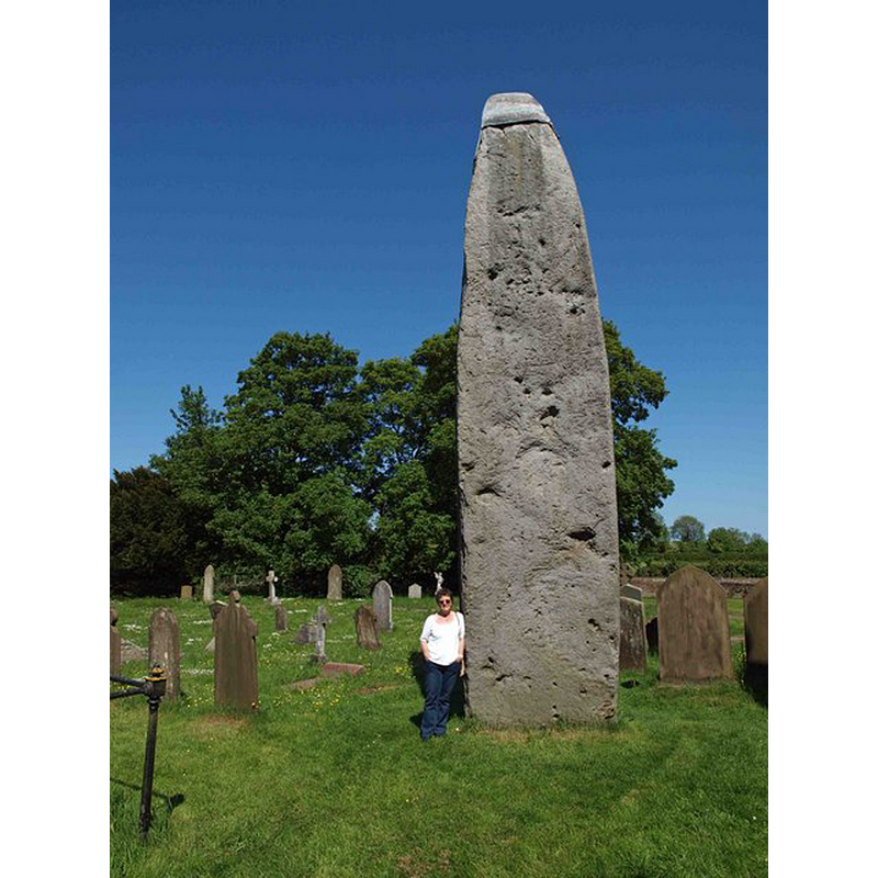
![Photo caption: "All Saints Church and Monolith, Rudston. Over 25' high [8 m], this Bronze Age stone is the largest monolith in Britain, and was probably a pagan worship monument."](/static-50478a99ec6f36a15d6234548c59f63da52304e5/compressed/1140731020_compressed.png)
Scene Description: Photo caption: "All Saints Church and Monolith, Rudston. Over 25' high [8 m], this Bronze Age stone is the largest monolith in Britain, and was probably a pagan worship monument."
Copyright Statement: Image copyright © Miss Steel, 2007
Image Source: digital photograph taken 9 June 2007 by Miss Steel [www.geograph.org.uk/photo/501153] [accessed 31 July 2014]
Copyright Instructions: CC-BY-SA-2.0
view of church exterior - southwest view
Copyright Statement: Image copyright © Dr Patty McAlpin, 2009
Image Source: digital photograph taken 18 July 2009 by Dr Patty McAlpin [www.geograph.org.uk/photo/1409350] [accessed 31 July 2014]
Copyright Instructions: CC-BY-SA-2.0
view of church exterior - churchyard, cemetery - detail
Scene Description: Photo caption: "Rudston monolith. In the Church (All Saints) Yard Rudston. Approximately 8m above ground it is Britain’s tallest standing stone. It’s weight is estimated at 40 tonnes. In the late 18th century tests revealed that there is as much again of the stone buried in the ground. dating from 2000 BC the stone is believed to come from near Whitby".
Copyright Statement: Image copyright © Steve Fareham, 2009
Image Source: digital photograph taken 31 May 2009 by Steve Fareham [www.geograph.org.uk/photo/1330394] [accessed 31 July 2014]
Copyright Instructions: CC-BY-SA-2.0
view of church interior - chancel - detail
![the southeast corner of the presbitery, with the piscina and sedilia on the right [south] side](/static-50478a99ec6f36a15d6234548c59f63da52304e5/compressed/1140731017_compressed.png)
Scene Description: the southeast corner of the presbitery, with the piscina and sedilia on the right [south] side
Copyright Statement: Image copyright © Miss Steel, 2007
Image Source: digital photograph taken 9 July 2007 by Miss Steel [www.geograph.org.uk/photo/505850] [accessed 31 July 2014]
Copyright Instructions: CC-BY-SA-2.0
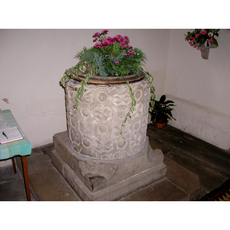
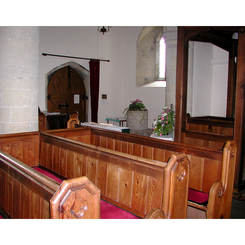
view of font and cover in context
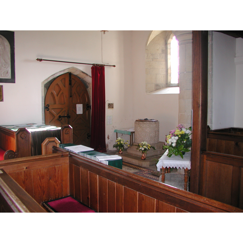
Copyright Statement: Image copyright © Colin Hinson, 2008
Image Source: digital photograph August 2004 taken by Colin Hinson [www.yorkshireCDbooks.coml]
Copyright Instructions: Image and permission received (e-mail of 13 August 2005)
view of font and cover in context - northeast side
Copyright Statement: Image copyright © Colin Hinson, 2008
Image Source: digital photograph July 2004 taken by Colin Hinson [www.yorkshireCDbooks.coml]
Copyright Instructions: Image and permission received (e-mail of 17 July 2004)
view of object
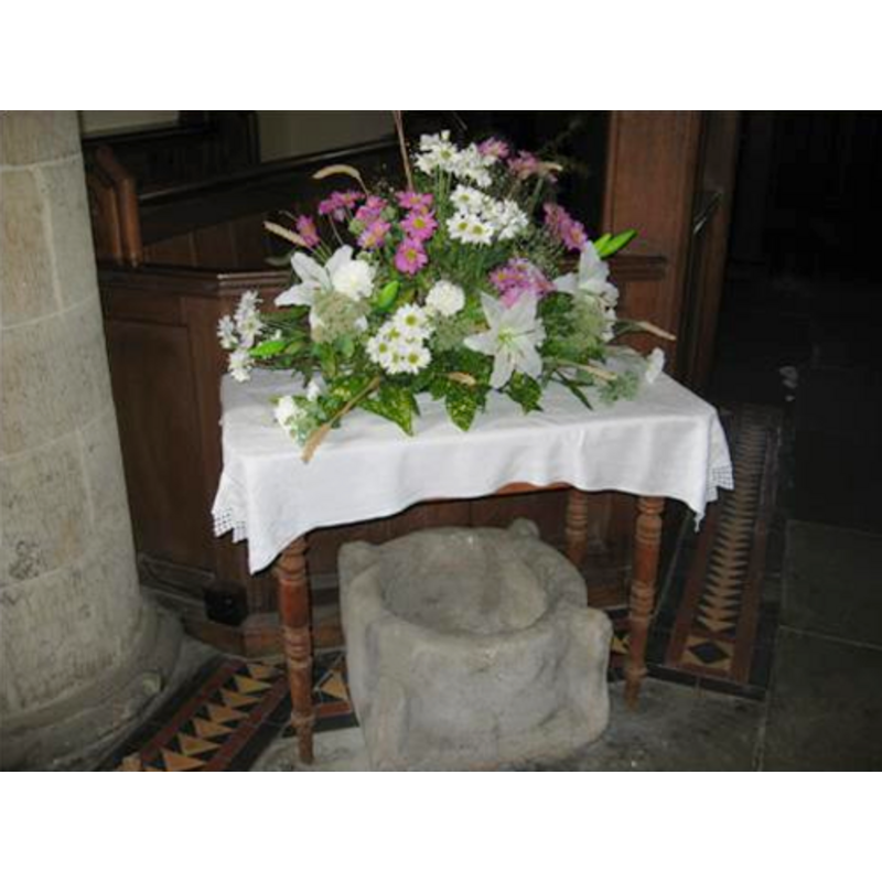
Copyright Statement: Image copyright © Mary Harris, 2003
Image Source: digital photograph January 2007 taken by Mary Harris
Copyright Instructions: Standing permission
view of object
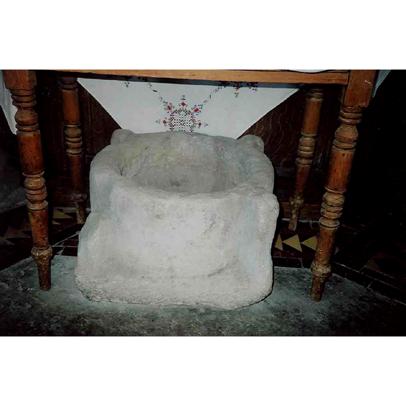
Scene Description: most likely a mortar
Copyright Statement: Image copyright © Mary Harris, 2003
Image Source: digital photograph January 2007 taken by Mary Harris
Copyright Instructions: Image and permission received (e-mail of 6 January 2007)
INFORMATION
Font ID: 01053RUD
Object Type: Baptismal Font1
Font Century and Period/Style: 12th century, Late Norman
Cognate Fonts: Similar ornamentation found in the fonts at Nafferton, Bainton, Barmston, Carnaby and Weaverthorpe, all in the East Riding of Yorkshire.
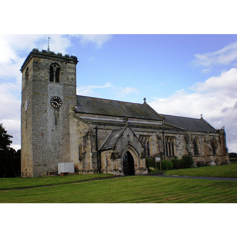
Church / Chapel Name: Parish Church of All Saints
Font Location in Church: Inside the church, at the W end
Church Patron Saint(s): All Saints
Church Address: Church Lane, Rudston, East Riding of Yorkshire YO25 4UE
Site Location: East Riding of Yorkshire, Yorkshire and the Humber, England, United Kingdom
Directions to Site: Located at the B1253, 10 km W of Bridlington
Ecclesiastic Region: Diocese of York
Historical Region: Hundred of Burton
Font Notes:
Click to view
There are three entries for Rudston [variant spelling] in the Domesday survey [http://domesdaymap.co.uk/place/TA0967/rudston/] [accessed 31 July 2014], but there is no mention of a church or cleric in any of them. A font here is noted and illustrated in Prickett (1831). Sheahan & Whellan (1857) report: ''the font is circular''. The National Gazetteer of 1868 mentions "a font of great antiquity" in this church. Although not mentioned in Glynne's visit to this church on 16 September 1873, Butler (2007) footnotes the omission. Bulmer's Directory of 1890 notes: "At the west end of the south aisle stands the font, a very fine piece of Norman work, righly ornamented with a diaper pattern." The font is listed in Cox & Harvey (1907) as a noteworthy example of baptismal fonts from the Norman period. Noted in Hobson (1924) as a Norman font with decoration similar to the type found on the font at Weaverthorpe. Described in Tyrrell-Green (1928) as a tub-shaped diapered font with "a very rich effect being produced by the insertion of small crosses or other figures and emblems within the trellis pattern"; this same source (ibid.) mentions that the fonts at Nafferton, Bainton, Barmston, Carnaby and Weaverthorpe, all in the East Riding of Yorkshire, have similar ornamentation. English Heritage notes: "Church. C12 west tower, early C13 aisles to nave, late C13 chancel, C19 belfry, C19 porch and alterations including tracery. [...] C12 font with alternating circle and lozenge ornament." In Pevsner & Beave (1995): ''Norman. It is almost identical to that at Weaverthorpe. Drum shape, carved with circles and octagons alternating horizontally as well as vertically.'' The font consists of a tub-shaped basin with practically vertical sides decorated as indicated in Tyrrell-Green above, raised on a square lower base that has the two east angles cut away to a spur (?), and a lower volume that is also square but plain and slightly wider. The basin well has vertical sides and a flat bottom with a central drain, all of it lead-lined, the upper fold of the lining trimmed at the rim. The south side of the basin has two metal straps forming a cross shape and providing the loop to anchor the cover lock, a rare design not common in baptismal fonts of any period. Wooden font cover [date unknown].
Credit and Acknowledgements: We are grateful to Colin Hinson, of www.yorkshireCDbooks.com, and to Mary Harris, of Richmond Hill, Ontario, for the photographs of this font
COORDINATES
UTM: 30U 675056 5997298
Latitude & Longitude (Decimal): 54.094044, -0.323072
Latitude & Longitude (DMS): 54° 5′ 38.56″ N, 0° 19′ 23.06″ W
MEDIUM AND MEASUREMENTS
Material: stone, type unknown
Font Shape: tub-shaped
Basin Interior Shape: round
Basin Exterior Shape: round
Drainage System: centre hole in basin
Drainage Notes: lead lining
LID INFORMATION
Date: modern
Material: wood
Apparatus: no
Notes: flat, with metal decorations and ring handle, modern
REFERENCES
- The National Gazetteer: a Topographical Dictionary of the British Isles, London: Virtue & Co., 1868
- Bulmer, T., History, Topography, and Directory of North Yorkshire, Comprising its Ancient and Modern History; [...], Preston: T. Bulmer & Co. (T. Snape & Co. Printers), 1890
- Cox, John Charles, English Church Furniture, New York: E.P. Dutton & Co., 1907, p. 229
- Glynne, Stephen Richard, The Yorkshire notes of Sir Stephen Glynne (1825-1874), Woodbridge: The Boydell Press; Yorkshire Archaeological Society, 2007, p. 352 fn2
- Hobson, Bernard, The East Riding of Yorkshire (with York), Cambridge: At the University Press, 1924, p. 106, 108
- Mann, Faith, Early Medieval Church Sculpture: a Study of 12th Century Fragments in East Yorkshire, Beverley: Hutton Press, 1985, p. 32
- Pevsner, Nikolaus, Yorkshire: York and the East Riding, London: Penguin, 1995, p. 664
- Prickett, Marmaduke [Revd.], An historical and architectural description of the Priory Church of Bridlington, in the East Riding of the County of York, London; Bridlington: Printed for T. Stevenson and sold by C.J.G. and F. Rivington; Forth and Furby, 1831, p. 56 and pl. XII
- Sheahan, James Joseph, History and topography of the city of York; the East Riding of Yorkshire and a portion of the West Riding […], Beverley: printed for the publishers by John Green, Market Place, 1857, p. 489 / [http://books.google.co.uk/books?id=pnEMAAAAYAAJ&pg=PA484&lpg=PA484&dq=lowthorpe+church+font&source=web&ots=voqP9Oob0V&sig=eG9y4rQzjY9QXoOVBZVVv4af2Sc&hl=en&sa=X&oi=book_result&resnum=1&ct=result#PPP5,M1] [accessed 2 July 2008]
- Tyrrell-Green, E., Baptismal Fonts Classified and Illustrated, London: Society for Promoting Christian Knowledge: The Macmillan Co., 1928, p. 18