Goring / Goring-on-Thames / Goring on Thames
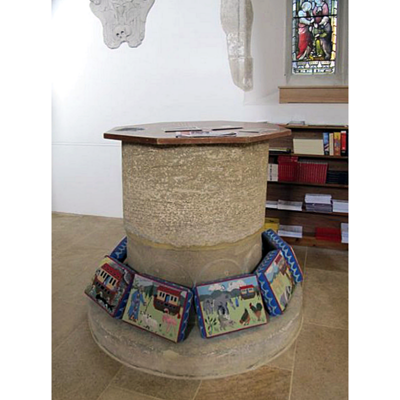
Image copyright © Bill Nichols, 2009
CC-BY-SA-3.0
Results: 6 records
view of font and cover
Scene Description: the old basin mounted on a new base and plinth after its 1937 restoration [cf. FontNotes]
Copyright Statement: Image copyright © Bill Nichols, 2009
Image Source: digital photograph [edited] taken 6 December 2009 by Bill Nicholls [www.geograph.org.uk/photo/1624717] [accessed 16 January 2013]
Copyright Instructions: CC-BY-SA-3.0
view of font and cover in context
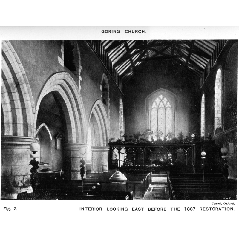
Scene Description: the top of the font and old cover are visible in the foreground here -- the photograph dates to before the 1887 restoration
Copyright Statement: Image copyright © [in the public domain]
Image Source: Keyser (1918: fig. 2)
Copyright Instructions: PD
view of church exterior - southeast view
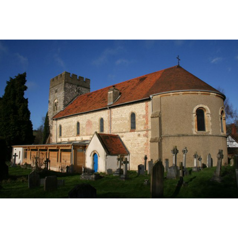
Copyright Statement: Image copyright © Bill Nichols, 2009
Image Source: digital photograph taken 6 December 2009 by Bill Nicholls [www.geograph.org.uk/photo/1622258] [accessed 16 January 2013]
Copyright Instructions: CC-BY-SA-3.0
view of font and cover in context
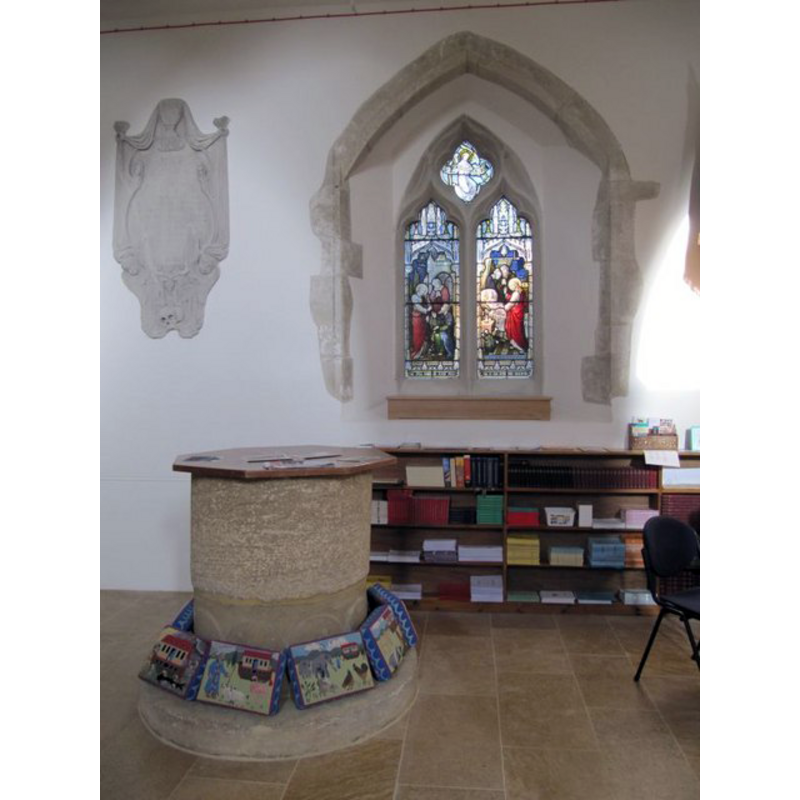
Copyright Statement: Image copyright © Bill Nichols, 2009
Image Source: digital photograph taken 6 December 2009 by Bill Nicholls [www.geograph.org.uk/photo/1623548] [accessed 16 January 2013]
Copyright Instructions: CC-BY-SA-3.0
view of church interior - nave - looking west
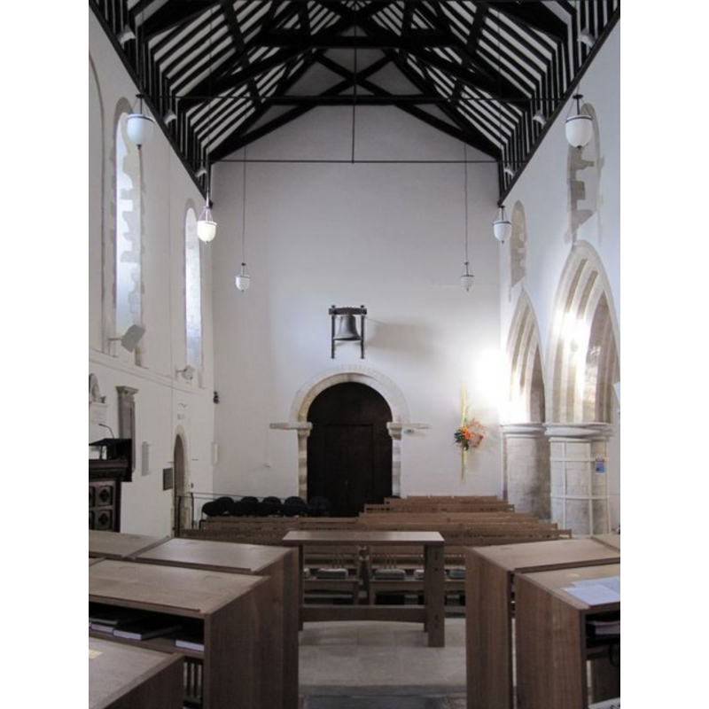
Copyright Statement: Image copyright © Bill Nichols, 2009
Image Source: digital photograph taken 6 December 2009 by Bill Nicholls [www.geograph.org.uk/photo/1623601] [accessed 16 January 2013]
Copyright Instructions: CC-BY-SA-3.0
view of church interior - nave - looking east
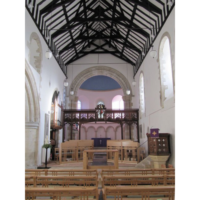
Copyright Statement: Image copyright © Bill Nichols, 2009
Image Source: digital photograph taken 6 December 2009 by Bill Nicholls [www.geograph.org.uk/photo/1624658] [accessed 16 January 2013]
Copyright Instructions: CC-BY-SA-3.0
INFORMATION
Font ID: 01038GOR
Object Type: Baptismal Font1
Font Date: ca. 1100?
Font Century and Period/Style: 12th century [basin only], Medieval [composite]
Church / Chapel Name: Parish Church of St. Thomas of Canterbury
Font Location in Church: Originally against the W pier of the N aisle [reported ca. 1928 unused outside the church] -- Reported later beneath the W tower
Church Patron Saint(s): St. Thomas of Canterbury [aka St. Thomas à Becket]
Church Notes: Noted in [http://www.zen17095.zen.co.uk/sttoms.htm] [accessed 24 June 2007]: "Built about 1100, probably by Robert d’Oilly, the great Norman Baron and staunch supporter of William the Conqueror who rewarded him with 60 manors including Garinges (Goring)."
Church Address: Goring, Oxfordshire RG8 9AW
Site Location: Oxfordshire, South East, England, United Kingdom
Directions to Site: Located at the junction of the B4526 and the B4009, 6-7 km N of the M4, 10-12 km WNW of Reading
Ecclesiastic Region: Diocese of Oxford
Additional Comments: abandoned font: reported ca. 1928 unused outside the church
Font Notes:
Click to view
Described in 'Church notes...' (1887) in the context of some "notes [...] taken between 1835 and 1840": "Font very plain, large, and placed against the west pier of the north aisle" [NB: the same entry notes that the church was "unfortunately [...] in a filthy condition"]. Listed in Tyrrell-Green (1928) as a tub-shaped baptismal font of the Norman period; he reported it ca. 1928 lying unused outside the church. [NB: it is not clear when this font was removed from inside the church [cf. infra]; a pre-1887 photograph reproduced in Keyser (1918) shows a font in the nave, but it does not appear to match the description in Tyrrell-Green above; no font is mentioned in the description of the church and its contents in Keyser]. The Parish Church web site [www.zen17095.zen.co.uk/sttoms.htm] [accessed 24 June 2007] notes: "FONT - Norman. Restored to its original place in Church, 1937, with new cover and base. It had been “dumped” at Gatehampton for almost 90 years" and dates the church to ca. 1100. In Sherwood & Pevsner (1974): "Font. C12. Tub-shaped. The base is modern." The present font cover is octagonal [why?], flat and plain; modern, but bebore the 1887 restoration of the church it had a three-tier round dome cover on it.
COORDINATES
UTM: 30U 629046 5709523
Latitude & Longitude (Decimal): 51.522064, -1.139914
Latitude & Longitude (DMS): 51° 31′ 19.43″ N, 1° 8′ 23.69″ W
MEDIUM AND MEASUREMENTS
Material: stone, type unknown
Font Shape: tub-shaped
Basin Interior Shape: round
Basin Exterior Shape: round
Drainage System: ¸
LID INFORMATION
Date: modern
Material: wood
Apparatus: no
Notes: the present cover is octagonal [why?], flat and plain; modern
REFERENCES
- "Church notes, chiefly in Berks, Wilts, and Oxford, with a few in Somerset and Gloucestershire", 44, Archaeological Journal, 1887, pp. 43-50; 185-193; 291-303; 397-402; p. 294
- Keyser, Charles E., "Notes on the churches of South Stoke, North Stoke, Ipsden and Checkendon. Oxfordshire", New Series vol. XXIV, Journal of the British Archaeological Association, 1918, pp. [1]-32; fig. 2
- Tyrrell-Green, E., Baptismal Fonts Classified and Illustrated, London: Society for Promoting Christian Knowledge: The Macmillan Co., 1928, p. 18, 40