Boveney / Bufanege / Bouenie / Bovenie / Lower Boveney
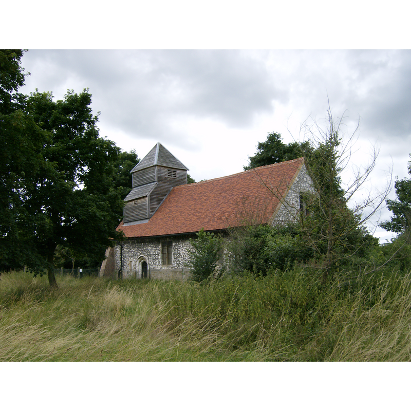
Image copyright © Matthiasb, 2010
CC-BY-SA-2.0
Results: 3 records
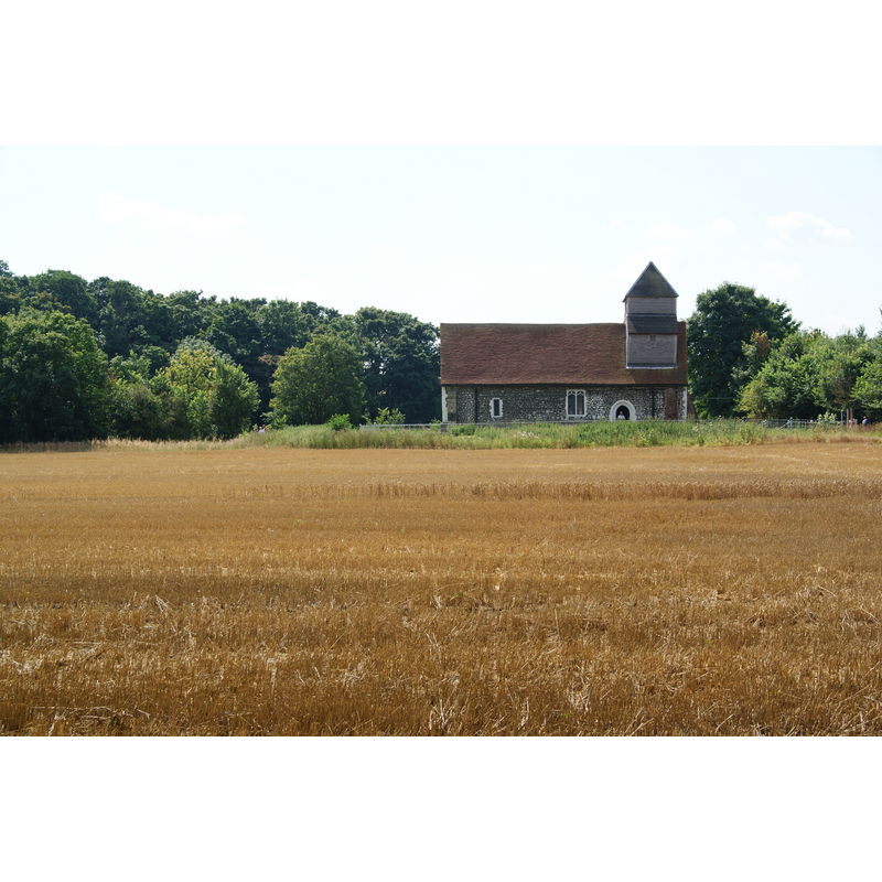
view of church exterior - southeast view
Copyright Statement: Image copyright © Matthiasb, 2010
Image Source: digital photograph taken 1 August 2010 by Matthiasb [http://en.wikipedia.org/wiki/File:St_Mary_Magdalene_Church_Boveney.JPG]
Copyright Instructions: CC-BY-SA-2.0
view of church exterior in context - north view
Scene Description: Source caption: "St Mary Magdalene, Boveney. A redundant church with mediaeval features and possible origins in the Norman era. It is owned and maintained by the Friends of Friendless Churches. The Thames runs just the other side of it."
Copyright Statement: Image copyright © Bill Boaden, 2012
Image Source: digital photograph taken 9 August 2012 by Bill Boaden [www.geograph.org.uk/photo/3103251] [accessed 27 October 2015]
Copyright Instructions: CC-BY-SA-2.0
view of church exterior - southwest view
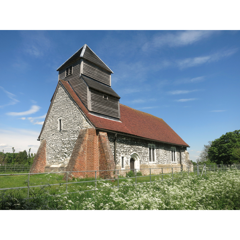
Scene Description: Source caption: "St Mary Magdalene, Boveney. This beautiful 12th century church was built to serve the hamlet of Boveney and passing commercial traffic on the Thames. It was declared redundant in 1975 when there were plans to knock it down or make it into housing. It was taken into charitable care by The Friends of Friendless Churches, who have done a lot of restoration work. It is still a consecrated building."
Copyright Statement: Image copyright © Des Blenkinsopp, 2015
Image Source: digital photograph taken 13 May 2015 by Des Blenkinsopp [www.geograph.org.uk/photo/4499841] [accessed 27 October 2015]
Copyright Instructions: CC-BY-SA-2.0
INFORMATION
Font ID: 01018BOV
Object Type: Baptismal Font1
Font Century and Period/Style: 12th - 13th century [composite font?] [re-cut?], Medieval [composite]
Church / Chapel Name: Chapel of St. Mary Magdalene
Font Location in Church: Inside the church
Church Patron Saint(s): St. Mary Magdalene
Church Notes: Church originally 12thC; redundant since 1975; in the care of the charity the Friends of Friendless Churches since 1983
Church Address: Lock Path, Boveney, Dorney, Buckinghamshire SL4 6QQ
Site Location: Buckinghamshire, South East, England, United Kingdom
Directions to Site: Located 3 km W of Eton, near Windsor
Ecclesiastic Region: Diocese of Oxford
Historical Region: Hundred of Burnham
Additional Comments: altered font? / composite font? / re-cut font?
Font Notes:
Click to view
There are two entries for Boveney [variant spelling] in the Domesday survey [http://opendomesday.org/place/SU9377/boveney/] [accessed 3 November 2015], neither of which mentions cleric or church in it. The RCAHM (Buckinghamshire, 1912) notes: "Font: plain, tapering cylindrical bowl, of limestone, with projecting edge-roll, possibly re-cut base, in two courses, same width as bottom of bowl, apparently of clunch, covered with old whitewash, possibly 13th-century, the base older than the bowl." Described in the the Victoria County History (Buckingham, vol. 3, 1925) almost verbatim after the RCAHM [cf. supra]. Listed in Tyrrell-Green (1928) as a tub-shaped baptismal font of the Norman period.
COORDINATES
UTM: 30U 663320 5706991
Latitude & Longitude (Decimal): 51.490444, -0.647468
Latitude & Longitude (DMS): 51° 29′ 25.6″ N, 0° 38′ 50.89″ W
MEDIUM AND MEASUREMENTS
Material: stone, type unknown
Font Shape: bucket-shaped, mounted
Basin Interior Shape: round
Basin Exterior Shape: round
REFERENCES
- Victoria County History [online], University of London, 1993-. URL: https://www.british-history.ac.uk.
- Great Britain. Royal Commission on Historical Monuments (England), An inventory of the historical monuments in Buckinghamshire, London: H.M. Stationary Office, 1912-, vol. 1: 60
- Tyrrell-Green, E., Baptismal Fonts Classified and Illustrated, London: Society for Promoting Christian Knowledge: The Macmillan Co., 1928, p. 18