East Shefford / Little Shefford / Schipford / Scifford / Shiford / Sibeford / Sibesford / Siford / Sipford
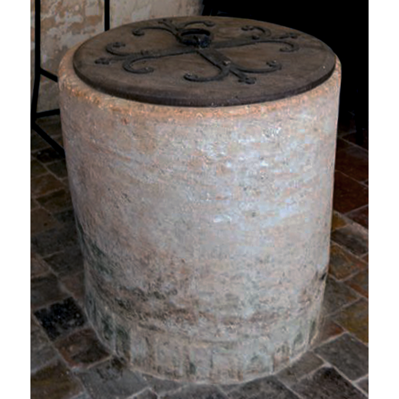
Image copyright © David Ross & Britain Express Ltd, 2015
Standing permission
Results: 5 records
view of font and cover
Copyright Statement: Image copyright © David Ross & Britain Express Ltd, 2015
Image Source: detail of a digital photograph taken by David Ross [www.britainexpress.com/attractions.htm?attraction=4026] [accessed 26 May 2015]
Copyright Instructions: Standing permission
design element - architectural - arcade - blind - round arches
Scene Description: The arcade is now [1998] hardly discernible except as a pattern of indentations
Copyright Statement: Image copyright © David Ross & Britain Express Ltd, 2015
Image Source: detail of a digital photograph taken by David Ross [www.britainexpress.com/attractions.htm?attraction=4026] [accessed 26 May 2015]
Copyright Instructions: Standing permission
view of church exterior - south view
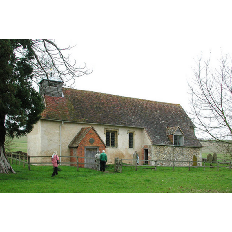
Copyright Statement: Image copyright © John Salmon, 2004
Image Source: digital photograph taken 3 April 2004 by John Salmon [http://www.geograph.org.uk/photo/331059] [accessed 7 November 2011]
Copyright Instructions: CC-BY-SA-3.0
view of church interior - nave - looking west
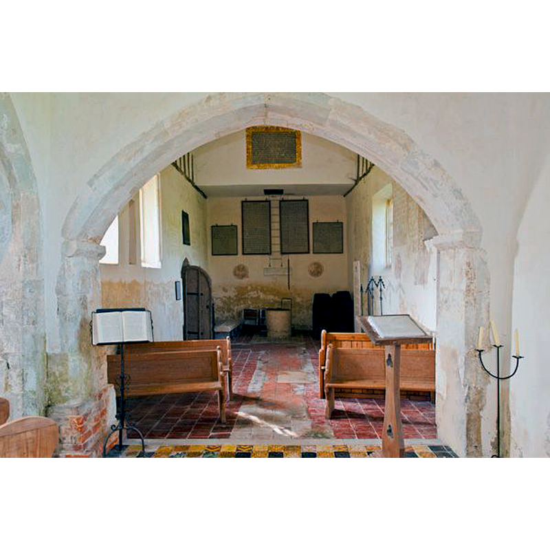
Scene Description: the old font is visible at the back end
Copyright Statement: Image copyright © David Ross & Britain Express Ltd, 2015
Image Source: digital photograph taken by David Ross [www.britainexpress.com/attractions.htm?attraction=4026] [accessed 26 May 2015]
Copyright Instructions: Standing permission
view of church interior - nave - looking east
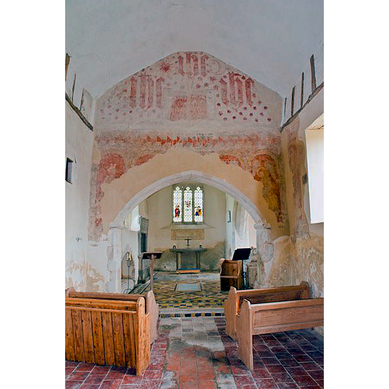
Copyright Statement: Image copyright © David Ross & Britain Express Ltd, 2015
Image Source: digital photograph taken by David Ross [www.britainexpress.com/attractions.htm?attraction=4026] [accessed 26 May 2015]
Copyright Instructions: Standing permission
INFORMATION
Font ID: 01016EAS
Object Type: Baptismal Font1
Font Century and Period/Style: 11th - 13th century, Norman
Church / Chapel Name: Parish Church of St. Thomas [redundant]
Font Location in Church: Inside the church, in the W end of the nave
Church Patron Saint(s): St. Thomas
Church Notes: the VCH [cf. FontNotes] notes that the old church was of unknown dedication -- "In 1958 there were plans to demolish St Thomas' but this was prevented by the Friends of Friendless Churches. The church was vested in the Redundant Churches Fund, the forerunner of the Churches Conservation Trust in 1972" [CRSBI (2008)]
Church Address: East Shefford, Berkshire, England, RG17 7EF
Site Location: Berkshire, South East, England, United Kingdom
Directions to Site: Located 8 km NE of Hungerford, off the A338
Ecclesiastic Region: Diocese of Oxford
Historical Region: Hundred of Eagle [in Domesday]
Additional Comments: recycled font: now base-less; originally raised on five columns
Font Notes:
Click to view
There is an entry for [East] Shefford [variant spelling] in the Domesday survey [http://opendomesday.org/place/SU3874/east-shefford/] [accessed 21 May 2015], but it mentions neither cleric nor church in it. Tyrrell-Green (1928) lists a tub-shaped baptismal font of the Norman period in this church. The Victoria County History (Berkshire, vol. 4, 1924) notes: "The old church, of unknown dedication, [...] was abandoned when the new church was erected on the hill-side above in 1869. [...] The church was restored by subscription in 1887 and the monuments cleaned. [...] The fabric is usually said to have been rebuilt late in the 15th or early in the 16th century, but it seems more likely that the walls of the chancel and nave represent a late 12th-century building, [...] The font is unmounted and of plain cylindrical tub-shaped type, 30 in. high, and is of 12th-century date. Described and illustrated in the CRSBI (2015): "At W end of nave stands an almost cylindrical tub font of oolitic limestone without base or plinth. According to notes made in 1911 and recorded in the church, it originally stood on 5 shafts, but none of these could be found. The bowl is plain except for a band around the bottom carved with simple arcading, now badly eroded." [NB: if the font was ever raised on a base, it would have been a very short one, no more than 20 cm or so, as fonts rarely varied significantly in height from the ca. 3 ft. [90-100 cm] standard height]
Credit and Acknowledgements: We are ggrateful to David Ross and Britain Express [www.britainexpress.com] for the photographs of this church and font
COORDINATES
UTM: 30U 608415 5703226
Latitude & Longitude (Decimal): 51.4698, -1.4391
Latitude & Longitude (DMS): 51° 28′ 11.08″ N, 1° 26′ 20.76″ W
MEDIUM AND MEASUREMENTS
Material: stone, limestone (oolitic limestone)
Number of Pieces: one
Font Shape: tub-shaped, cylindrical, unmounted
Basin Interior Shape: round
Basin Exterior Shape: round
Rim Thickness: 11 cm [calculated]
Diameter (inside rim): 54 cm*
Diameter (includes rim): 76 cm*
Basin Total Height: 76 cm*
Height of Base: [missing]
Font Height (less Plinth): 76 cm* [missing base not included] -- 75 cm**
Notes on Measurements: * CRSBI (2015) / ** VCH
LID INFORMATION
Date: modern?
Material: wood, oak?
Apparatus: no
Notes: round and flat, with metal decoration and ring handle
REFERENCES
- Victoria County History [online], University of London, 1993-. URL: https://www.british-history.ac.uk.
- Corpus of Romanesque Sculpture in Britain and Ireland, The Corpus of Romanesque Sculpture in Britain and Ireland, The Corpus of Romanesque Sculpture in Britain and Ireland. URL: http://www.crsbi.ac.uk.
- Tyrrell-Green, E., Baptismal Fonts Classified and Illustrated, London: Society for Promoting Christian Knowledge: The Macmillan Co., 1928, p. 17