Drayton nr. Banbury / Draiton/ Draitone / Drayton Cherwell
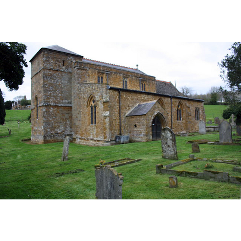
Image copyright © Roger Templeman, 2016
CC-BY-SA-2.0
Results: 2 records
view of church exterior - southwest view
Copyright Statement: Image copyright © Roger Templeman, 2016
Image Source: digital photograph taken 18 April 2016 by Roger Templeman [www.geograph.org.uk/photo/4916888] [accessed 7 November 2017]
Copyright Instructions: CC-BY-SA-2.0
view of church exterior - northeast view
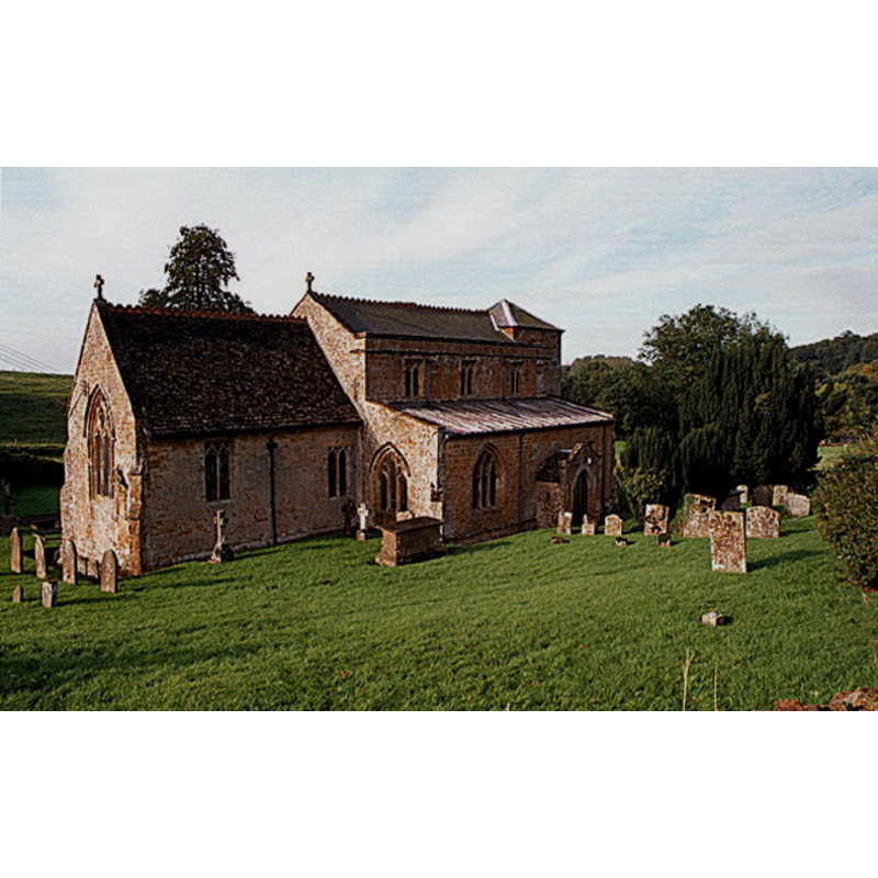
Copyright Statement: Image copyright © Geoffrey Lloyd, 2000
Image Source: digital photograph taken September 2000 by Geoffrey Lloyd [http://www.geograph.org.uk/photo/33905] [accessed 14 November 2011]
Copyright Instructions: CC-BY-SA-2.0
INFORMATION
Font ID: 01010DRA
Object Type: Baptismal Font1
Font Century and Period/Style: 12th - 13th century, Medieval
Church / Chapel Name: Parish Church of St. Peter
Font Location in Church: Inside the church
Church Patron Saint(s): St. Peter
Church Address: 1 Rectory Gardens (off Stratford Road), Drayton, Banbury OX15 6EG, UK
Site Location: Oxfordshire, South East, England, United Kingdom
Directions to Site: Located off the A422, 3 km WNW of Banbury [NB: not to be mistaken with the other Drayton listed in this Index in Oxfordshire; the other Drayton is located near Abingdon, about 10 km N of Wallingford]
Ecclesiastic Region: Diocese of Oxford
Historical Region: Hundred of Bloxham
Additional Comments: composite font? 12thC basin on a 14thC base?
Font Notes:
Click to view
There are three entries for this Drayton [variant spelling] in the Domesday survey [http://opendomesday.org/place/SP4241/drayton/] [accessed 7 November 2017], none of which mentions priest or church in it. The Ecclesiastical and Architectural Topography of England: Oxfordshire (1850) notes: "The font is plain." Listed in Cox & Harvey (1907) with a baptismal font of the Norman period. Noted in Kelly's Oxford Directory of 1911 [http://www.historicaldirectories.org/hd/d.asp] [accessed 30 June 2007]: "the font is plain and round". The Victoria County History (Oxford, vol. 9, 1969) notes: "Drayton church is not mentioned until 1223, [...] the date of the first recorded presentation. [...] The Church [...] is mainly of 14th-century date, but the plain font is earlier." Listed in Tyrrell-Green (1928) describe the font as tub-shaped and put it in the same period/style. There is no font mentioned in Sherwood & Pevsner (1974). The entry for this church in the CRSBI (2017) mentions "a plain font of uncertain date" in this church. [NB: not to be mistaken with the other Drayton listed in this Index in Oxfordshire, which is located about near Abingdon].
COORDINATES
UTM: 30U 610942 5770087
Latitude & Longitude (Decimal): 52.07024, -1.38138
Latitude & Longitude (DMS): 52° 4′ 12.86″ N, 1° 22′ 52.97″ W
MEDIUM AND MEASUREMENTS
Material: stone, type unknown
Font Shape: tub-shaped
Basin Interior Shape: round
Basin Exterior Shape: round
REFERENCES
- Victoria County History [online], University of London, 1993-. URL: https://www.british-history.ac.uk.
- Corpus of Romanesque Sculpture in Britain and Ireland, The Corpus of Romanesque Sculpture in Britain and Ireland, The Corpus of Romanesque Sculpture in Britain and Ireland. URL: http://www.crsbi.ac.uk.
- Cox, John Charles, English Church Furniture, New York: E.P. Dutton & Co., 1907, p. 186
- Kelly, Kelly's Directory of Oxfordshire, London: Kelly's Directories Ltd., 1911, p. 97 / [http://www.historicaldirectories.org/hd/d.asp] [accessed 30 June 2007]
- Kroesen, Justin E.A., The Interior of the medieval village church = Het middeleeuwse Dorpskerkinterieur, Leuven: Uitgeverij Peeters, 2004, p. 328
- Parker, John Henry, The Ecclesiastical and architectural topography of England: Oxfordshire, Oxford, London: Published under the sanction of the Central Commitee of the Archaeological Institute of Great Britain and Ireland [by] John Henry Parker, 1850, [unpaged -- entry 130] / [http://books.google.ca/books?id=maikb1i3wSUC&pg=PT144&lpg=PT144&dq=longcot+church+font&source=web&ots=p3k5tJJE6J&sig=KYjkm8H5wOoAuH7BvnLp7JqMPus&hl=en&sa=X&oi=book_result&resnum=6&ct=result#PPA17,M1] [accessed 31 December 2008]
- Tyrrell-Green, E., Baptismal Fonts Classified and Illustrated, London: Society for Promoting Christian Knowledge: The Macmillan Co., 1928, p. 17