Kirkhope / Manor-Water
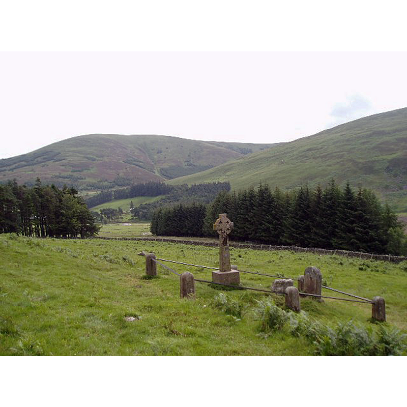
Image copyright © Eileen Henderson, 2006
CC-BY-SA-2.0
Results: 3 records
view of font in context
Scene Description: Source caption: "Site of Kirk of St Gordian. A stone cross and hollowed-out font stone, along with a headstone, stand close to the track from Langhaugh to Old Kirkhope. This view looks eastwards towards Langhaugh."
Copyright Statement: Image copyright © Eileen Henderson, 2006
Image Source: digital photograph taken 8 July 2006 by Eileen Henderson [www.geograph.org.uk/photo/199101] [accessed 19 April 2019]
Copyright Instructions: CC-BY-SA-2.0
view of context
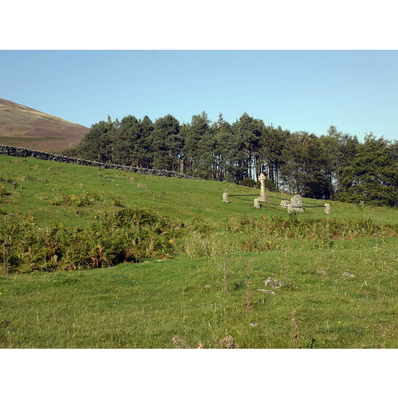
Scene Description: Source caption: "Site of St Gordian's Kirk. Next to the modern cross is the socket for an older cross, marked on the map as a font stone."
Copyright Statement: Image copyright © Richard Webb, 2015
Image Source: digital photograph taken 2 October 2015 by Richard Webb [www.geograph.org.uk/photo/4879628] [accessed 19 April 2019]
Copyright Instructions: CC-BY-SA-2.0
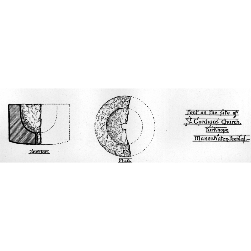
view of font - plan and section
Copyright Statement: Image copyright © [in the public domain]
Image Source: digital image of a drawing in Walker (1887: 404)
Copyright Instructions: PD
INFORMATION
Font ID: 00961KIR
Object Type: Baptismal Font1, fragment
Church / Chapel Name: St. Gordian's church ruins
Font Location in Church: Reported by Walker (1887) "on the site of St Gordian's Church, near the head of Manor Water."
Church Patron Saint(s): St. Gordianus [aka Gordien, Gondran]
Site Location: South Lanarkshire, Scotland, United Kingdom
Directions to Site: Located about 30-35 km N of Dumphries (up the A76 to Carronbridge, then left on the A702 to the first right turn past Nether Fingland; this road, which veers south, leads to Kirkhope)
Additional Comments: abandoned and damaged font: little more than half of this bowl remains, lying on the site of an old church -- re-cycled font? (used at some point as a base for a cross? [cf. FontNotes])
Font Notes:
Click to view
Walker (1887) reports that "little more than half of this bowl remains; it lies on the site of St. Gordian's Church, near the head of Manor Water". The entry "028 Font Stone, Kirkhope, Manor" in Ancient Stones [www.ancient-stones.co.uk/borders/021/028/details.htm] [accessed 19 April 2019] reads: "The font stone, actually a re-worked base for a cross can be found beside St Gordian's Cross on the hillside above Kirkhope Burn. The cross-base, of grey sandstone, has been much damaged, particularly the socket which has been enlarged, apparently by battering, to form a rough basin with a notch for an overflow. It measures 0.66m x 0.56m on plan and reaches 0.43m high.[...] The stone was only brought to the site in the 19th century and once stood at the road junction between Hallyards and Manor Kirk. Why it was moved is not known but is likely to have some religious connection. It is also believed to have been the pedestal for a boundary stone marking the meeting point of three laird's lands and was thought to have stood at the foot of the Glack Brae on the route of an ancient drove road that links to the Thief's Road. A close study of the stone brought some interesting thoughts to light. The recess on top of the stone appears to have been created in two separate and distinct stages. The first stage is the formation of a shallow bowl or basin with a v-shaped notch in the rim to act as an outflow. The second stage is where the bowl has been deepened by cutting a straight sided pocket to take a cross-base. This would suggest that the stone was originally use as a font for religious or other ritual (pagan?) purposes then was later used as a cross-base." The entry for Kirkhope in CANMORE (National Record of the Historic Environment) [https://canmore.org.uk/site/49894/kirkhope] [accessed 19 April 2019] reports: "Walker (J R Walker 1887), notes a font (not the Font Stone) at this site in 1887, though this was not seen in 1957." The latter reference and the discrepancy in the measurements appear to obviate that the stone identified in Walker [cf. supra] is not the same that is now [2019] reported on the enclosure next to the stone cross reckoned by some as the likely site of Kirkside Church.
COORDINATES
UTM: 30U 482404 6157558
Latitude & Longitude (Decimal): 55.5637, -3.279
Latitude & Longitude (DMS): 55° 33′ 49.32″ N, 3° 16′ 44.4″ W
MEDIUM AND MEASUREMENTS
Material: stone, type unknown
Number of Pieces: one
Font Shape: cylindrical
Basin Interior Shape: round
Basin Exterior Shape: round
Drainage System: centre hole in basin
Rim Thickness: 10 cm*
Diameter (inside rim): 30 cm*
Diameter (includes rim): 50 cm*
Basin Depth: 22.5 cm*
Basin Total Height: 32.5 cm* / 43 cm**
Trapezoidal Basin: 56 x 66 cm**
Notes on Measurements: * Walker (1887: 407) / ** Ancient Stones [cf. FontNotes]
REFERENCES
- Walker, J. Russell, "Scottish Baptismal Fonts", 21 or N.S. 9, Proceedings of the Society of Antiquaries of Scotland, 1887, pp. 346-448; p. 402, 407 and ill. on p. 404