Ordiap
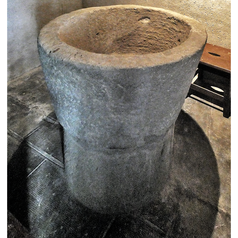
Image copyright © Kike Lombardero, 2023
Image and permission received from the author via Mikel Unanue (e-mail of 14 Janury 2023)
Results: 11 records
view of font
Copyright Statement: Image copyright © Kike Lombardero, 2023
Image Source: digital photograph January 2023 by Kike Lombardero
Copyright Instructions: Image and permission received from the author via Mikel Unanue (e-mail of 14 Janury 2023)
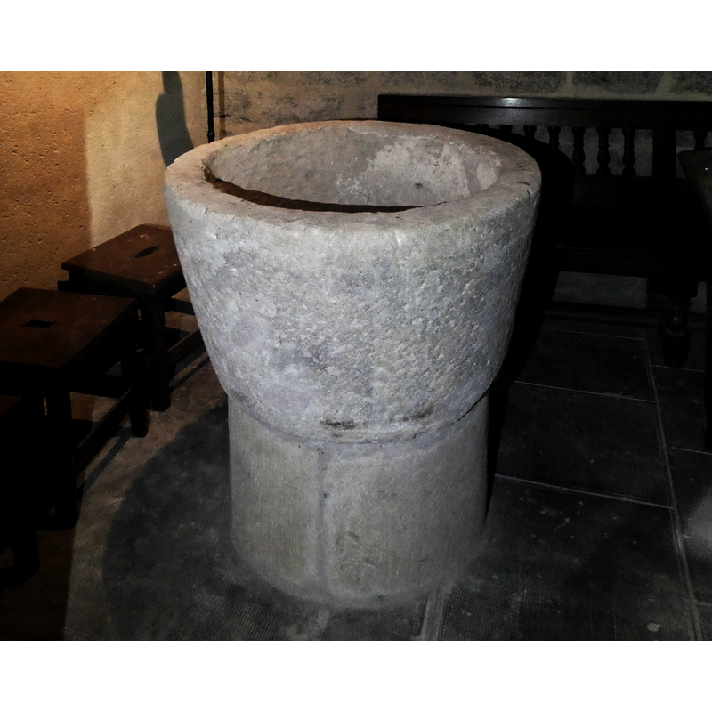
view of font
Copyright Statement: Image copyright © Kike Lombardero, 2023
Image Source: digital photograph January 2023 by Kike Lombardero
Copyright Instructions: Image and permission received from the author via Mikel Unanue (e-mail of 14 Janury 2023)
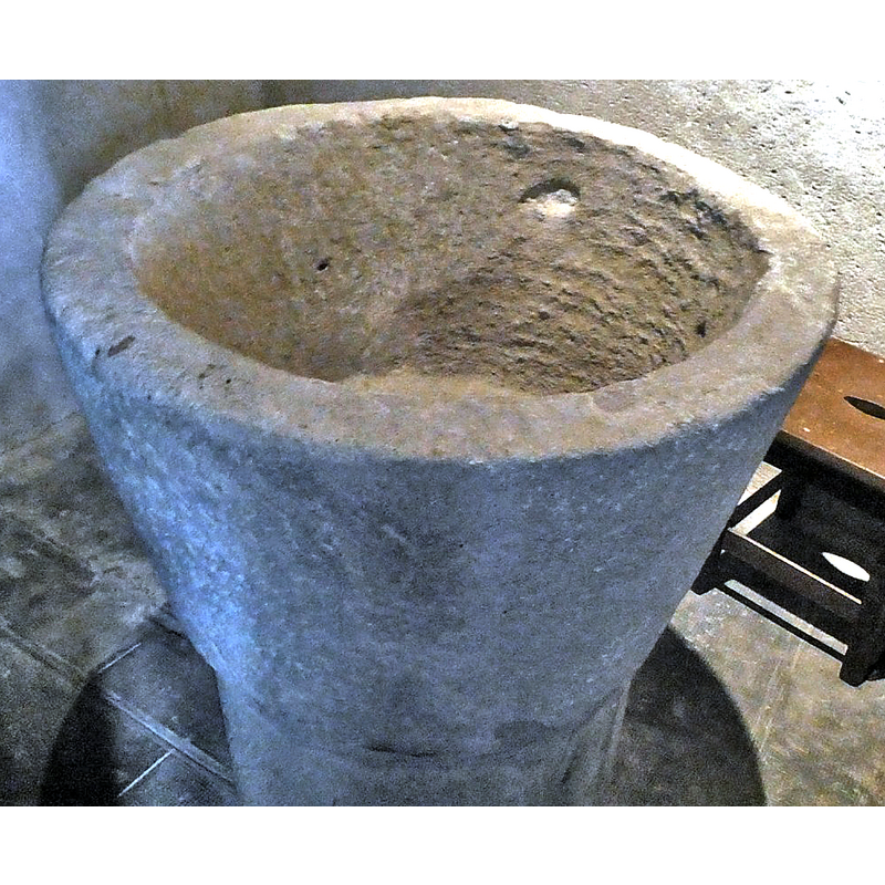
view of basin - upper view
Copyright Statement: Image copyright © Kike Lombardero, 2023
Image Source: digital photograph January 2023 by Kike Lombardero
Copyright Instructions: Image and permission received from the author via Mikel Unanue (e-mail of 14 Janury 2023)
view of church exterior - churchyard, cemetery - tombstone
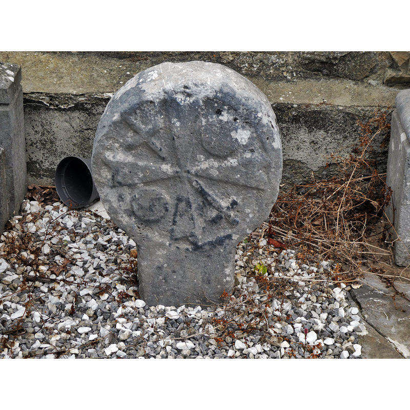
Scene Description: "Hilarri" - Basque funeral stela
Copyright Statement: Image copyright © Kike Lombardero, 2023
Image Source: digital photograph January 2023 by Kike Lombardero
Copyright Instructions: Image and permission received from the author via Mikel Unanue (e-mail of 14 Janury 2023)
view of church exterior - portal
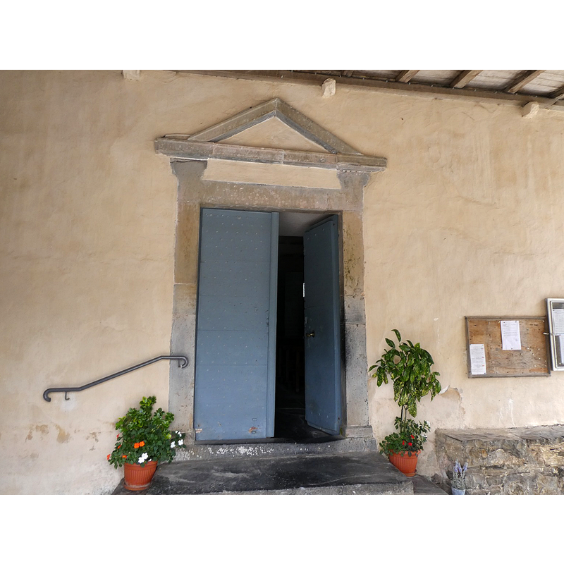
Copyright Statement: Image copyright © Kike Lombardero, 2023
Image Source: digital photograph January 2023 by Kike Lombardero
Copyright Instructions: Image and permission received from the author via Mikel Unanue (e-mail of 14 Janury 2023)
view of church exterior - west view
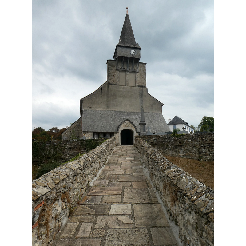
Copyright Statement: Image copyright © Kike Lombardero, 2023
Image Source: digital photograph January 2023 by Kike Lombardero
Copyright Instructions: Image and permission received from the author via Mikel Unanue (e-mail of 14 Janury 2023)
view of church exterior in context - northwest view
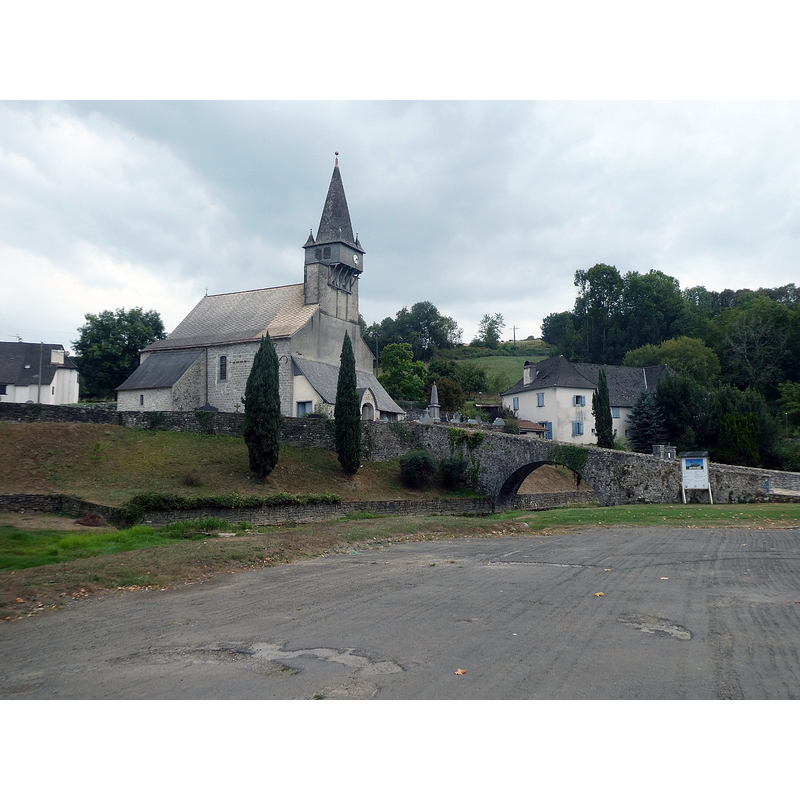
Copyright Statement: Image copyright © Kike Lombardero, 2023
Image Source: digital photograph January 2023 by Kike Lombardero
Copyright Instructions: Image and permission received from the author via Mikel Unanue (e-mail of 14 Janury 2023)
view of church exterior - east view
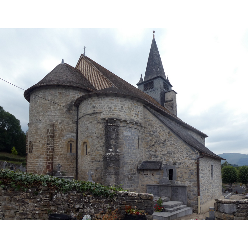
Copyright Statement: Image copyright © Kike Lombardero, 2023
Image Source: digital photograph January 2023 by Kike Lombardero
Copyright Instructions: Image and permission received from the author via Mikel Unanue (e-mail of 14 Janury 2023)
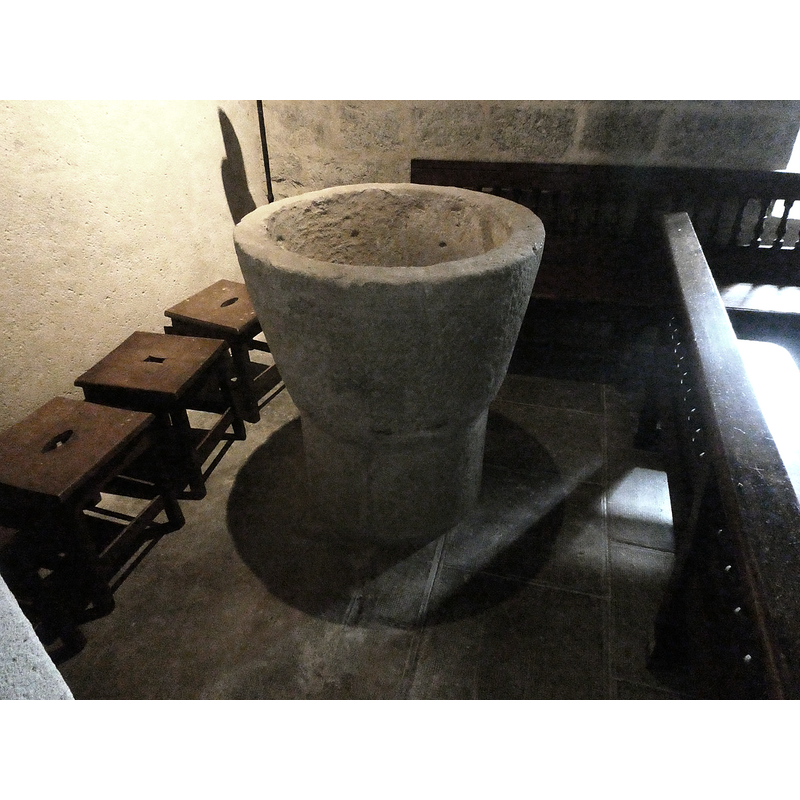
view of font in context
Copyright Statement: Image copyright © Kike Lombardero, 2023
Image Source: digital photograph January 2023 by Kike Lombardero
Copyright Instructions: Image and permission received from the author via Mikel Unanue (e-mail of 14 Janury 2023)
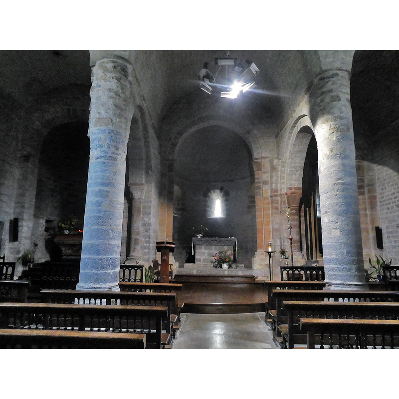
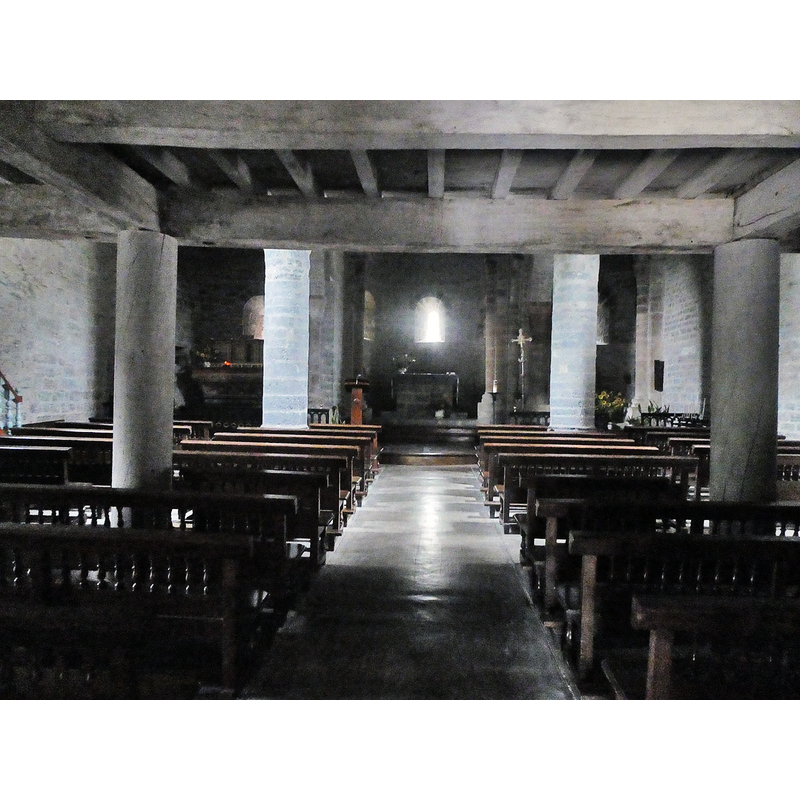
view of church interior - looking east
Copyright Statement: Image copyright © Kike Lombardero, 2023
Image Source: digital photograph January 2023 by Kike Lombardero
Copyright Instructions: Image and permission received from the author via Mikel Unanue (e-mail of 14 Janury 2023)
view of church interior - looking east
Copyright Statement: Image copyright © Kike Lombardero, 2023
Image Source: digital photograph January 2023 by Kike Lombardero
Copyright Instructions: Image and permission received from the author via Mikel Unanue (e-mail of 14 Janury 2023)
INFORMATION
Font ID: 00236ORD
Object Type: Baptismal Font1
Font Century and Period/Style: 12th - 13th century, Romanesque
Church / Chapel Name: Église paroissiale Saint-Michel d'Ordiap / Urdiñarbeko eliza
Font Location in Church: Inside the church
Church Patron Saint(s): St. Michael
Church Notes: 12thC(?) church -- listed in Mérimée [ref.: PA00084472]: "L'église dépendait autrefois d'une maison de refuge, prieuré détaché de l'abbaye de Roncevaux. Les pèlerins en marche vers Compostelle s'y arrêtaient. L'édifice fut élevé vers le début du 12e siècle : le choeur et les deux culs de fours absidiaux datent de cette époque. La première travée de la nef, bâtie en même temps, eut ses voûtes exhaussées sans doute au milieu du 12e siècle. La façade et la travée attenante ont été remplacées par des maçonneries modernes."
Church Address: 64130 Ordiarp, France
Site Location: Pyrénées-Atlantiques, Nouvelle-Aquitaine, France, Europe
Directions to Site: Located off the D348 [aka Rte. de Garibie], S of the D918, 10 km NNW of Tardets Sorholus, about 30 km W of Oloron Sainte-Marie
Ecclesiastic Region: Diocèse de Bayonne, Lescar et Oloron
Historical Region: Aquitaine
Font Notes:
Click to view
Baptismal font of stone consisting of a bucket-shaped basin raised on a broad cylindrical base, both plain; the base may be a later replacement. No cover present
Credit and Acknowledgements: We are grateful to Kike Lombardero for his photographs of this church and font
COORDINATES
UTM: 30T 667143 4783524
Latitude & Longitude (Decimal): 43.186, -0.943195
Latitude & Longitude (DMS): 43° 11′ 9.6″ N, 0° 56′ 35.5″ W
MEDIUM AND MEASUREMENTS
Material: stone, type unknown
Font Shape: bucket-shaped, mounted
Basin Interior Shape: round
Basin Exterior Shape: round
Drainage Notes: no lining